FOOLOW TO GREAT LONGSTONE
A TO Z – DERBYSHIRE AND THE PEAK DISTRICT – CHAPTER 16
FOOLOW (1.5 miles from Eyam, off the A623 between Stoney Middleton and Wardlow Mires – SK191768)
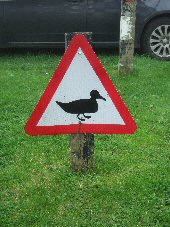
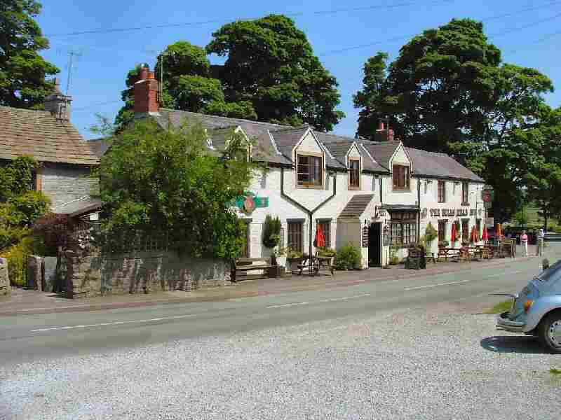
The small upland Derbyshire village of Foolow, with its light grey stone houses, is one of the most picturesque in the whole of the Peak National Park. Pretty limestone dwellings cluster around the well-turned-out village green, the centrepiece of which is the duck pond. It was not like this in the days when Foolow was predominantly a farming community. When the cattle were driven in from the fields for milking, they drank from the mere, often making the green muddy and covered with hoof marks. Nowadays, animals are no longer brought into the village to drink at the mere, and the ducks have taken over. There is even an official duck crossing warning sign as you come around the corner opposite the village’s only public house.
Fine 17th- and 18th-century cottages surround the green, in the centre of which is the village cross. At the front of the cross is a bull ring that once stood by the roadside. Behind the pond, an ancient well is enclosed on three sides by a stone wall.
FOREMARKE HALL (off the Milton to Ingleby road, south of the River Trent – SK333265)
Foremarke Hall is an impressive Georgian mansion, built in Palladian style in 1760 for the parliamentary reformer, Sir Francis Burdett. It is now a preparatory school for nearby Repton School. The view of the hall and the ornamental lake is out of sight from the Milton to Ingleby road, but much admired by visitors and footpath walkers.
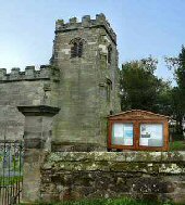
The area around the hall is spelt differently, with the final ‘e’ removed. St Saviour’s Church is a Grade I listed parish church that stands a short distance to the west of the hall. The church dates from 1662 and was built by Sir Francis Burdett, reusing stone from a ruined chapel at nearby Ingleby.
Foremark Reservoir is owned by Severn Trent and cared for in partnership with the National Trust. The reservoir and 230-acre nature reserve at Foremark are home to a rich diversity of wildlife. Carver’s Rocks, a Site of Special Scientific Interest, is well visited. With its open spaces, woodland trails, a public bridleway and views across the water, it is a popular family attraction.
FROGGATT (off the A625 between Calver and Longshaw – SK246764)
Froggatt lies on the well-wooded banks of the River Derwent. The Duke of Rutland originally owned the village, where mainly farmers and stonemasons occupied the attractive stone cottages, 17 of which The Duke built over 200 years ago. Some are still standing and have been supplemented by expensive detached properties, primarily the homes of commuters and retirees. The Chequers Inn is a traditional Peak District public house situated below Froggatt Edge, and is popular with walkers and climbers. On the outskirts of Froggatt is a 17th-century bridge, unusual in having a large central arch on the village side and a smaller arch on the other side, likely due to its extension following the widening of the river when the Derwent was dammed at Calver. Froggatt show is held on the August Bank Holiday and is the descendant of the former village’s ‘cow club.’ It is very popular and attracts large crowds of locals and tourists on fine sunny days.
FROGGATT EDGE (off Bar Road from Calver to Curbar Gap)
The gritstone escarpment of Froggatt Edge towers above the small village of Froggatt. It is easily accessible from car parks at both ends of the ridge. It offers magnificent views across both the moors and the valley, and is regularly used by walkers and climbers throughout the year.
GLAPWELL (on the A617 approximately one mile from Junction 29, M1 motorway – SK478662)
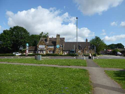
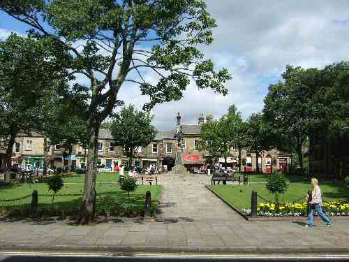
Glapwell stands at the top of a steep hill, close to Bramley Vale, which is located lower down the hill, near the M1 motorway. The village has a long history that stretches back to the Ice Age, and numerous archaeological finds have been made in the area up to Roman times. Although recorded in the Domesday Book, the village remains a small and predominantly residential area, Glapwell Colliery having closed in the 1970s. The Young Vanish Inn, at the centre of the village, was named after a famous 19th-century racehorse.
GLOSSOP (at a meeting point of the A624, A6016 and A57 in NW Derbyshire – SK035942)
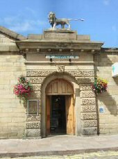
Situated in the far northwest corner of Derbyshire, in an area of outstanding natural beauty, Glossop is often referred to as the northern gateway to the Peak. The best place to view Glossop is from the Sheffield Road near where it emerges from the Snake Pass. From here, you get a fantastic view of the town nestling in a deep valley surrounded by hills, which form a natural amphitheatre.
There are two distinct parts to Glossop: the busy, bright, and modern town centre and the quieter, unspoilt village of Old Glossop. The former has several delightful sandstone buildings built around Norfolk Square, which, together with its lawns, trees, and flower beds, considerably enhances the appearance of the town centre. Early in the 19th century, the area by Glossop Brook was developed and named Howardtown after the chief landowner, Bernard Edward Howard. Cotton manufacturing took place there at a rapidly increasing pace. As a result, the population increased sixfold over half a century.
It may come as a surprise to visitors that Glossop Town Football Club was one of the founding members of the Football League. Perhaps even more surprising is that members of the Wood family, wealthy local mill owners who were great benefactors to the town, helped establish Arsenal Football Club and served as directors of the club for over 100 years.
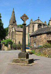
OLD GLOSSOP (on the north-east side of the town – SK042948)
The old village, once the centre of a vast, scattered, and mountainous parish, had a market and fair as far back as 1290, expanding around a market cross and parish church. Ancient buildings from the 17th, 18th and 19th centuries are tucked in along its narrow streets. It is an ancient settlement, possessing evidence of occupation during Roman, Saxon, Norman and medieval times. In 78 AD, the Romans built a fort in the vicinity, which was named Melandra. It was the most northerly of three forts in Derbyshire and at one time garrisoned 500 soldiers. Following a severe fire 62 years after its erection, the building was abandoned, and all that now remains are its foundations.
GOYT VALLEY (off the A5004 Buxton to Whaley Bridge Road)
The ruggedly picturesque Goyt Valley, surrounded by heather-clad moors, has been a popular destination for visitors since Victorian times. The appearance of the valley changed dramatically in the 1930s with the construction of the Fernilee Reservoir and, some thirty years later, the Errwood Reservoir. Now the reservoirs provide leisure facilities, in a valley rich in industrial heritage and wildlife.
Near Goytsclough Quarry is what remains of the old Paint Mill. It operated in the 19th century when a water wheel crushed locally mined barytes into a powder to manufacture paint. It was from Goytsclough Quarry that Thomas Pickford established a family business repairing roads. It progressed to such an extent that by the 18th century, James Pickford became known as the ‘London to Manchester Waggoner.’ Today, the business continues to thrive as one of the major removal and storage companies in Europe. Near Derbyshire Bridge are the remains of dozens of old coal mining shafts, which provided coal for homes.
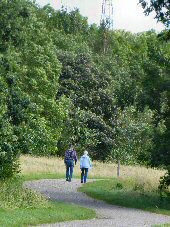
GRASSMOOR (3 miles to the south of Chesterfield on the B6038 to North Wingfield – SK412673)
The village was formerly the home of a mining community. But Grassmoor Colliery closed in 1971, and all the other local pits by the mid-1980s. It is now predominantly a residential village with no major employers. Grassmoor Country Park is situated at the northern end of the Five Pits Trail and is a very popular local amenity for walking, cycling, and horse riding, featuring a network of mostly surfaced paths. The ponds and woodland attract a wide variety of wildlife. Paul Burrell, who at one time served as the butler to Diana, Princess of Wales, grew up in the village.
GREAT HUCKLOW (off the B6049 between Bradwell and Tideswell – SK079178)
Sheltering under Hucklow Edge, the tiny village of Great Hucklow is a popular stopping-off place for walkers. For which the Queen Anne pub has been a beneficiary. The village had a theatre for over 40 years, which operated from 1938 to 1970. Large audiences attended every production, with visitors coming from all over the country. On the northern side of the village, the land rises steeply to Hucklow Edge, where the Derbyshire and Lancashire Gliding Club operates flights. In 1954, the World Gliding Championships were held there.
GREAT LONGSTONE (off the A6020 from Ashford in the Water, 1 mile from Monsal Head – SK200717)
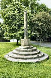
Sheltered by Longstone Edge from the cold north winds, the attractive limestone village of Great Longstone winds its way along a minor road linking Monsal Head and Hassop. The carvings in St Giles’ church of a milkmaid and a miner accurately reflect the two primary sources of wealth in the village during past centuries.
The foundations of St. Giles Church date back to the Norman period. It is an interesting old church with a splendid 15th-century roof featuring finely moulded beams. A tablet in the church commemorates Dr Edward Buxton. He returned from retirement at the age of 73 to provide a service to the villagers when a typhoid epidemic affected every household but one. No fee was asked for, and everyone in Great Longstone survived. The good doctor prescribed ‘wort’: a beer before the processes of fermentation are complete. It was brewed daily at a farm on Church Lane.
The doctor lived at Church Lady House, a late medieval building that contains at least one cruck frame. It is said to be haunted by a lady dressed all in black. The adjacent building, once a barn belonging to Church Lady House, was used as a theatre at one time. It is now a private residence.
