GRINDLEFORD TO HARTSHORNE
A TO Z – DERBYSHIRE AND THE PEAK DISTRICT – CHAPTER 17
GRINDLEFORD (on the B6001 two miles south of A6187 Sheffield to Hathersage road – SK244778)
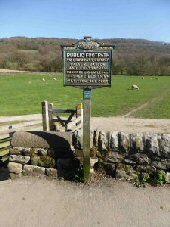
Situated in a beautiful setting with wooded hillsides rising above the River Derwent, the village of Grindleford occupies a desirable spot. It is a busy place where several roads converge. Before the bridge was built, a ford crossed the river, which was an important crossing point for centuries.
Grindleford is a ‘modern’ parish, formed as recently as 1987, out of the parishes of Eyam Woodlands, Stoke, Nether Padley and Upper Padley. This ended a lot of confusion, as since the 14th century, the development near the road bridge had been known as Grindleford Bridge. However, ‘Bridge’ was dropped after the Second World War. The railway station, although in Nether Padley, was named Grindleford in the 1890s.
Rising steeply up from the Sir William Hotel is Sir William Hill, which reaches a height of over 1,400 feet on Eyam Moor. There are several theories regarding the origin of its name. The one that suggests it commemorates Sir William Cavendish, who owned nearby Stoke Hall, may be correct. On the other side of the valley, amidst gorgeous woodland scenery, is Padley Gorge, a great favourite among visitors to the Peak.
GRINDON (off the B5053 Bottom House [off A523 – Leek/Ashbourne] to Warslow road – SK085545)
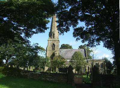
Grindon is a small, isolated village, overlooking the Manifold Valley, amidst magnificent Peak District scenery. The needle-like spire of its church acts as a landmark for miles across the lonely hills. The remoteness of the village is put into perspective by an inscription in the church to six airmen, including two press reporters, whose plane crashed while bringing relief to stricken villages cut off by blizzards in 1947. The plane went down on Grindon Moor when parachuting food supplies to the villages of Butterton, Grindon, Onecote and Wetton.
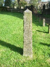
All Saints’ Church is often referred to as the ‘Cathedral of the Moors’. It stands at a height of 1,050 feet above sea level with its elegant spire towering above the sycamore trees around the churchyard. The church was rebuilt in the mid-1800s, but a church has been on the site since at least the 11th century. Inside, two coffins and a battered Norman font remain from the previous church. An unusual sight near the church entrance is a Rindle Stone, which records that: ‘The Lord of the Manor of Grindon established his right to this rindle at Stafford Assizes on 17 March 1872’. Exactly why the Lord of the Manor should want to assert his right to the rindle is uncertain, as a rindle is a stream which runs only in wet weather.
The War Memorial is the church clock high on the south face of the tower. It keeps ‘Grindon time’ since its ebony pendulum causes it to speed up in wet weather and, conversely, slow down in dry weather. The ancient tradition of Hedgehog Rolling was revived in 2002, with hogs fashioned from giant fir cones. This tradition seems to date back to when hedgehogs were kept as pets for pest control and were specially trained for hedgehog races. It is claimed that Lewis Carroll got the idea for the Flamingo and Hedgehog Croquet game in Alice in Wonderland after visiting Grindon on Hedgehog Rolling Day. On the same day, several other events also take place.
HADDON HALL (2 miles to the south of Bakewell, on the A6 – SK235663)
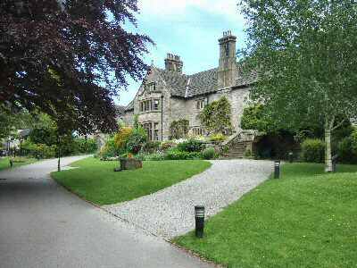
Haddon Hall, mentioned in the Domesday Book, is perhaps the most perfect example of a medieval manor house in this country. It has been the location for several major feature films and TV dramas over the years. It is where the romantic legend of Dorothy Vernon’s elopement with John Manners is supposed to have taken place. In recent times, the hall was Mr Rochester’s home, Thornfield, in the BBC’s adaptation of Jane Eyre. The gardens are a delight and are said to be the most romantic in Britain, with the colourful, walled garden falling in terraces towards the River Wye. Numerous varieties of climbing and rambler roses cover the limestone walls.
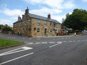
HANDLEYS (in the north east corner of Derbyshire between Staveley, Whittington, and Eckington – Middle Handley -SK406778)
Here, farms, cottages and houses group into three hamlets, surrounded by beautiful countryside. They are known as West Handley, Middle Handley and Nether Handley. At one time, there was a Methodist chapel, school, post office, and several shops, as well as a church and a public house in the area. Now only the Devonshire Arms remains. On the edge of Middle Handley is ‘murder field’ where the body of 23-year-old Eliza Hudson was found. Her husband, Benjamin Hudson, was tried, convicted and hanged behind closed doors at Derby gaol. Previously, all hangings were carried out in the open, when crowds gathered to watch the proceedings, the more notorious the person hanged, the larger the crowd. Sideshows were not uncommon, featuring acrobats and other forms of entertainment. Traders sold souvenirs, and there were even gingerbread effigies of the prisoner awaiting execution. Apart from local people, others came by train on what they regarded as a good ‘day out’.
HARBOROUGH ROCKS (1.5 miles east of Brassington, off the High Peak Trail– SK242553)
The rocks are easy to access from the High Peak Trail, from where you can visit the site of the cave once occupied by human inhabitants. People lived in the area in prehistoric times. Remains of Bronze and Iron Age man have been found. Daniel Defoe called at the rocks on his ‘Tour through Great Britain’ in the early 18th century and described a family living in the cave. Only a short distance away is Minning Low, where Neolithic chambered barrows were found on the summit.
HARDWICK HALL (off the M1 at junction 25 and the A6175 Clay Cross Road – SK463638)
The hall is one of the finest and most complete Elizabethan houses in the country. Built by Bess of Hardwick, it is said to be ‘more glass than wall’ and is in the hands of the National Trust. The Old Hall, cared for by English Heritage, stands nearby and is now in a state of ruin.
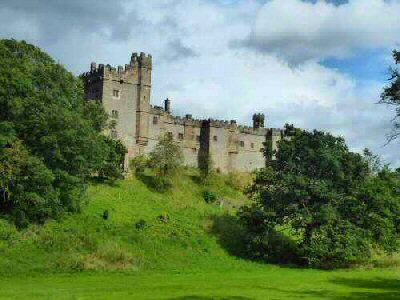
HARTINGTON (2 miles west of A515, Ashbourne to Buxton Road, on the B5054 – SK129604)
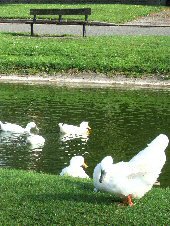
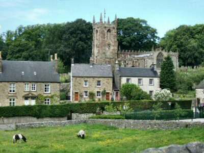
The picturesque village of Hartington, with its spacious marketplace, village green, delightful duck pond, and limestone houses, makes it one of the major tourist centres in the Peak District. It has more the air of a prosperous market town than a village. It was the first village in the Peak District granted a charter to hold weekly markets and an annual fair. These have long since ceased with the moving away of commercial activity. However, even today, the village has a range of services equivalent to those of a small town.
Once an important stopping place for pack horses and drovers and then for stagecoaches, both The Charles Cotton and The Devonshire Arms are former coaching inns. Now, the village provides for tourists and local people, and there are several tempting cafes, quality gift and craft shops and a newsagent. Most noticeable is the small supermarket housed in the rather grand old Market Hall, built in 1836, with three rusticated stone arches. The village pump on the green was regularly used before piped water arrived. The old Victorian letterbox that used to stand outside the former post office has been relocated further up the road, together with the post office.
The size and stature of St. Giles Church provide further evidence of the village’s former status. Standing on rising ground with an impressive battlemented west tower, the church presents an imposing sight. It is somewhat unusual in construction as both Staffordshire Redstone and Derbyshire limestone have been used with gritstone detailing to produce a pleasing effect.
HARTSHORNE (north of Swadlincote on A514 to Ticknall – SK327207)
Hartshorne’s history goes back to the Ice Age, a quern stone for grinding corn having been found in a nearby sandpit. The sandpit is now the recreation ground behind Dunsmore Way. In later years, the settlement was mentioned in the Domesday Book as being worth ten shillings.
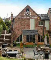
One of the village’s mills produced screws on a commercial basis in the late 1700s. In the 1980s, the building was rescued from dereliction and converted into a public house and restaurant. The water wheel has been sympathetically restored, but both the dam and mill pond have been removed. The wheel is now driven by a small engine rather than water power.
St Peter’s Church dates to the 14th century, but was almost entirely rebuilt in 1835. The Rector of Hartshorne, William Dethick, founded a free school for local children in 1626. It contains some fine alabaster effigies.
