HEIGHTS OF ABRAHAM TO HOLLINS CROSS
A TO Z – DERBYSHIRE AND THE PEAK DISTRICT – CHAPTER 19
HEIGHTS OF ABRAHAM (northwest of Matlock Bath, looking towards High Tor – SK293586)
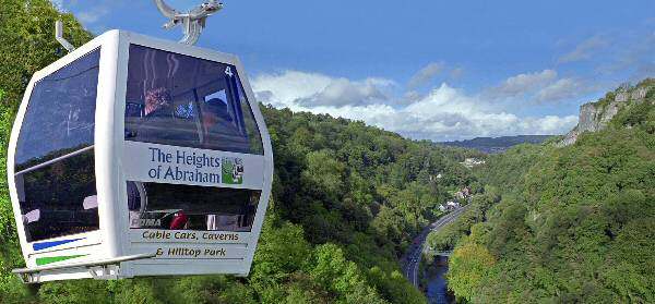
Cable cars glide back and forth from the Heights of Abraham, taking visitors to the top of the pleasure grounds that have been in use since the 1780s. When Queen Victoria visited Matlock Bath in 1844, she ascended the Heights on a donkey. Nowadays, visitors typically use cable cars, which first began operating in 1984. The more energetic take the more strenuous option and walk.
HIGHAM (west of the A610 between Alfreton and Chesterfield – SK390588)
Higham is a pretty village of attractive stone-built houses in an area where red brick predominates typically. It has a market cross indicating its former importance. The cross has been relocated to protect it from damage caused by the increase in road traffic. The main street follows the line of the old Roman, Rykneld Street. John Smedley, the well-known industrialist, built a Wesleyan Chapel and later a school in the village.
HIGH PEAK JUNCTION (off the Cromford to Lea and Holloway road – SK312599)
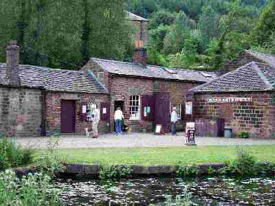
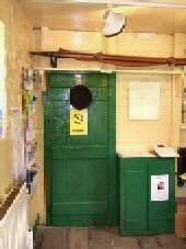
The High Peak Junction Visitor Centre is an excellent place to start or finish a walk along the Cromford Canal or the High Peak Trail. The High Peak Junction Workshops date back to the earliest days of the railway, having been built between 1826 and 1830. They remain virtually unchanged since their railway days, featuring tools, railway artefacts, a joiner’s bench, a forge, and bellows. The cast-iron, fish-bellied rails on either side of the inspection pit could be the oldest length of railway line in the world still in its original position. A leaflet has been produced to help visitors identify the extensive array of memorabilia on display.
HIGH PEAK TRAIL (High Peak Junction to Dowlow, near Buxton)
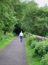
The construction of the Cromford and High Peak Railway was considered an engineering masterpiece. It has attracted railway enthusiasts, not only from this country but all over the world. It linked High Peak Junction at 277 feet above sea level with Whaley Bridge at 517 feet. In the middle, it rose to over 1,000 feet at Ladmanlow. Stretching 38 miles in length, the line fully opened in 1831 for the transportation of minerals, corn, coal, and other commodities from one canal to the other. Following its closure, the land was jointly purchased by Derbyshire County Council and the Peak Park Planning Board, in partnership with the Countryside Commission. It was converted into the High Peak Trail and ran as far as Dowlow. The trail is part of the Midshires Way and the new Pennine Bridleway and Pennine Cycleway.
HILTON (on the old Derby to Uttoxeter road, south of the new A50 –
SK245305)
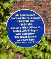
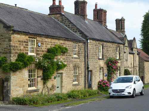
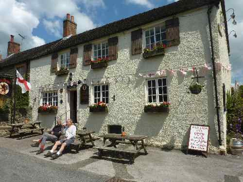
Entering Hilton from Derby, you pass the Old Talbot public house, a 16th-century cruck building. It is a Grade II listed building and features a malt drying kiln at the back of the main fireplace, dating back to the days when it was an old ale house. The oldest building on Main Street is Wakelyn Hall, where Mary, Queen of Scots, is reputed to have stayed on her journey to imprisonment in Tutbury Castle. A notable development in recent times has been the conversion of the former gravel works into a nature reserve and bird sanctuary, owned by the Derbyshire Naturalists Trust. Air Commodore Martin Massey CBE DSO MC was born at Hilton House in 1898. He was the Senior Officer at Stalag Luft III Sagan who authorised ‘The Great Escape’. A blue plaque is affixed to the outside wall of the building.
HOGNASTON (1 mile west of Carsington Water, off the B5035 Ashbourne to Wirksworth road – SK235506)
The attractive old village of Hognaston stands on a hillside overlooked by Hognaston Wynn, which protects it from the north. It has been in existence for at least 1,000 years. Aerial photographs have revealed evidence of medieval field structures and the locations where properties that are now long since demolished once stood. The first settlers were drawn to the village by the plentiful supply of spring water marked by a series of wells along the road. During the 1976 drought, some of the wells were brought back into use. It was once a bustling place in coaching days, when the London to Manchester coaches would pass through the village. Much longer ago, it may even have been on the Roman road to Little Chester.
In 1675, John Ogilby compiled the first proper road map of England – previous ones had been of little practical use. He called himself ‘Cosmographer to the King, Charles II’. On his map, the only road in Derbyshire shown goes through Hognaston, when it would have been little more than a cart track. Ogilby measured the distance not only in miles but also in furlongs, all this with nothing more to help than a wheel geared to a counting device.
HOLLINSCLOUGH (off the B5053 near Longnor – SK065665)
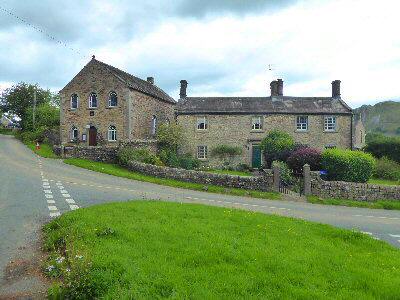
The village nestles at the head of the River Dove in picturesque surroundings. It is a joy to visit for anyone interested in walking and exploring the sights. In the 18th and early 19th centuries, it was on the Silk Road to Macclesfield and was a local centre for silk weaving and button making. It is probably best known for its Methodist Chapel, founded by John Lomas. He was a packhorse man and silk trader who represented the interests of hawkers and pedlars at the House of Commons in 1785. The chapel hall is open for seasonal events and serves as a focal point for the village.
HOLLINS CROSS (crossing point on Great Ridge between Eyam and Castleton)
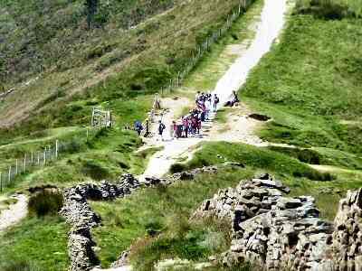
Hollins Cross is located on the Great Ridge between Lose Hill and Mam Tor, serving as a meeting point for paths from the Castleton and Edale directions. As it is the lowest point, it is a popular route for walkers crossing the ridge between the two villages, or to start a walk across the Great Ridge. Coffins had to be carried to Castleton for burial, and the traditional route was over Hollins Cross, before Edale Church came into existence. It caused considerable delays to burials in winter when the path was often impassable. The cross from which the crossing gets its name has long since disappeared.
