JENKIN CHAPEL TO KIRK HALLAM
A TO Z – DERBYSHIRE AND THE PEAK DISTRICT – CHAPTER 22
JENKIN CHAPEL (on the road up from Goyt Valley to Saltersford – SK989777)
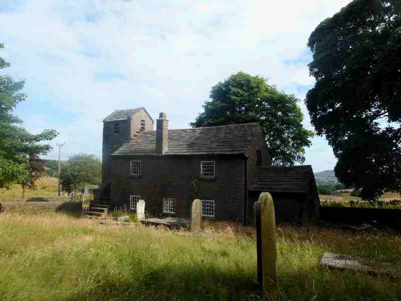
The Chapel is in an isolated location at Saltersford, on the western side of the Peak District, at the junction of three ancient trackways, known as ‘Salters’ Ways,’ once used by packhorses carrying salt. Later, by cattle drovers and sheep dealers. The Chapel’s outward appearance is more like that of a Georgian farmhouse with a chimneystack than for the purpose for which it was intended. The tower features an external staircase, and inside the chapel are box pews, an octagonal pulpit, and a carved reading desk.
It was built in 1733 by local people using local materials. They also raised the money to pay for a minister and added a tower 22 years later. It is an Anglican chapel in the diocese of Chester, and services are still held there. Please check arrangements with the diocese before travelling.
KETTLESHULME (on the B5470 road from Whaley Bridge to Macclesfield – SK989797)
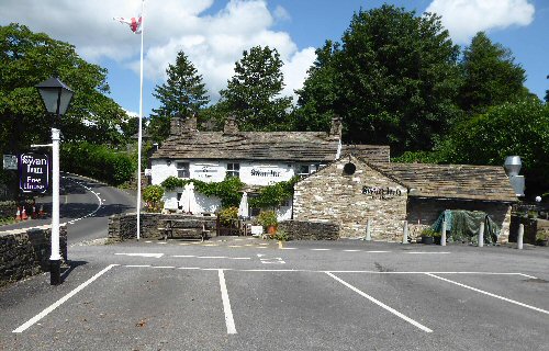
The village is located in a glorious rural setting in Cheshire, close to the border with Derbyshire, in the valley of the Todd Brook, a tributary of the River Goyt. It was once a centre for the manufacture of candlewick material, but this ceased in 1937. The old mill remains and has been described by English Heritage as ‘the last example of a mill where water-powered and steam machinery was used together and survives intact’. It is Grade II listed. Kettleshulme is very popular with walkers, who often start and finish walks at the 15th-century Swan Inn. Curiously, the village was once the home to Amos Broadhurst, who in the 19th century had a beard that was seven feet long.
KEDLESTON HALL (off the Allestree to Weston Underwood road – SK312403)
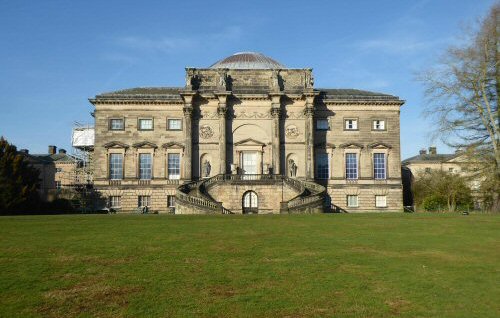
Only three miles from Derby city centre, Kedleston Hall, a magnificent Neo-Classical Georgian house, stands within over 800 acres of an Italian-style classical landscape. The present house was built for Nathaniel Curzon, the 1st Lord of Scarsdale, whose family has lived at Kedleston since the 12th Century. The house passed into National Trust ownership in 1987, but the Curzon family still occupies a wing to this day.
The gardens are landscaped in the form of a fashionable Pleasure Ground of that period. A ha-ha or sunken wall allows uninterrupted views of the parkland while simultaneously keeping the animals within their designated grazing area. Robert Adam designed the attractive three-arched bridge over Cutler Brook, which was widened into a series of lakes and cascades.
KILLAMARSH (on the B6058, in northeast Derbyshire midway between Chesterfield and Sheffield – SK458806)
Killamarsh was originally a farming community, but in the 19th and 20th centuries it became a thriving mining area. Since the closure of the pits, other industries have started up, and the village is well served with local shops and amenities. Rother Valley Country Park, located to the north of the village, was created in the early 1980s as part of the restoration works following the end of opencast mining. The River Rother passes through the centre of the park. Killamarsh Forge produced the wire used in the second trans-Atlantic telegraph cable. Fred Greaves, born in the village in 1890, was the first person in Derbyshire during World War I to be awarded a Victoria Cross.
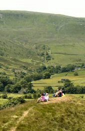
KINDER SCOUT (a plateau covering 5 square miles north of Edale, east of Hayfield)
The right to roam the privately owned moor above Edale was severely restricted until the 1950s. Now that access to roam has been negotiated, subject to specific bylaws, the moors are very popular with walkers. However, Kinder Scout, a plateau that spans five square miles and reaches a maximum elevation of 2,088 feet, can be a very hazardous place. The weather can change quite suddenly from bright sunshine to thick mist, making it impossible to find your way without a compass. But for those who come unprepared to walk on Kinder and others who prefer more gentle exercise, the Vale of Edale offers a splendid alternative.
KINGS NEWTON (off the B587 Stanton-by-Bridge to Melbourne Road – SK388262)
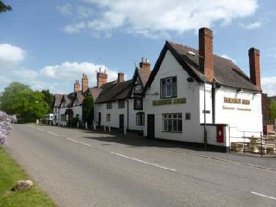
Nicholas Pevsner described the main road through the small village of Kings Newton as ‘one of the most attractive main streets in Derbyshire’. Pevsner wrote a series of 46 volumes of county guides, under the title of ‘The Buildings of England’ (1951-1974).
It is a gem of an old English village, with a great variety of well-cared-for old houses covering a wide age range, that all blend superbly together as a whole. A cottage with three crucks, one of which is visible from the outside, is considered to have been ancient when Elizabeth I came to the throne. Many of the other houses date back to the 18th century, and there are a few of recent origin along Trent Lane, as well as a small new development behind the Hardinge Arms. There is a further small development behind the former Packhorse pub. A short distance from this point, is the Holy Well, a spring of pure drinking water where local inhabitants once filled their buckets. In 1985, the local Civic Society restored the well and its surrounds and it was re-dedicated by the Vicar of Melbourne. There is a plaque by the well on which is carved the original inscription.
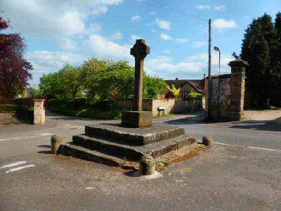
The village was granted a market in 1231, and the steps of the market cross remain, surmounted by a modern cross erected to commemorate the accession to the throne of Edward VIII. It represents a very rare commemoration of a King who was never crowned!
KIRK HALLAM (on the A6096, Spondon to Ilkeston Road – SK455403)
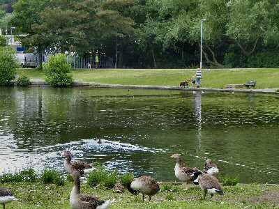
The village of Kirk Hallam is by a branch of the Erewash Canal, near Ilkeston. It is one of several ‘Hallams’ in the locality. The population expanded dramatically in the 1950s when the public sector and local employers, Stanton and Staveley, carried out significant housing developments. Further public and private house development occurred in the 1960s and 1970s. All Saints’ Church dates from the late Norman period. Kirk Hallam Lake and Meadows wildlife haven comprises a large lake, a section of the River Nutbrook, and several meadows.
