INTRODUCTION
Elton is an unspoilt village, very popular with walkers and cyclists, who enjoy the beautiful countryside and peaceful surroundings. There are also a few surprises nearby with a hermit’s cave, a bizarre rock formation where Druids may once have worshipped, four standing stones and Castle Ring Circle.
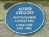
Almost every reference you read about Elton tells you at an early stage that it is a cold place. This might seem a little unfair for somewhere close to the southern edge of the Peak District. But on closer examination, it becomes clear that the village, at an altitude of 900 feet, does not have any protection from the cold north and east winds. Even Alf Gregory, a former resident who was on the successful Mount Everest expedition in 1953, said it was ‘a cold place’ and like living ‘on the top of a mountain’.
ELTON’S BRACING CLIMATE
It must raise the inevitable question as to why the village was built in such an exposed position. The proximity to the Portway, replaced in 1811 by a turnpike road, was the main road running from north to south through the area. In addition, the fact that lead was in plentiful supply, as was water, was probably a significant factor behind the location of the village. The land was also suitable for sheep rearing to provide the lead miners with an additional income.
Elton’s bracing climate seems to suit the inhabitants, many of whom have lived to a considerable age. Few people, including those not born in the village, have moved away. There is a good community spirit, and the people are warm and friendly.
GEOLOGICAL DIVISION
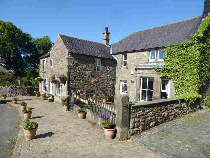
The village is on a division in the underlying rocks that runs along the main street. Limestone is on the north side and gritstone on the south. It produces an unusual effect with gritstone vegetation on one side and limestone on the other. The houses, too, reflect the division, with some built of gritstone and others of limestone, or a mixture of both.
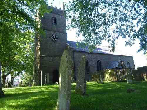
ALL SAINTS’ CHURCH
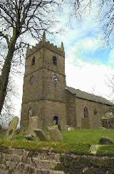
All Saints’ Church was built in 1811 and replaced an earlier church dedicated to St Margaret after its steeple had fallen off a few years earlier. Illegal lead mining underneath the church caused the damage. Another misfortune befell the church after rebuilding; the font was thrown out and left to decay. Several years later, the vicar of Youlgreave removed it and used it as an ornamental water butt. His successor, aware of the value of the font, had it installed in Youlgreave Church. After realising their mistake, the people of Elton tried to get it returned, but without success and had to make do with a replica.
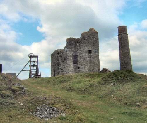
LEAD MINING
There is plenty of evidence in the fields where the lead miners used to operate. On the eastern side of the village, close to the Old Portway, now Dudwood Lane, was the Portway Mine. It was the largest mine in the area, along with the Elton Cross, a short distance further away to the north.
ANCIENT HISTORY
The Hermit’s Cave at Cratcliffe Rocks, where, under an overhang of rock, a carved crucifix remains, was at one time home to a hermit. In the Middle Ages, hermits were looked on as holy men. Appointed to lonely places by a bishop, they rendered hospitality and assistance to travellers.
Behind Harthill Moor Farm is a perfect little Iron Age Fort, Castle Ring, possibly dating back over 300 years BC. At night, when the moon is full, fairies are supposed to emerge for music and dancing. The four great standing stones, near the Hermit’s Cave, date back even further to over 1,000 years BC.
THE VILLAGE
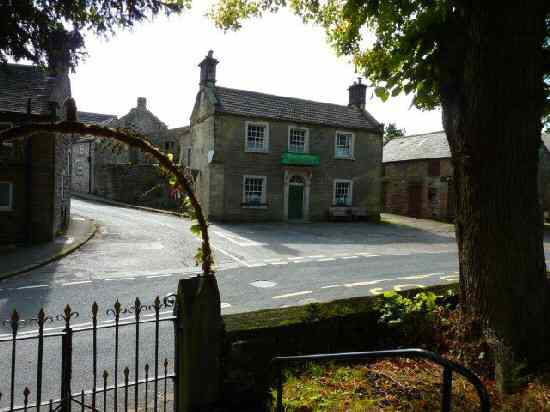
There are no shops in the village, but there is a pub, The Duke of York. It is old-fashioned, but the welcome is warm, as is the blazing coal fire in the lounge on a cold night.
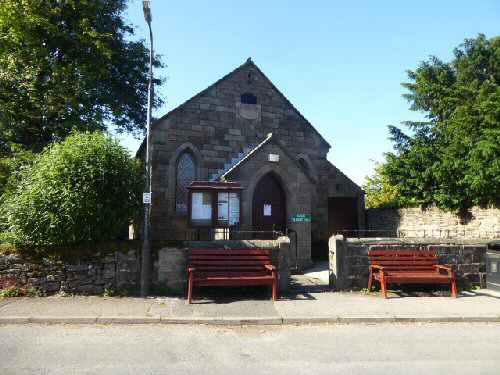
Elton once held strong Nonconformist traditions; the old Wesleyan Methodist Chapel is now the Village Hall, and the former Wesleyan Ebenezer Chapel a private house. The Primitive Methodist Chapel closed after its Harvest Festival service in 2011.
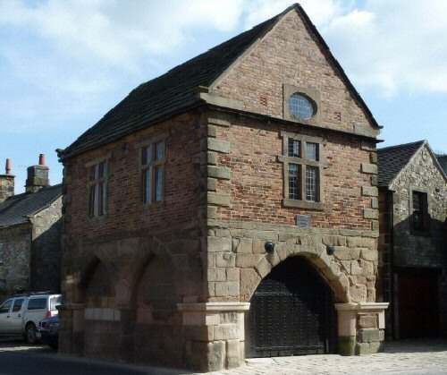
Along the main street, there are several 17th-century stone houses. The oldest is The Old Hall, which for many years acted as a Youth Hostel before being put up for sale in 2002. Built of gritstone, part of which dates to 1688. By contrast, across the road, Greenacres Farm, is constructed of pure limestone.
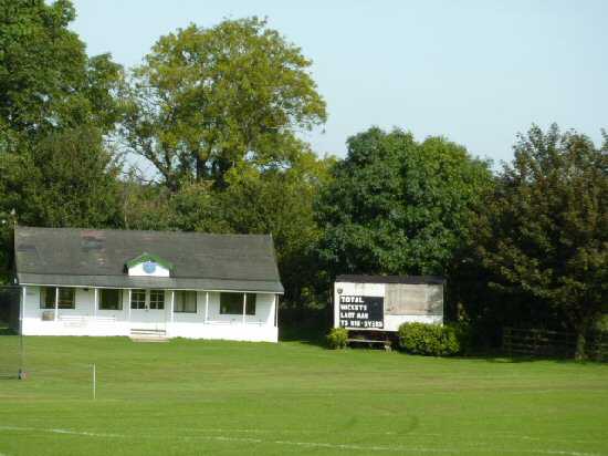
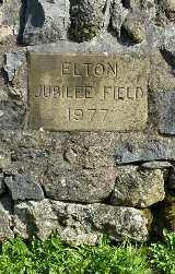
The school stands on the south side of the main street. It was extended when the population increased in 1890. During the Jubilee year, 1977, the villagers got together and raised the money to buy a field for sport and recreation for the young and not so young!
TEN FASCINATING FACTS ABOUT ELTON
1. The village is set on a division in the underlying rocks that runs along the main street. Limestone is on the north side and gritstone on the south. It produces an unusual effect with gritstone vegetation on one side and limestone on the other. The houses, too, reflect the division, with some built of gritstone and others of limestone, or a mixture of both.
2. At the bottom of the hill on the western side of the village is the tiny hamlet of Gratton, which at one time was the home of a cheese factory operated by a consortium of local farmers.
3. Unlike many of its neighbours, Elton is not a tourist ‘hotspot’ and remains completely unspoiled. However, it is visited on a regular basis by walkers. Cyclists used to be more prolific when Elton Café was still open, as it acted as a meeting point before its closure.
4. The Duke of York Inn is an award-winning CAMRA pub listed on the CAMRA National Inventory of Historic Pub Interiors.
5. Elton remains a somewhat remote and rather desolate Peakland village. But it is more accessible now, the main Bakewell to Ashbourne Road runs half a mile away.
6. During the winter of 1933, the village was cut off by snow, and the inhabitants were near starvation until the local men cut a channel through the snow to neighbouring Winster.
7. Many of the buildings in the village bear the date of construction carved into the stonework.
8. Limestone-built Greengates Farm of 1747, which stands on the south side of the Main Street, is one of the most attractive.
9. Homestead Farm is also late 17th century, whilst Elton House at the end of Moor Lane bears the date 1710. At the bottom of Ivy Lane stands Lavender Cottage with a carved lintel above the door bearing the date 1672.
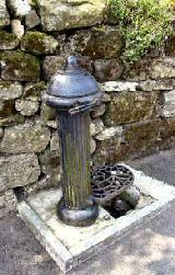
10. Opposite the Duke of York is Well Street, so named because of the well which still stands with its beautiful syphon-pump at the bottom of the sloping street.
ELTON WALK