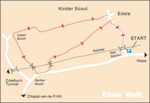
VALE OF EDALE WALK
THE WALK
The Vale of Edale Walk provides excellent views of the valley and the surrounding hills without the effort required in climbing the surrounding hills.
The Old Nag’s Head is the official starting point of the Pennine Way, which winds northward nearly 250 miles to Kirk Yetholm on the Scottish border. Your walk only goes one and a half miles along the route, with Kinder Scout glowering on one side and a chain of hills stretching out along the valley on the other. After leaving the Pennine Way, you return along the valley floor. When you first cross the railway line, the entrance to Cowburn Tunnel can be seen further up the line. It is Britain’s ninth-longest tunnel.
Barber Booth is a delightful little hamlet where several properties provide holiday accommodation. The house where Methodism first began has been demolished, but the chapel of 1811 stands nearby. After crossing the railway line a second time, the walk returns to Edale across farmland. From there, you retrace your steps to the walk’s starting point.
LOOKOUT FOR
Route Point 1 – The Church of the Holy and Undivided Trinity, Edale, is a Grade II listed parish church. It replaced a 17th-century church that stood across the road, which had been rebuilt on the same site in 1812. Originally part of Castleton parish, it only became a parish in 1863. The church is popular with visitors, some of whom use the hourly train service from Manchester to Sheffield.
Point 2 – The Old Nag’s Head is where Fred Heardman, the publican known to his friends as ‘Bill the Bogtrotter’, set up the Edale Mountain Rescue Team of volunteers. Many walkers had cause to be grateful to Fred and his friends before the official mountain rescue service began. It is the traditional starting point of the Pennine Way. You must complete the walk to qualify for a copy of the blank framed certificate in the Old Nag’s Head.
Point 3 – The Pennine Way is a National Trail in England, with a small section in Scotland. The trail stretches 268 miles from Edale and ends at Kirk Yetholm, just inside the Scottish border. It runs along the Pennine Chain, often described as the backbone of England; it is one of Britain’s best-known and most challenging walks. The path was the idea of the journalist and rambler Tom Stephenson, who proposed the concept in a national newspaper article in 1935 and persuaded Parliament to create the walk.
Point 5 – Jacob’s Ladder is said to be some people’s vision of heaven, leading on to the peat moors of Kinder Scout. Gritstone boulders mark the route airlifted in by helicopter. It probably got its name from a local farmer, Jacob Marshall, who farmed the land at Edale Head in the 18th Century. He reputedly cut steps into this route section to allow easier access to his land from the nearest settlements.
Point 7 – When you cross the railway line for the first time, the entrance to Cowburn Tunnel can be seen further up the line, Britain’s ninth-longest tunnel. It takes the Hope Valley Line out of Edale Valley, emerging near Chapel Milton, 2.5 miles east of Chinley Railway Station. Unusually, the line does not follow a constant gradient between Dore (near Sheffield) and Chinley. The summit lies within the tunnel, about a quarter of the way from the eastern end.
Point 8 – David Taylor, a wandering Methodist preacher and a colleague, having lost their way walking through a blinding snowstorm, saw the light shining in a solitary house at Barber Booth. They knocked at the door and walked in. The occupier, John Hadfield, grabbed the sword he had used at the Battle of Prestonpans from the mantelpiece and prepared himself for battle. Upon seeing this, David Taylor said, ‘Peace to this house’. Not only did this allay Hadfield’s fears, but shortly afterwards, prayers were said, and he agreed to have the house used for Methodist services. A new chapel has replaced it.
WALK DETAILS
Length: 4 miles.
Start: Edale Car Park at the foot of the road to the village.
Location: Off A625 Castleton to Hope Road.
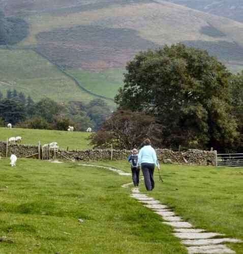
Terrain: Easy, mainly flat walk with fabulous views to admire. It can be muddy after wet weather.
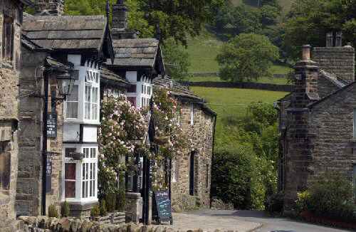
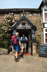
Refreshments: The Nag’s Head is a splendid old pub built in 1577. It is the southern starting point of the long-distance Pennine Way Walk. Penny Pot Café is situated close to the railway station and car park.
THE ROUTE

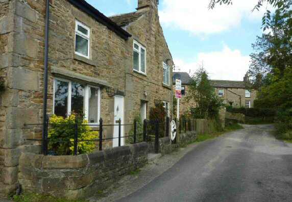
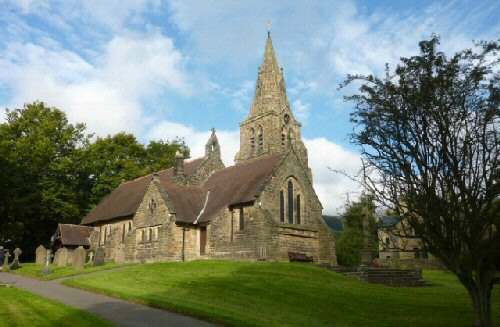
1. From Edale Car Park, walk up the road past the Moorland Centre, which is only open by appointment, and the Church of the Holy and Undivided Trinity.
2. On reaching the village, Edale Church of England Primary School and the Old Nags Head public house are on your right.
3. Turn left just before reaching the public house, signed for the ‘Pennine Way and Upper Booth’. Go through a swing gate up a tree-lined path before turning left at a signpost.
4. Angle to the right along a paved path across a field to a stile and follow a clear path across three fields.
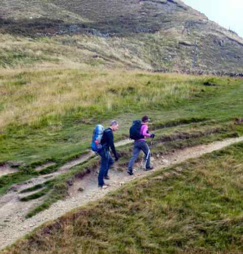
5. The path continues to the left of a few trees to another stile. Keep to the left of a tall waymarked post to follow the direction shown on the side of the post ‘PW – Jacobs Ladder.’
6. Go through a stile and walk down the hill through hillocks along a clear path that descends through several stiles before going over a stile by a gate down a rough track leading to a lane.
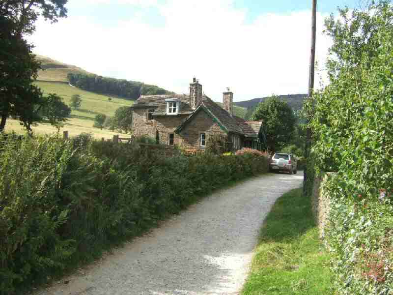
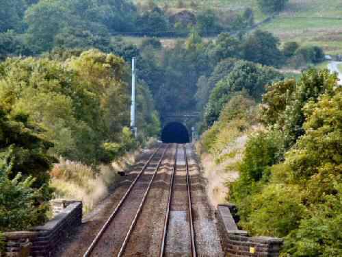
7. At the junction with another lane, turn left and left again within 20 yards, through a waymarked gate and cross the field to go through a stile gate. Follow a well-trodden path through a series of fields with the fence on your right. After leaving the fence, continue angling to the left diagonally across the next field to join a farm track. The track bends right over a railway bridge; the Cowburn Tunnel is a short distance up the line.
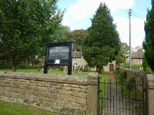
8. Continue to the left through a farmyard, past a row of cottages at Barber Booth and Edale Methodist Church. At a ‘T’ junction, turn left, and within 80 yards, left again at a footpath sign down a stony lane.
9. After re-crossing the railway line, turn right through a high gate stile to soon take the ‘Edale’ sign through a stile by a metal gate. Follow the path through three short fields close to the hedge on your right.
10. Cross the next field, angling slightly to the left to go through a stile, over a footbridge, and across a farm drive in front of you to another stile on the left.
11. Go to the right, aiming about 40 yards left of a gateway on the opposite side of the field, to a footpath sign marked ‘Grindsbrook.’ Avoid the path on the right unless you do not want to revisit Edale.
12. Continue through two gate stiles in quick succession and then, keeping close to the fence on the right, cross two fields and follow the waymarkers in the next field to reach a farm track. Go right down the track coming out by the Old Nags Head pub, and after exploring the village and perhaps taking refreshment, turn right and retrace your steps back to the walk’s starting point.
EDALE