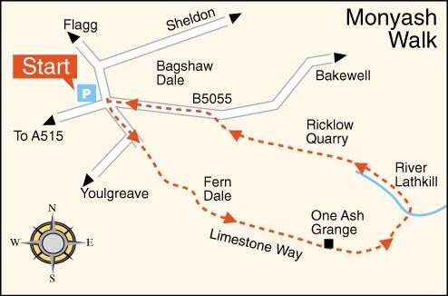
MONYASH AND LATHKILL DALE WALK
THE WALK
After walking down Sheldon Road and negotiating the crossroads, you pass Fere Mere on the right. After leaving the road, you walk through typical upland limestone countryside with stone walls dividing relatively small fields. Underfoot, the conditions are pretty good as rainwater soon drains through the limestone surface.
In just over one mile, you reach One Ash Grange; the Cistercian monks of Roche Abbey in Yorkshire once had a farm and manor here. The path then drops steeply to Lathkill Dale, a National Nature Reserve, whose clear waters are reputedly the purest in the county.
On your right, near the river’s source, is Parson’s Tor, where the Rev Lomas from Monyash fell to his death. About a quarter of a mile further on, the spoil heaps of the Ricklow Quarry are where Ashford Marble was extracted.
LOOK OUT FOR
Route Point 1 – Only Fere Mere, once the village’s source of drinking water, remains of the five meres that initially existed to retain water in what was otherwise a dry limestone area. Meres are round ponds, usually with concrete bases, to prevent the water from seeping away. The making of which was once an essential industry in Derbyshire. Opposite Fere Mere is Chandler’s House, where candles were made for mining and domestic use, with tallows supplied by local butchers.
Point 3 – One Ash Grange is just over one mile from Monyash, where the Cistercian monks of Roche Abbey in Yorkshire once had a farm and manor. It is claimed, probably incorrectly, that monks who had been unruly were sent there as punishment. Later, it was the home of John Gratton, the most famous Midland Quaker, who lived in the village for 40 years. For over 100 years, Monyash was a stronghold for the Quaker movement.
Point 4 – Lathkill Dale is the valley of the River Lathkill, which emerges from springs below Lathkill Head Cave or, in wet weather, from the cave. The river valley is part of the Derbyshire Dales National Nature Reserve. It is popular with visitors for its natural environment and wildlife. Charles Cotton, the co-author of The Compleat Angler, called it ‘by many degrees, the purest and most transparent stream that I ever saw, either at home or abroad, and breeds, it is said, the reddest and best trouts in England’.
Point 5 – Forms of impure limestone mined at Ricklow Quarry, then polished and turned jet black, were used for ornamental purposes after being cut. It was known as Ashford Black Marble and was in demand in Victorian times. Henry Watson founded the Ashford black marble works in 1748 at Ashford-in-the-Water at a site now acquired by the Water Board. The business finally closed in 1905. Ashford church houses one of the finest examples of an inlaid tabletop with pieces of Ashford Marble.
WALK DETAILS
Length: 3.75 miles.
Start: Monyash Car Park, on Sheldon Road, a few yards from the crossroads.
Location: On the B5055 Bakewell Road, about one mile from the A515 Ashbourne to Buxton Road.
Terrain: Apart from a steep, slippery descent to Lathkill Dale and a long, steady climb through Ricklow Quarry, it is a relatively straightforward but very stony walk. You encounter a lot of stiles during the first part of the walk, but the route to follow is relatively straightforward.
THE ROUTE

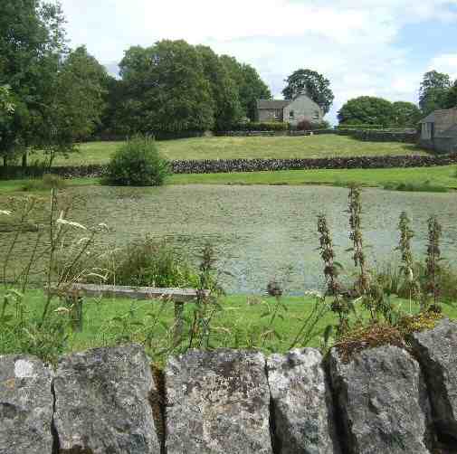
1. Walk to the right from the car park, keeping straight on at the crossroads towards Youlgreave. Alongside the footpath on your left is Fere Mere, once the village’s primary source of drinking water. When the road bends to the right, the path carries straight on to join a walled track.
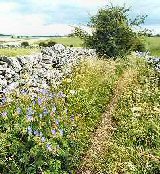
2. At the end of the walled track, go over a stile and keep close to the wall on the right and go over another stile by a National Trust Sign. Continue in the same direction, angling slightly to the right to go over a stile. Then, keeping close to the wall on the left, cross another stile next to a cattle drinking trough.
3. Near the next field’s top corner, go over a stile in the wall on the left and continue with the wall now on your right. On reaching a farm gateway on the right, go through it to follow the track into One Ash Grange farmyard.
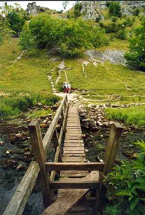
4. Take the sign to the left in the farmyard past a camping barn around the rear of some old buildings, and with the hay shed on the left, go over a stile with a steep fall. Head straight for the rocky valley beyond, where the path descends steeply before bending slightly to the left to cross the footbridge over the river into Lathkill Dale.
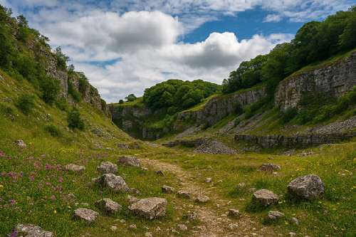
5. Walk to the left up Lathkill Dale for about one and a half miles past Parson’s Tor on your right. Continue through Ricklow Quarry, which is quite stony in places.
6. Turn left at the Monyash to Bakewell Road and head back towards the village past the Village Hall to reach the crossroads, where you turn right back to the walk’s starting point.
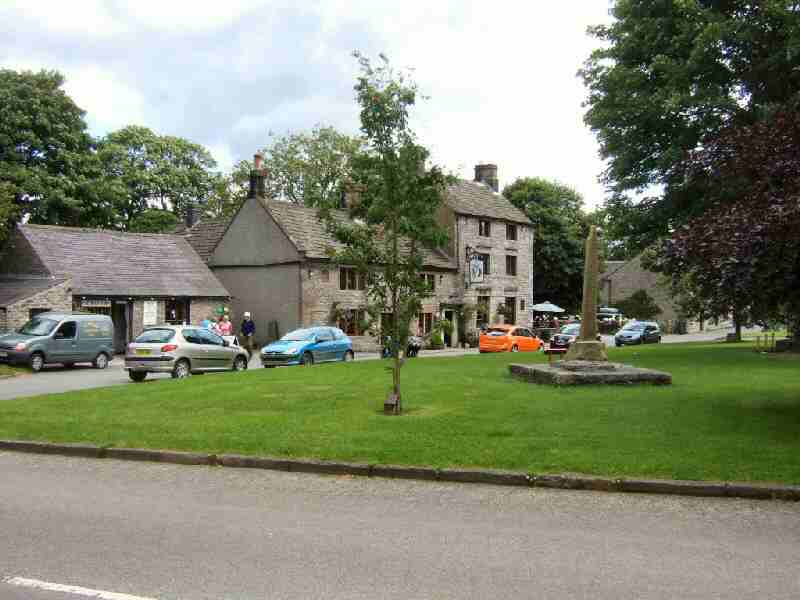
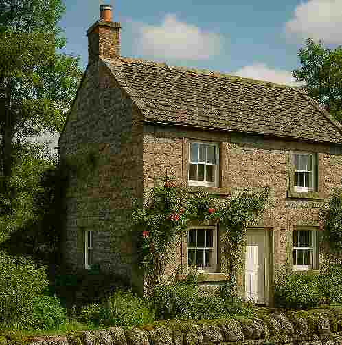
MONYASH