INTRODUCTION
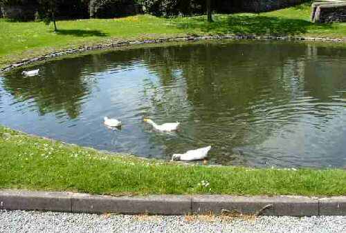
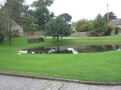
The small upland Derbyshire village of Foolow, with its light grey stone houses, is one of the most picturesque in the whole of the Peak National Park. Pretty limestone dwellings cluster around the well-turned-out village green, the centrepiece of which is the duck pond. Visitors often stop there to watch the ducks swimming on the pond and enjoy the idyllic scene. Those who carry cameras with them will not be able to resist taking a few images to capture the moment. It is no wonder that pictures of Foolow appear in so many tourist guides.
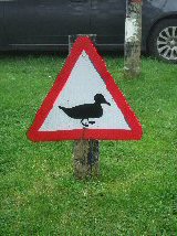
It was not like this in the days when Foolow was predominantly a farming community. The cattle brought in for milking drank from the mere, often making the green muddy and covered with hoof marks. Nowadays, animals are no longer driven into the village to drink at the mere, and the ducks have taken over! There is even an official duck crossing warning sign as you come around the corner opposite the village’s only public house.
THE VILLAGE GREEN
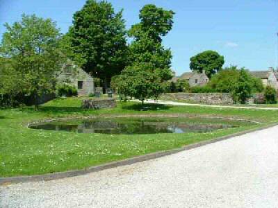
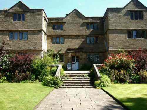
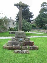
Some fine 17th and 18th-century cottages surround the green. Also prominent are the bay windowed Manor House and its handsome outbuildings, and the Old Hall, split into two residences. The village cross now stands on a plinth in the centre of the green and bears the date 1868, when it was moved from the chapel gates. In front of the cross is a bull-ring that once stood by the roadside. Behind the mere, there is an ancient well enclosed on three sides by a stone wall.
THE WHITE PEAK
On the limestone uplands, water used to be a rare commodity before piped water arrived. Foolow, having several natural wells, was attractive to settlers. Travellers in medieval times, between the established settlements of Eyam, Stoney Middleton and Tideswell, would no doubt also use the wells to quench the thirst of the animals they were driving.
Foolow is on the edge of the White Peak and surrounded by small fields enclosed in a network of limestone walls, which gleam white in the sunshine. On the North West side of the village is Tup Low, where there is a Bronze Age tumulus and at Long Low, a cairn built of limestone blocks set in a circle. When excavated, it contained ninety human remains.
LEAD MINING
The discovery of rich veins of lead along Eyam and Hucklow Edges to the north of the village, and the Watergrove Mine to the south, led to the opening of lead mines. In the early 18th century, the population of Foolow was considerably greater than it is today. With the decline of lead mining, the villagers returned to farming. But, there are no longer any working farms in the centre of the village.
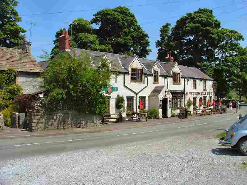
THE BULL’S HEAD
The Bull’s Head still survives; it is the last of five pubs that once helped to quench the thirst of hard-drinking lead miners. It has been licensed for well over 200 years, although not always under the same name. Until a few years ago, it used to be called the Lazy Landlord, which at the time was said to be an appropriate description of the landlord. Now the name has been changed back to the Bull’s Head, and the former landlord has departed. Recently refurbished, it is an excellent example of how a traditional old English country pub should look. It has stone-flagged floors and a roaring log fire in winter.
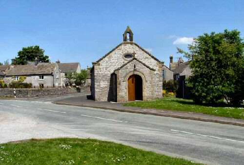
THE CHURCH OF ST HUGH
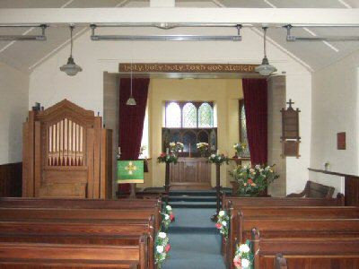
The delightful little Anglican Church of St. Hugh, across the road from the pond, was originally a smithy. The foundation stone for the church was laid in August 1888, the official opening taking place just before Christmas the same year; since then, several extensions and improvements have taken place. Local people have made many donations to the church, including the brightly coloured tapestry kneelers. They are the work of members of the congregation, mostly dedicated to the memory of loved ones. Labels underneath the kneelers indicate who they have been donated by, who they are in memory of and who undertook the work. Almost side by side with the Anglican Church, but a little further back from the road, stands the former Wesleyan Reform Church of 1836. It has a particularly imposing Tuscan porch entrance and pointed lancet windows, but it is now a private residence.
THE VILLAGE
Piped water only arrived in the village in 1932. Before that, villagers had to fetch and carry buckets of water. The sewage system came later in the 20th century, and soon afterwards, newcomers started to move into the village, attracted by the superb location and improved amenities. Now no longer the centre of a farming community, development in the village is tightly controlled by the Peak Park Planning Laws.
Farms still survive outside the village, but it is for the walking and beautiful scenery that most people come to Foolow, to explore the high escarpment behind the village and the many footpaths in the area. For those who want something different, they can always visit the Derbyshire and Lancashire Gliding Club, which is situated nearby.
Foolow revived the old custom of well dressing in 1983. Two wells, a main well and a children’s well, are erected on the village green on the Saturday before the last Sunday in August and blessed the same day. The following week, teas are served in the Village Hall, and money raised for charity.