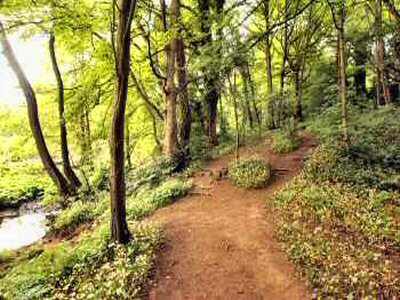
Calver Walk is an easy, level walk along riverside paths by the River Derwent between Calver and the pretty village of Froggatt. The riverbank is well-wooded, and near the midway point, there are good views of Froggatt Edge.
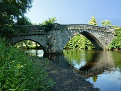
Froggatt Bridge is unusual in having a large central arch on the village side and a smaller arch on the far side. This is probably because the bridge was extended following the river’s widening when the Derwent was dammed at Calver.
The return journey is along the opposite bank of the River Derwent and finally through fields to join the road leading from Calver Mill.
LOOK OUT FOR
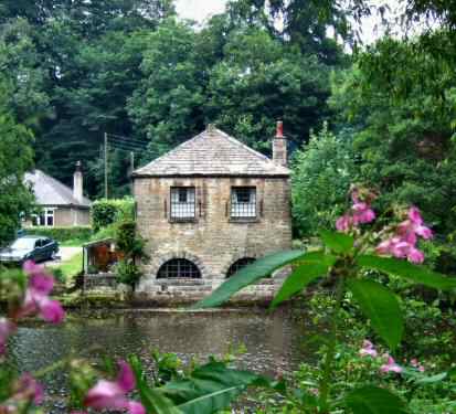
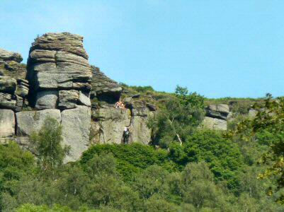
Route Point 3 – Close by New Bridge, the attractive, eye-catching 18th-century Shuttle House looks out across the river. It originally housed the sluice machinery to control the speed of the water from the river to power Calver Mill. A short distance further along the river, a huge pool has been created by a substantial weir. A Grade II listed structure, the weir reconstruction was completed in 2010. This project involved not only repairing the structure of the weir itself but also putting in a fish pass, creating new paths and improving access for disabled people. Point 4 – The gritstone escarpment of Froggatt Edge towers above the small village of Froggatt, which lies on the well-wooded banks of the River Derwent between Grindleford and Calver. The Chequers Inn is a traditional Peak District country public house that sits below Froggatt Edge and is popular with walkers and climbers.
Shuttle House
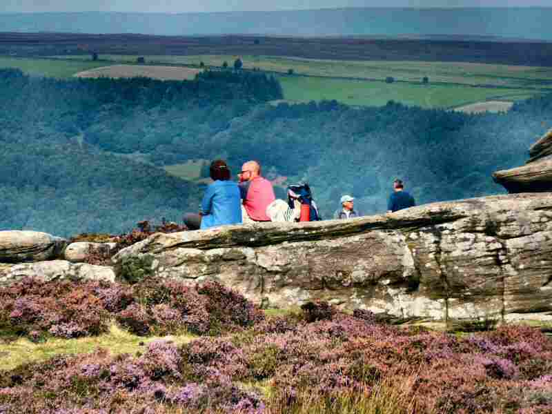
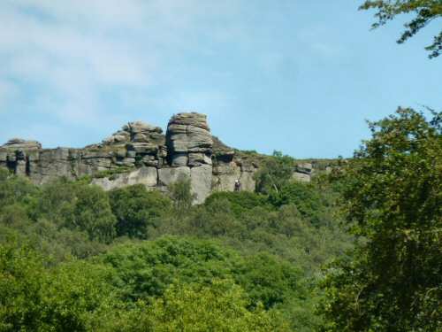
Froggatt Edge
Point 5 – On reaching the outskirts of Froggatt, cross the river by the 17th Froggatt Bridge. As you cross the bridge, take a careful look at both sides. The bridge is unusual in having a large central arch on the village side and a smaller arch on the far side. This was probably because it was extended following the widening of the river when the Derwent was dammed at Calver.
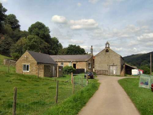
Point 6 – A short distance before the end of the walk, you pass Stocking Farm, with its very dignified barn and interesting-looking bell tower. In the early 19th century, an upper room in the barn was used for religious services, and later, it was also utilised as a school. When All Saints’ Church was consecrated in 1868, services were transferred, and a few years later, the barn lost its school and bell
Froggatt Bridge
Stocking Farm
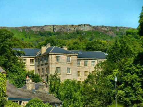
Point 7 – In 1778, a small mill was built close to the new bridge at Calver, and this was soon followed by the building of a much larger water-powered cotton mill. The second building was destroyed by fire and replaced by the impressive seven-story granite building that still remains today. Calver Mill achieved national recognition shortly after the Second World War, in a popular television series, when it was featured as ‘Colditz,’ the notorious German POW camp. During the series, the swastika flew high above the mill, but no one was fooled. The mill has been converted into luxury apartments.
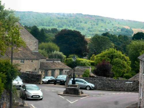
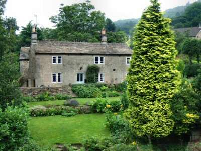
Point 8 – Calver is one of a combined parish of three with Curbar and Froggatt, which are both situated higher up the eastern slopes above the Derwent. Calver is the oldest and largest and was once a centre for cotton spinning. The centre of the village, where there are some lovely old houses, is to the west of the main road and often missed by visitors.
Calver Mill
Calver Village Centre
WALK DETAILS
Length: 2.25 miles.
Start: Take the A623 Baslow to Stoney Middleton Road. Park at the roadside near the Bridge Inn (SK248744).
Terrain: Flat, easy walking, mainly along the riverbank. It can be muddy during wet weather.
Refreshments: The Bridge Inn at Curbar by the River Derwent, the Derwentwater Arms, at the top of the hill above Calver village, which overlooks the cricket ground. Café 19 at Calver Crossroads, the Eating House near the river.
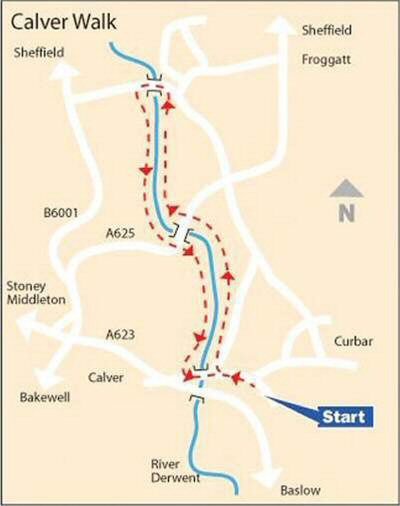
Calver Walk Map
THE ROUTE
1. Walk past the Bridge Inn and down Dukes Drive, the middle of the three roads. The bottom goes into Calver Village, and the top leads through Curbar to Curbar Edge. The signpost indicates that it is one mile to Froggatt by road. 2. After about 250 yards, where a short stretch of wall ends, turn to the left through a stile gateway along a riverside path. 3. Continue along the path by the river. Soon, you will pass a substantially sized weir and the eye-catching Shuttle House on the opposite bank. 4. On reaching the B6054, with New Bridge on your left, cross the road and stay beside the river for about half a mile. Where you leave the riverbank by a wall stile, turn left, and walk a short distance down the road towards Froggatt with the river bridge on your left. Here, you can make a short detour to briefly look at this interesting little village, which rises steeply up the hillside. 5. Cross Froggatt Bridge and turn sharp left to walk along the other side of the river, returning to New Bridge, where you cross the road and go down an access track by two cottages. 6. The walk continues close to the river. After reaching an open field, the path angles slightly to the right at a ‘Heritage Way’ sign. At the end of the field, go through a stile to the left of Stocking Farm.
7. Walk down the farm drive. The entrance to Calver Mill, now used for accommodation, is on your left as you approach the end of the drive. 8. If you wish to explore Calver, turn to the right at a ‘T’ junction of roads, go to the left and cross the footbridge by the side of the road over the River Derwent. The Bridge Inn is on your right as you return to the starting point of the walk.