ASHOVER WALK
THE WALK
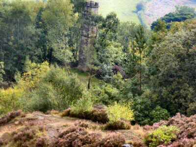
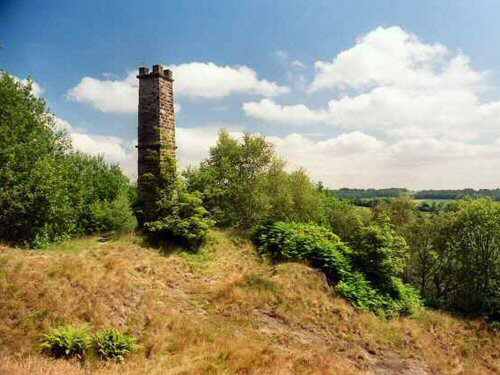
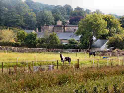
Ashover Walk is a most enjoyable walk and has good views of the attractive North-East Derbyshire countryside. There is plenty of evidence of the area’s former industrial past, but much of it is well concealed, particularly in the summer when the leaves are on the trees. During the early stages of the walk, sightings are made of the former Ashover Light Railway trackbed, but it is the Gregory Mine that is most impressive, with its tall chimney still remaining intact as if guarding the route to Cocking Tor.
LOOK OUT FOR
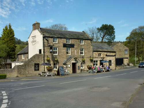
Route Point 1 – The Black Swan public house is over 300 years old and is said to contain the ghost of a “Laughing Cavalier” in its upper rooms. In a hollow, a short distance above the Black Swan, it is alleged that the sport of bear baiting once took place. Ashover Parish Hall is situated by the village cricket ground and recreation area, a short distance up the road from the pub. Opened in the 1980s, it has become a popular venue for weddings, concerts, family parties, conferences, training seminars and exercise classes. It is regularly used by local clubs and societies.
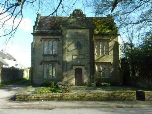
Point 2 – The Bassett Rooms, formerly called the Parish Rooms, were renamed in honour of the Bassett family on 17 February 2002 to mark the centenary year of Miss Elizabeth Bassett. She had worked tirelessly to support the local community for most of her life. Her family was in the confectionery business and created Liquorice Allsorts, which are universally recognised in this country. Originally, the rooms were built as a girls’ school in 1877. The introduction of Free State education in the late 19th and early 20th centuries made the school no longer necessary, and it was converted into Parish Rooms.
Point 5 – An application for a light railway to run from Stretton, just south of Clay Cross, to Ashover was made in 1918. It was granted, and the official opening of the Ashover Light Railway took place on 6 April 1925. The railway was built almost exclusively of second-hand equipment from the War Disposals Department. It was mainly constructed to carry freight from the Clay Cross Company’s own quarries at Ashover, Fallgate and Milltown. The extracted minerals were used in the Clay Cross Works or sold elsewhere. The line also carried passengers using six American steam locomotives called after members of the Jackson family who owned the company: Hummy, Guy, Joan, Peggy, Bridget and Georgie. At first, the line was very popular with tourists, but this soon slowed, and it ran its last passenger service in 1936, although excursions were still operated. Competition from road transport and the loss of a limestone order forced the line’s closure in 1950. Although a short stretch of line around the Fallgate works continued to be used until it closed in 1968.
Point 7 – Gregory Mine is most impressive, with its tall chimney still remaining intact, which appears as if it is standing guard over the route to Cocking Tor. It was once one of the most productive lead mines in England. It was said to produce 1,511 tons annually and provide employment for 300 people. Work started in 1758 and was finally finished 46 years later. The tall chimney and white slurry heaps are all that remain. Alongside the track from the mine is a spring of clear water, and further on, paving slabs have been used to improve the surface where horses once trod.
Point 8 – Overton Hall, a country house built in 1699, just outside Ashover. It was once the home of the famous naturalist Sir Joseph Banks, who accompanied Captain Cook on his first journey around the world, where he made wide-ranging botanical discoveries. Although his main base was in London, he regularly stayed at Overton Hall with his wife and sister, where he met for talks with many distinguished visitors from the scientific community. For a short period at the beginning of the Second World War, the pupils from Derby School were evacuated to Overton Hall. On its completion, the pupils were moved again to Amber Valley Camp on Woolley Moor, about five miles away. After the war, the school moved back to St Helen’s House, Derby, but a few years later, it was re-sited at Moorway Lane, Littleover.
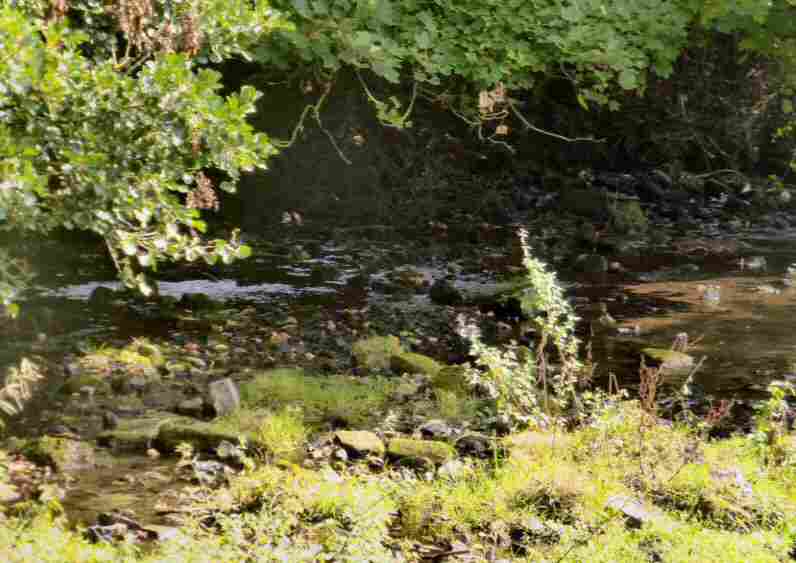
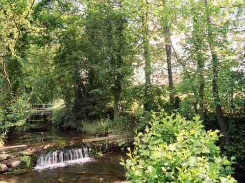
Point 10 – The River Amber is a tributary of the River Derwent. It rises a short distance to the north of Ashover, flows southwards through Ogston Reservoir to Pentrich, and continues westward through Wingfield Park to join the River Derwent at Ambergate. The River Amber gives its name to the local government district of Amber Valley. The parliamentary constituency of Amber Valley also covers a similar area.
WALK DETAILS
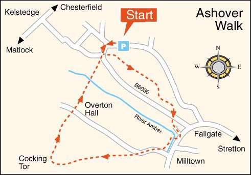
Length: Ashover Walk is 4 miles in length, plus the opportunity to extend the walk by climbing up Cocking Tor, before returning to the published walk.
Start: Leave the A632 Matlock to Chesterfield Road at Kelstedge along the B6036 for Ashover. The car park is 50 yards from the Black Swan public house on the Alton Road (SK350633).
Terrain: Apart from two short, steep gradients and one descent, the remainder of the route is mainly easy walking. The walk is best tackled in dry weather, as conditions underfoot on the climb up towards Cocking Tor may be difficult. Ensure no one in your party strays from the path during the early stages of the walk, as there are several quarries in the area, often hidden from view.
Refreshments: The village has three excellent pubs: the Black Swan, Crispin Inn and Old Poets Corner—Ashover Stamp Café, which is part of the village post office.
THE ROUTE
1. Walk to the left from the car park, past the Black Swan, and follow the road around to the left down Church Street.
2. Opposite the Crispin Inn, turn down the narrow path to the left of the Bassett Rooms and walk past the village playing fields and cricket ground along a stiled path. On reaching an open field, continue with the field boundary on your right. Here, you must watch out for a stile on your right, which takes you into another field where you turn a sharp left to go through a gateway. Maintain the same direction to go through a squeezer stile. Follow the field boundary round to reach the bottom corner, where you go through a stile by a gateway.
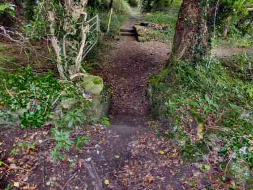
3. Keeping to the right, continue through a small copse and an area of woodland to follow the path as it descends to a high wall, where you turn right. The path goes through an area where buildings once stood; here, you keep to the right past a white bungalow, where a flight of steps in the corner of the field leads down to a road.
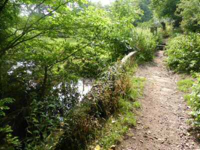
4. Go to the left of the cottages facing you. Turn right by Greenbank, the last cottage, down a short drive and along a relatively narrow, sometimes overgrown path. On reaching a road by a ‘T’ junction, ignore the right turn and go down the road by the side of the River Amber for about 100 yards before turning right at a footpath sign to cross a bridge over the river. Once over the bridge, turn sharply left.
5. Follow the path, keeping close to the quarry boundary fence and taking a right fork. Cross the former Ashover Light Railway line, which is separated by a pair of stone steps.
6. Soon, the route leaves the trees to follow a fenced path to an access road. Continue straight ahead along the road, which bends slightly to the right and starts to rise gently to a group of buildings.
7. By the buildings, turn right at a path indicator into a wooded area to climb steeply up a gulley, turn right at the top, to the site of the Gregory Mine. The mine chimney is on the left, partly hidden in the trees. You might like to climb to the top of Cocking Tor and enjoy fabulous views before returning to the walk. The route for the walk heads to the right across the cleared area at the mine to the gap in the surrounding trees, where the footpath is evident between two posts and railings.
8. Follow the track through the wood, with views of Overton Hall as it descends, where grit stone slabs protect the ancient trackway.
9. On reaching the drive to Overton Hall, continue straight ahead up a rough track. At the top of the hill, you are confronted with several options. Take care to go through the stile by the gateway and not through the gateway itself. Follow the path as it descends steeply down a paved path to reach a hollow track.
10. Continue down the track as it levels out and bends to the left – to run alongside the former railway line – before crossing the line and the River Amber.
11. A short, steep climb brings you back to Ashover, where you turn left and right up Church Street. Follow the road around to the right to reach the car park and the start of the walk to complete Ashover Walk.
Ashover