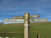
HARTINGTON THREE DALES WALK

Hartington Hall
Hartington Hall

THE WALK

Hartington Three Dales Walk descends gently to Beresford Dale, where the River Dove meanders slowly through a beautifully wooded dale, over a succession of tiny weirs. Once across the water meadow, Wolfscote Dale is entered, which becomes progressively more spectacular as you walk, with the sides of the dale rising almost vertically. Biggin Dale, in stark contrast, is dry except in wet weather.

The return journey is mainly along walled tracks with excellent countryside views as Hartington approaches.

LOOK OUT FOR

Route Point 1 – Peak & Northern Footpaths Society promotes the interests of footpath users by monitoring and improving rights of way. They have a team of over 150 Footpath Checkers who regularly walk footpaths checking for problems. Any issues are reported to the responsible local authority and followed up later to ensure the problem has been solved. They also have a Signpost Team that erects signposts to aid the public. All members of the Society are volunteers. 

Point 4 – Beresford Dale is one of the prettiest dales in the Peak District, enclosed by trees. Alongside the first of two footbridges over the River Dove is the Pike Pool. This name can confuse people as it is not named after some huge fish but the jagged spike of limestone that rises above the river. When you cross the first bridge, you leave Derbyshire and enter Staffordshire, returning to the former county a little later when the second bridge is crossed – the River Dove marking the boundary between the two counties.

Peak & Northern Footpath Sign
Beresford Dale
Beresford Dale

Point 6 – Wolfscote Dale becomes progressively more spectacular as you walk, with the sides of the dale rising almost vertically. At first, the sides of the valley alongside the River Dove are bare and rock-fringed, but this soon changes, with the slopes on the right becoming thickly wooded. The dale, rich in wildlife, is wilder than Dovedale and more unspoiled. A series of small weirs add to the beauty of the valley. After about one and a half miles of attractive scenery, you reach the cliffs of Drabber Tor, beyond which lies the entrance to Biggin Dale.

Point 7 – Biggin Dale is appropriately named after the village of Biggin from where it is entered. It is designated a National Nature Reserve and contains a fine range of flowers in spring. Many limestone-loving plants, including purple orchids, harebells and purple-flowered meadow cranesbill, are to be found in the reserve. It is usually a pleasant limestone dale, but underground waterways emerge from springs during periods of heavy rain, producing a swift-running stream. Biggin is an old village first mentioned in 1223 when it was called Newbiggin. At that time, there was a monastic settlement of the Cistercian order owned by the monks of Garendon Abbey in Leicestershire. They established a sheep ranch at Biggin Grange, which, although rebuilt since monastic times, still retains one ancient outbuilding. Farming has remained an important occupation in the village since the monks set up their farm.

Wolfscote Dale
Wolfscote Dale
Biggin Dale
Biggin Dale

Point 9 – A dew pond is an artificial pond intended for watering livestock, the making of which was once an important industry in Derbyshire. The ponds normally exist where a natural surface water supply may not be readily available, as in the White Peak, where rainfall rapidly percolates through the limestone beneath the surface. Despite the name, the ponds main supply of water is rainfall and not dew. According to researcher Edward Martin, ponds are often built in hollows, where cool air is likely to gather and moist air forms over the surface to reduce evaporation. The village of Biggin is only a short distance away. There is the Waterloo pub and the charming 17th century Biggin Hall, which is very popular with walkers both for food and accommodation.

Point 12 – Hartington Hall was opened as a Youth Hostel in 1934 and became the property of YHA in 1948. It was originally built as a manor house in 1611 by Hugh Bateman and served as the family’s home for over 400 years. In 1862 substantial alterations and extension work was carried out by Henry Isaac Stevens a Derby based architect. It is a fine example of a yeoman farmer’s house and a Grade II listed building. Bonnie Prince Charlie is said to have slept in one of the rooms during the Jacobite Rebellion of 1745.

Biggin Hall
Biggin Hall
Hartington Hall
Hartington Hall

WALK DETAILS

Length: 6 miles.

Start: Hartington is on the B5054 about two miles west of the A515 Ashbourne to Buxton road. Hartington Village Car Park is on the southwestern side of the village (SK129604).

Terrain: After a gentle descent to Beresford Dale, the route is mostly flat, apart from the long, steady climb up Biggin Dale, which is deeply rutted and rock-strewn in places. After heavy rainfall, the dale changes from a dry dale to one with a stream flowing through it. The path through Morson Wood and Beresford Dale can be muddy in wet weather.

Refreshments: Charles Cotton Hotel is a traditional country hotel; Devonshire Arms is a 17th-century village pub with seating inside and out; Beresford Tea Rooms is a long-established business serving morning coffee, lunches, and afternoon teas; Hartington Farm Shop and Café is a recently established business.

THE ROUTE

Hartington Walk
Hartington Walk

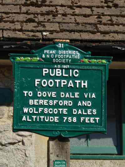
1. Cross the road from the car park and head towards the public toilets. Go up the steps on the left of the toilets by the Peak & Northern Footpaths sign and through the gate, then turn right to follow the surfaced path across the field.
2. Go over two stiles, on either side of a stony lane, and along a well-trodden path through two further fields.
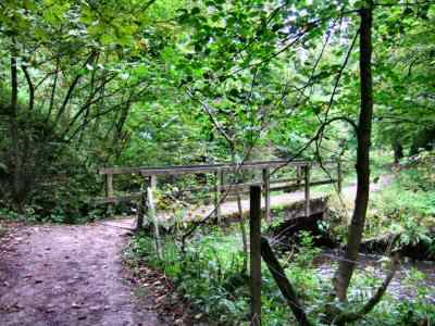
3. On entering the next field, aim to the left of a small tree. The path then drops gently down to a stile into an area of woodland alongside the River Dove, known as Morson Wood. You may be able to pick out Charles Cotton’s Fishing Temple, on the western side of the river, through the foliage, as you approach the wood.
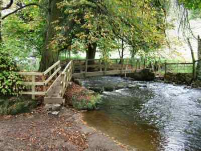
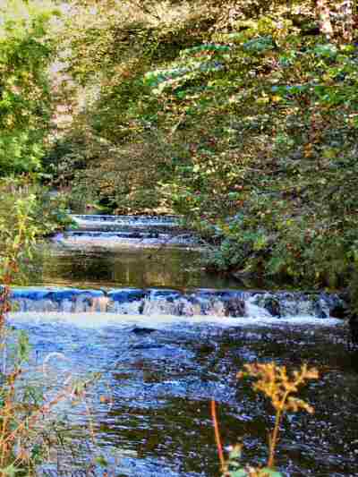
4. Follow the track through Beresford Dale, crossing a bridge to the other side of the river by the Pike Pool and continuing your walk downstream.
5. Cross a second bridge, leave the river, and walk straight across the water meadow to the stile in the far corner near the river, which has looped around to meet you.
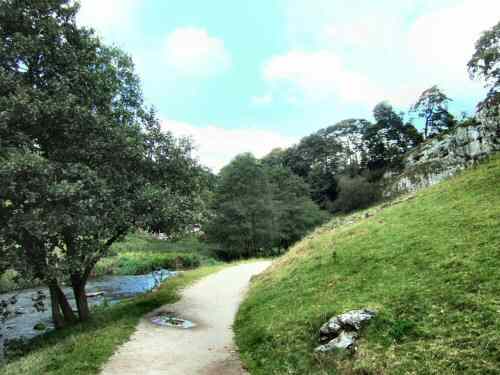
6. Cross two stiles and, with the river on the right, start your walk down Wolfscote Dale.
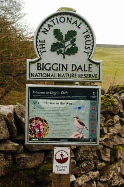
7. Continue along the side of the river for about one and a half miles before turning left, as a wall crosses your path, into a side valley. This is Biggin Dale, which is normally a dry valley except after very heavy rainfall. The path is easy to follow but is quite rough underfoot in places.
8. Follow the path up the dale, carefully examining trip hazards along the rough, stony path. As you get higher up the Dale, ignore the Dale coming in from the right.

Hartington Walk Sign
Walk Sign

9. Here, you take the left-hand fork past a dew pond to go left again up a slight rise to reach a narrow-walled track. Do not continue up the dale to Biggin unless you want to explore the village or perhaps have refreshment.
10. The track gradually widens as the walk continues, and the surrounding countryside has superb views.
11. Remain on the walled lane and look out for a triangle of grass where several lanes meet. After 200 yards, you cross a wall stile on your right. Angle to the left across two fields to the far corner of the second field, and turn left along another walled track.
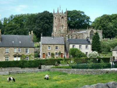
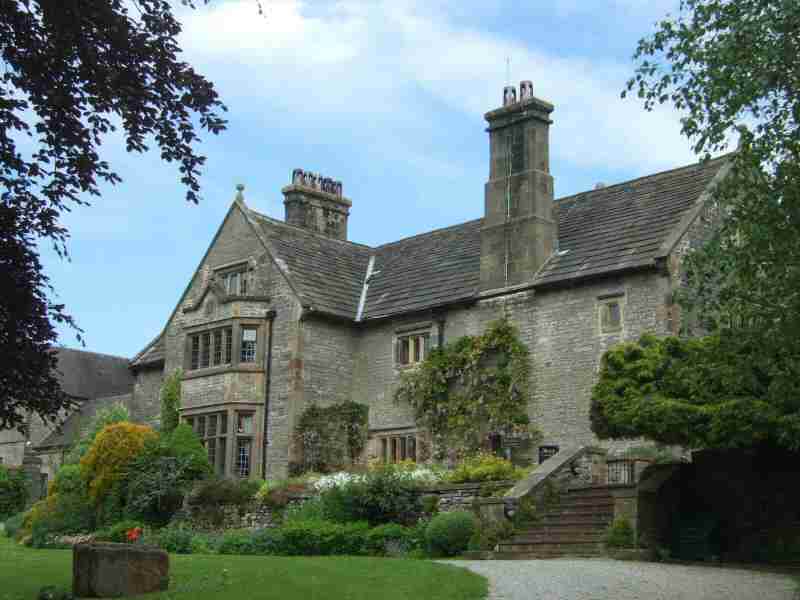
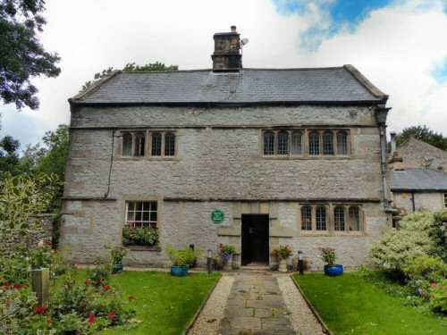
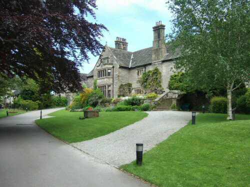
12. The track gently loses height before arriving at a road opposite Hartington Hall. Turn left down the bank to reach Hartington, where you turn left again to reach the walk’s starting point.

Hartington

First Bridge, Beresford Dale
Hall Bank
Hall Bank
Second Bridge, Beresford Dale