MELBOURNE TWO VILLAGES WALK

MELBOURNE TWO VILLAGES WALK
Melbourne Two Villages Walk is set among pleasant rolling countryside in South Derbyshire. In the early stages of the walk, you pass through the delightful village of King’s Newton, which is contained within the parish of Melbourne and became a centre for supplying fruit and vegetables several centuries ago. You then cross Newton Park and link up with the former Derby to Ashby Railway, which opened in 1867 and closed in 1982. It is now part of the Sustrans Cycle Trail.
Wilson, an attractive roadside village, is passed through on the way to Melbourne Park. It is on the border of Leicestershire and Derbyshire. Before administrative boundary changes in the late twentieth century, part of the village was in Derbyshire.
Melbourne has a wealth of historic buildings and a famous country house with formal gardens. It has one of the finest Norman churches in the country and a lovely 20-acre Pool where you can feed the ducks or rest awhile and admire the scenery.
LOOK OUT FOR
Route Point 1 – Castle Square is on the site of a medieval marketplace. On the north side stands the White Swan, with the inn sign clasping the corner of the building, and a large thatched cottage—divided into seven cottages in 1824 but now restored to one. There was once a substantial castle on the other side of the square. It fell into disrepair in the 17th century, and all that remains above ground is a wall of infillings. It is on private land at Castle Farm.
Point 2 – King’s Newton is a gem of an old English village, with a great variety of well-cared-for old houses covering a wide age range that all blend superbly together. Nicholas Pevsner, who wrote a series of 46 volumes of county guides under ‘The Buildings of England’ (1951-1974) series, described King’s Newton as having ‘one of the most attractive main streets in Derbyshire’.


Point 3 – King’s Newton Hall is the principal building in the village, but it looks much older than it is. For many years, the Hardinge family owned the hall until the death of John Hardinge, who died childless in 1729. The hall and grounds then came into the ownership of the Melbourne Estate. In 1859, fire gutted it, and it remained an empty shell until it was rebuilt in 1910 by Sir Cecil Paget. He had acquired it the previous year and meticulously restored the house to its former grandeur.
Point 5 –The former Derby to Ashby Railway opened in 1867 and closed in the 1980s. During the Second World War, the War Department used it has a railway training centre for the British Army and Allied engineers for training purposes from 1939 until late 1944. Here, preparations were made for the invasion of mainland Europe; engineers practised the demolition and rebuilding of railways and the running and maintenance of a railway line and its rolling stock. Following the closure of the Derby line (Derby to Worthington), Sustrans converted it into a footpath and cycle track known as the Cloud Trail. The trail is 13 miles in length, with numerous access points.


Point 6 – The Priory Church of St Mary and St Hardulph at Breedon-on-the-Hill is a landmark regularly seen on the walk. It is of national importance and stands on the site of an Iron Age fort on a limestone hilltop that a quarry has partly cut away. It was originally a monastery founded in about AD 676 and re-founded as an Augustinian priory early in the 12th century. The church is famous for its Saxon carvings dating back to the 8th and 10th centuries.
Point 7 – Wilson is a small village situated on the border of Leicestershire and Derbyshire. It is an ancient place, initially with a strong agricultural base and several farms. As the 20th century progressed, agriculture became less dominant, and no working farms remained in the village. The old farms and redundant outbuildings have been converted into private housing, and other houses built.


WALK DETAILS
Length: 4 miles.
Start: The Melbourne Two Villages Walk starts from Castle Square, Melbourne (SK389251). On the B587, just off the A514 Derby to Swadlincote Road.
Terrain: A leisurely walk with minimal ascent or descent, which includes a lovely stroll along Cloud Trail and through the village of Wilson. The farmland can be muddy.
Refreshments: Melbourne has cafes, pubs, and restaurants to suit all tastes. King’s Newton and Wilson have highly rated public houses.
THE ROUTE
1. From Castle Square, walk up Castle Street in an easterly direction; at a ‘T’ junction of roads by a triangle of grass, turn left and right along Pack Horse Road a few yards later. Opposite Queensway, turn right signed for King’s Newton down an enclosed path. When the path bends to the right, you turn left to walk across the bottom of a cemetery.
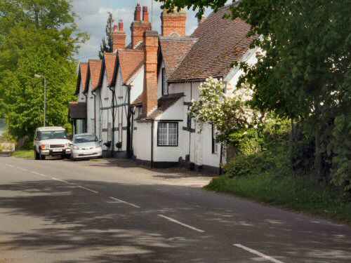
2. The path continues through bushes before, at a fork, you go to the left. Continue in the same direction to reach King’s Newton, where you turn left along the main street.
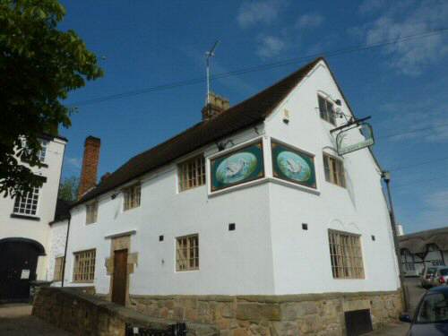
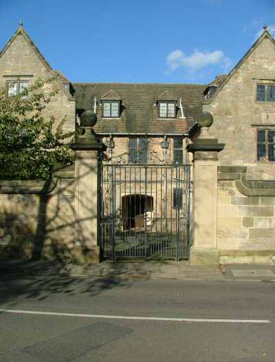
3. King’s Newton Hall is on the right, and the Hardinge Arms is on the left. On arriving at a mini-roundabout, turn right down Ward’s Lane, signed ‘Holy Well.’ After viewing the well, walk back up the road for about 20 yards and go over a stile on the left. Head straight across the field to an intersection of paths.
4. Take the path heading diagonally downhill towards a house, but before reaching it, go over a stile on the right by a metal gate. Cross the following field close to the hedge on the left and go over a stile in the bottom corner of the field into a lane.
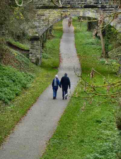
5. Walk down the lane for 25 yards before turning left down an access path. At the bottom, turn right along Cloud Trail, a tarmac trail for cyclists and walkers.
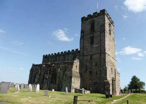
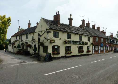
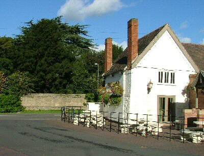
6. Continue for about one and a half miles, with frequent views of the Priory Church of St Mary and St Hardulph at Breedon-on-the-Hill. At a sign for the Bulls Head, turn right up an access road and again at the top to walk up a rough track to the Melbourne to Wilson road.
7. Go to the left and follow the road around through Wilson. Thirty yards after passing the Bulls Head, turn right at an access road and immediately go right again through a gateway.
8. Walk up a wide field, aiming about 15 yards to the right of a line of trees in the middle of the field. Maintain the same direction to the top of the field, where you will find a stile in a gap in the hedge, approximately at the midway point of the field boundary.
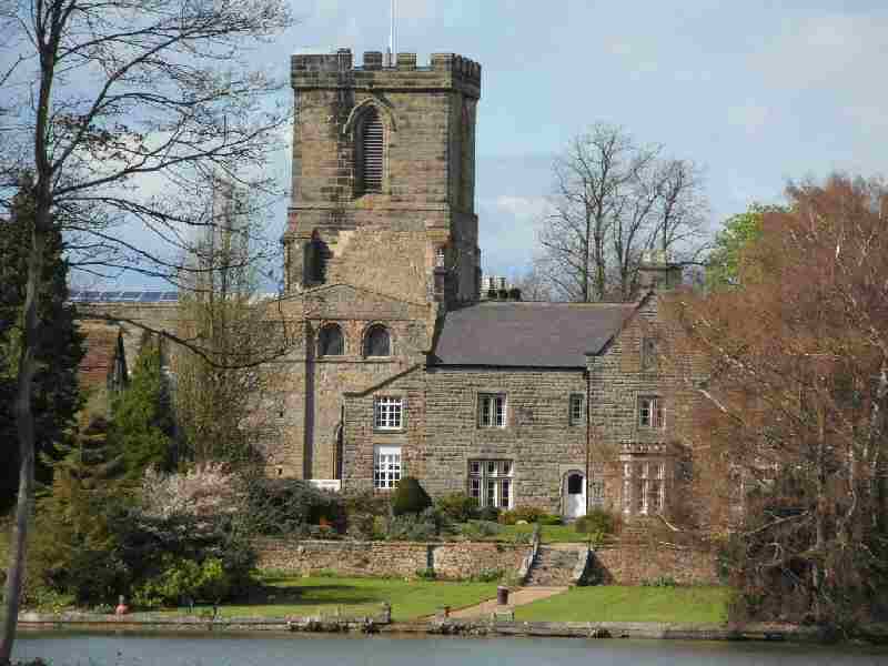
9. Go straight down the next field, close to the hedge on your right, to join a farm access track through another field. Continue straight on, and after leaving the field, follow the road as it curves around, with Melbourne Pool on your left.
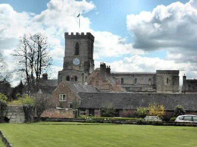
10. Walk along the estate road between Melbourne Hall and St Michael with St Mary’s Church to reach and cross Blackwell Lane. Continue up Castle Street and back to the walk’s starting point.
Melbourne


