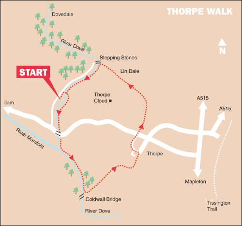
Thorpe and Dovedale Walk includes fantastic views, one of the country’s best-known river valleys, and the famous Dovedale Stepping Stones. The tiny limestone village of Thorpe is less than a mile from the stepping stones but still maintains an air of peace and quiet even in the middle of the summer.
LOOK OUT FOR
Route Point 1 – Ruskin described Dovedale as ‘An alluring first lesson in all that is beautiful’. The building of the Midland Railway in 1863 made the Peak only three hours from London. Many were the thousands who got off the train at Alsop-en-le-Dale Station and walked the length of Dovedale before catching a train home at Thorpe Station. The railway is no longer there, but cars and coaches still bring thousands of visitors to one of England’s most famous beauty spots.
Point 5 – The Manifold rises near Axe Edge just south of Buxton and joins the River Derwent near Coldwall Bridge. What sets it apart from most other rivers is that after reaching Wetton Mill, it disappears underground, most summers between May and October, except in very wet weather. After flowing underground through caves and subterranean passages, it resurfaces at the ‘boil holes’ near Ilam Hall. When the Manifold joins the Dove, it is the larger of the two rivers but still surrenders its name to the latter.
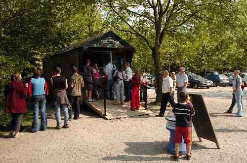
Dovedale Visitors
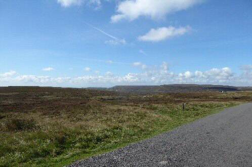
Axe Edge
Point 6 – Coldwall Bridge crosses the River Dove. The size of the long, wide grass-covered bridge arouses quite a lot of curiosity among visitors until maybe they notice the milestone a few yards up the track towards Thorpe, which reads ‘Cheadle 11 miles’. The bridge dates to when a coach road ran between Ashbourne and Cheadle. It fell into disuse at the start of the motoring age, the gradients proving too steep for the cars of that era.
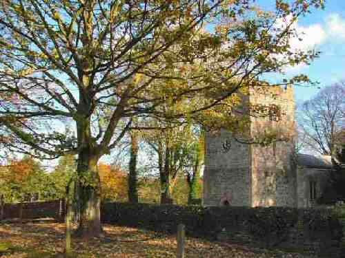
Point 8 – St Leonard’s Church has a stocky little Norman tower and a tub font, one of only three in Derbyshire. It also has a fine Elizabethan altar rail and some attractive stained glass, including a delightful narrow St. Leonard’s window. The Old Rectory stands next to the churchyard.
Coldwall Bridge
St. Leonard's Church
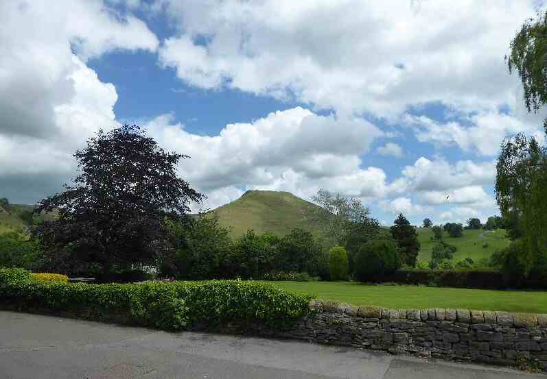
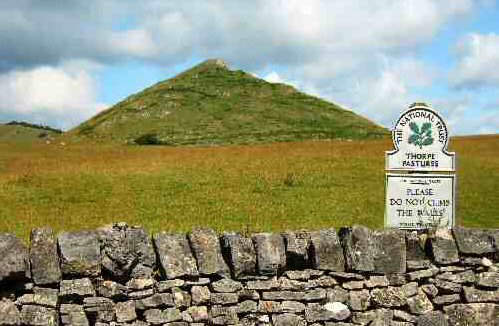
Point 9 – Thorpe Cloud is an isolated limestone hill in Derbyshire on the border with Staffordshire at the southern end of Dovedale. The name ‘cloud’ is from the Old English word clud, which means ‘hill’ and provides magnificent views from the top. It is in the ownership of the National Trust and is part of their South Peak Estate.
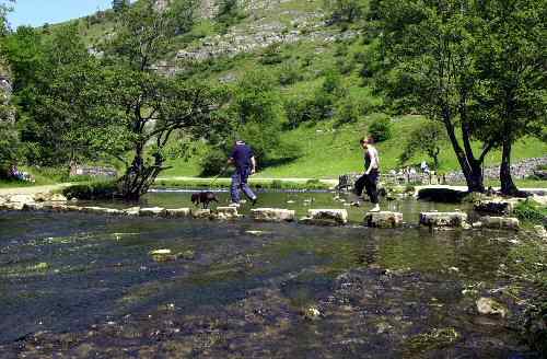
Point 10 – Dovedale, with its steep limestone sides and tree-covered slopes, is the valley that runs from the tiny hamlet of Milldale down to the large car park close to the road linking Ilam and Thorpe. In some places, the water has eroded the limestone into spectacular rock formations, such as the Lion’s Head and the natural archway in front of Reynard’s Cave. Crossing the Dovedale Stepping Stones is so popular that people often must wait for their turn.
Thorpe Cloud from Thorpe
Dovedale Stepping Stones
WALK DETAILS
Length: 3.75 miles. It is best to avoid it at peak times as the car park may be full.
Location: Thorpe and Dovedale Walk is off the A515, Ashbourne to Buxton Road. When travelling from Ashbourne, ignore the first turn for Thorpe, and only turn left off the A515 for Thorpe, opposite the turn for Tissington. Follow the road towards Thorpe, passing The Old Dog public house on your left. Continue through the village before descending to Dovedale, where you turn right for the car park.
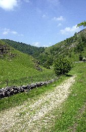
Terrain: Mostly easy walking, at first close to the river, where it can be muddy. The walk then climbs steadily up from Coldwall Bridge to Thorpe. After passing through the village, there is a gentle descent down Lin Dale to reach Dovedale Stepping Stones. They often flood after particularly heavy rainfall, but there is an alternative route.
Refreshments: At busy times, a kiosk opens at the car park. A National Trust café is at Ilam, and the Izaak Walton Hotel is only a short distance from the car park.
THE ROUTE
Lin DaleLeave the car park at Dovedale on the path between the toilet block and the River Dove. A few yards further on, go to the right over a footbridge.
Immediately, you are on the other side of the bridge. Go over a stile on the right and head across a field, angling slightly to the left and then to a stile by a loop in the river.
Continue by the riverbank for a short distance with the fence close to your left. On reaching an open field, keep to the right to go through a stile and over a plank in the bottom corner of the field.
Walk close to the river to reach a gate stile that leads to a short track leading to the road from Ilam to Thorpe.
A few yards to the left, you will see a stile by a finger post sign on the other side of the road. Cross the stile, angling slightly to the left across the field, to another stile by a metal gate. Look out for the River Manifold as it joins the River Dove.
Aim towards a hollow a short distance in front and follow it to a gate stile. Continue close to the river until you arrive at Coldwall Bridge.
Here, you turn left and walk up an old road that bends to the right near the top and leads you into Thorpe.
Walk along the road into the village, passing St Leonard’s Church on your right, where you bear left along Digmire Lane. At the end of the lane, cross the road and walk through the short-stay car park opposite, with the toilet block on your left.
Go over a stile at the top of the car park and walk along a track towards an old quarry. On your left is Thorpe Cloud, from the top of which you get a fantastic view
Keep the old quarry on your right as you gradually swing to the left to walk down Lin Dale to Dovedale Stepping Stones. Cross the stepping stones*, turn left down the road, and return to the car park.
ALTERNATIVE * If you do not want to cross the stepping stones, which may be underwater, carefully follow the scree-strewn riverbank to the left, cross the footbridge encountered earlier and return to the start of the walk.