
WALK DETAILS
Length: 5 miles.
Start: Any convenient car park in the centre of the town.
Location: Off the A61 in the centre of Alfreton. There are several signed car parks in the centre of the town.
Terrain: Easy walking, but some muddy patches. Watch out for flying golf balls when you cross Alfreton Golf Course.
Refreshments: There is a wide selection of cafés, pubs, and restaurants in Alfreton to suit all tastes.
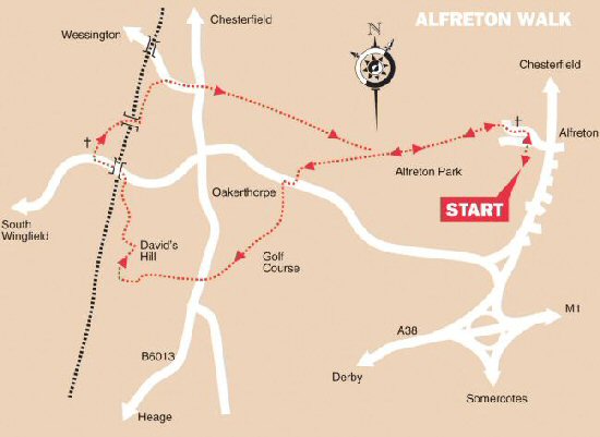
THE ROUTE
1. From the centre of Alfreton, make your way towards the A61, on the western side of the main shopping area. Look for the traffic lights at the corner of High Street and King Street, cross the road and walk down Church Street. Pass in front of the church along a stone slab path.
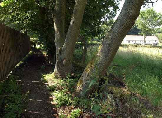
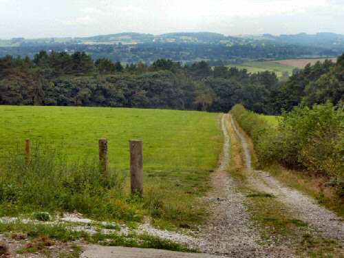
2. Leave the churchyard by a stile and turn immediately half left, to walk down a farm track for about half a mile through Alfreton Park. When the track swings right, head straight on following the Amber Valley Routeways 3 sign. Look out for a stile on the left, which you cross and walk down the side of the field to reach the A615.
3. Turn right along the footpath, not left as shown on some OS Maps, for approximately 40 yards. Cross the road to follow the signed path on the opposite side. Keep close to the side of the field, before taking a stile on the right 25 yards from the bottom of the field into a woodland area.
4. After you emerge from the trees, Alfreton Golf Course is soon reached, where you will need to look out for flying golf balls. Follow the designated route across the fairways with care. On the other side of the course, the path descends through the trees and continues straight on at an intersection of tracks to cross a stile by a cottage.
5. Cross the field in front of you, and turn right down a fenced path leading to the B6013. Go over the road and head for Hollowbank House Car Park, go through the car park, crossing a stile in the corner and turning left along the well-worn path as it winds its way up David’s Hill.
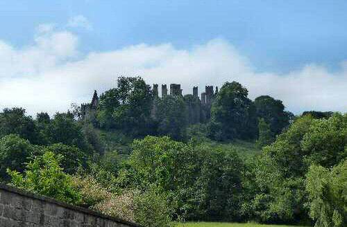
6. At the top of the field, go round a massive radio mast and turn right to walk along the edge of a wood. After 300 yards, a stile leads into the wood where a stepped path descends. Leave the wood by a stile into a field, and turn right. Just after coming out of the woods, look out for the view of Wingfield Manor. Follow the boundary around to a stile in the bottom corner.
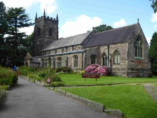
7. The path passes to the rear of some farm buildings and then bends to the left to the B5035, where you turn left and walk towards South Wingfield. On arriving at All Saints’ Church, follow the path through the churchyard. Keep to the right of the church and go through a gate stile into a field. Continue straight on across the first field; turn right up the next field to cross a railway bridge.
8. Then immediately turn left, keeping close to the railway line, to cross a field. A clearly marked path now takes you around a disused quarry and onto the A615. Turn right and walk up the wide grass verge, crossing the road before you get to the road junction, which makes it easier when you recross the A615. At the top of the hill, cross the stile directly in front of you and angle to the right.
9. Continue across four fields along an obvious route, continuing to angle slightly to the right, with Alfreton Church in view. When you finally reach the right-hand corner of the fourth field, cross the next two fields, keeping close to the hedge.
10. Turn right when you reach the top of the second field along a farm track for 70 yards and then take the stile on the left. From this point, you will be able to retrace your steps back to the start of the walk.
ALFRETON