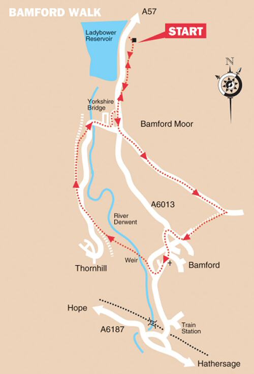
BAMFORD LADYBOWER WALK

The Green, Bamford
The Green, Bamford

THE WALK

The Bamford Ladybower Walk is a lovely walk that starts at the southern end of Derbyshire’s ‘Lake District’, at Heatherdene car park and picnic site, situated in one of the most picturesque spots in the county.

It continues through beautiful countryside with excellent views towards Win Hill and beyond, before visiting the attractive, gritstone village of Bamford. The return journey passes through pleasantly wooded countryside along a former railway track and the hamlet of Yorkshire Bridge.

LOOK OUT FOR

Route Point 1 – The tiny village of Yorkshire Bridge, in the Upper Derwent Valley, lies in the shadow of the dam wall of the Ladybower Reservoir. It’s neat, regimented rows of houses built to re-house the inhabitants of the former villages of Ashopton and Derwent. Both villages and the surrounding land were submerged when the reservoir was completed and filled with water. Yorkshire Bridge has its own pub of the same name, and the bridge spanning the River Derwent also bears the same name. Despite all the references to Yorkshire, you are still in Derbyshire; the boundary between the two counties is more than two miles away to the north east.

Point 3 – In 2012, when the Angler’s Rest, the last surviving pub in the village, was at risk of permanent closure, it was suggested by members of the public that it should be bought for community use. As a result, the pub became Derbyshire’s first community pub in 2013. Apart from the public house, it also houses a particularly attractive café and post office. Annually, the community project puts in over £100,000 into the local economy in wages, with over 90 per cent of the staff living locally. There is seating outside for both pub and café customers, and also a large car park.

Yorkshire Bridge Village
Angler's Rest, Bamford

Point 4 – The superbly situated village of Bamford stands at the heart of the Dark Peak, surrounded by high, impressive moorland scenery, with the gritstone edges of Bamford and Derwent on the northern side and to the west, Win Hill. To the south, the River Derwent flows through the village. At the centre is a pleasant, green triangle of land, where the Jubilee Stone commemorates Queen Victoria’s Jubilee. Opposite the green is a most unusual ‘V’ shaped style, with a cut-out designed. It allows the easy carriage of a bucket of water from the trough at the rear. A central Touchstone combines all four elements, and a Celtic symbol is present on all the touchstones to signify the millennium.

Point 5 – Situated as Bamford is in an area dominated by hills, it gives rise to the thought that the Industrial Revolution hadn’t had much of an effect on the village. It is far from the truth, as a corn mill operated in the village during the first half of the 18th century. Later converted to cotton spinning and doubling by local farmer and miller Christopher Kirk, who lost everything when the mill caught fire in 1791. The Moore family rebuilt the mill, created a weir to provide more power for their cotton mill, and gradually recruited a substantial workforce. Having changed hands several times, it closed in 1965 as a cotton mill. It is now high-class accommodation, which looks out on the weir and one of the most unusual river crossings in the country.

Bamford Touchstone Sculpture
Bamford Mill
Bamford Mill

Point 8 – Thornhill Trail runs along a former railway line and is made up of a mixture of grass and compacted stone. The line was specially constructed to carry stone from the railway sidings at Bamford to Fairholmes when the Derwent and Howden dams were constructed during the early 1900s. In the 1930s, when the construction of Ladybower began, it was reopened as a timberline. When it no longer served any useful purpose, the Peak District National Park Authority purchased it, and it is now a bridleway and footpath.

Point 9 – Following the renovation of the Ladybower Dam, a permissive path is open across the dam wall. At the western end of the dam is a small sculpture that forms part of the Bamford Touchstones Sculpture Trail, established by the residents of Bamford to mark the millennium. The Touchstones illustrate Air, Water, Earth and Fire and on a five-mile walk around the edges of the village. 

Thornhill Trail, Bamford
Ladybower Dam Wall
Ladybower Dam Wall

WALK DETAILS

CARE – The walk follows a slightly different route from that shown on the map due to a landslide and the closure of a path.

Length:    4.75 miles.

Start:    Heatherdene Car Park, or for train users, Bamford Railway Station.

Location:    On the A6013, between the A57 Snake Pass Road and the A6187 Hope Valley Road. Heatherdene Car Park is about half a mile north of Yorkshire Bridge. Railway users coming up from the station – start at point 4.

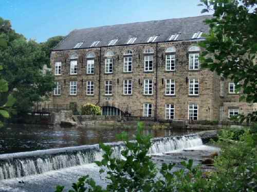
Terrain:    Mainly easy walking, with a short climb up New Road towards Bamford Moor. The river crossing at Bamford Mill can be tricky after heavy rainfall – in favourable conditions, it is one of the highlights of the walk.

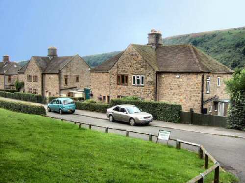
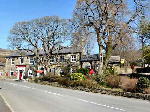
Refreshments:    The Angler’s Rest at Bamford became Derbyshire’s first community pub in 2013. Apart from the pub, it also houses a café, a post office, outside seating, and a large car park. At Yorkshire Bridge, the Yorkshire Bridge Inn is a popular visitor destination.

THE ROUTE

Stepping Stones, Bamford

1. Leave the car park and walk through the picnic area to follow the path to the A6013. Walk up the pavement for a short distance, past the Yorkshire Bridge Hotel. Turn left up New Road (the route differs from that shown on the map due to a landslide and the closure of a path). Approximately 700 yards up New Road, shortly after passing a farm on your right, look out for a footpath on the same side close to the driveway to farm buildings and turn right into a field.
2. Angle at about 45% to the left across the field to a stile near the bottom corner. In the next field, within a couple of yards, go through a gate stile into another field. Head straight down that field to a stile into a further field.
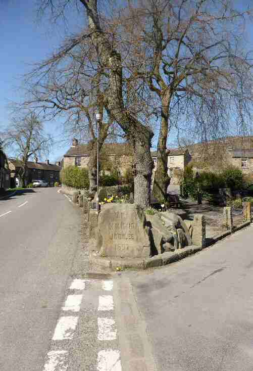
3. Go to the left and maintain the same direction along an obvious path that eventually angles to the right towards a group of houses and reaches the top end of a cul-de-sac named Greenhead Park. From there, keep straight on, walking between houses to reach the A6013 and turn left. Follow the road around past the Anglers Rest.
4. Continue through Bamford to the edge of the village. Turn right (Railway Users coming up from the station, turn left) immediately by a speed restriction sign, just past the last house in the village, along a road with a wide entrance.
5. Walk past the former mill, now turned into flats, and turn left into the car park. About two-thirds of the way down the car park, go to the left as directed by the sign to walk past the mill.
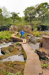
6. Cross the river by an unusual combination of stepping stones and two high footbridges to reach a field on the other side. Head diagonally across the field to a stile in the corner, and continue in the same direction across the next field to a stile by a gate.
7. Walk down a cart track to the left of a barn to go over a stile into the next field. Turn left by a footpath sign and walk up the field, close to the hedge on your left.
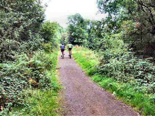
8. Partway up the field, cross a stile on your left and in about 15 yards, turn right along the Thornhill Trail. The track eventually crosses a road and continues through woodland, until at a junction of paths you fork to the right, signed for Yorkshire Bridge.
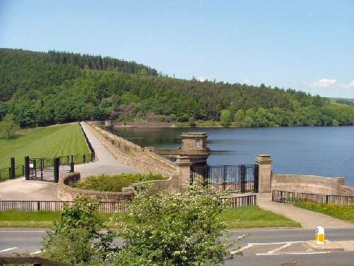
9. On reaching the road from Thornhill to Bamford, turn left and follow it to the bridge over the River Derwent. Here you turn right over the bridge and follow the road as it gently climbs up towards the A6013 with Ladybower Dam Wall in the distance on your left.
10. Just before reaching the top of the road, turn left between the A6013 and the last row of houses, along Bemrose Gate. (Railway users, should walk to the top of the road and turn right along the A6013 and then turn left up New Road – and continue from point 1 of the walk – otherwise, to see Ladybower, turn left before returning to this point).
11. Leave the Yorkshire Bridge estate at the Yorkshire Bridge Hotel, turn left and retrace your steps to the starting point of the walk.
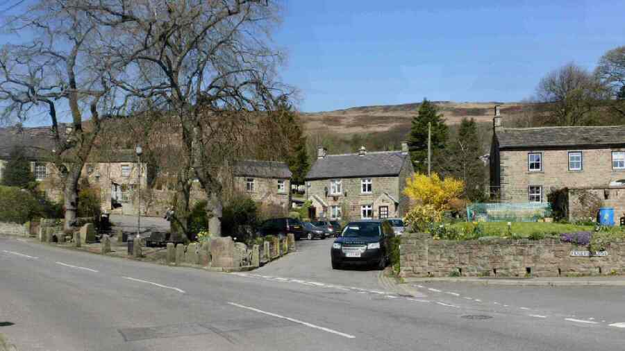
BAMFORD

V. R. Diamond Jubilee Stone, Bamford
Bamford Ladybower Walk Map (note route change)