BELPER TO BIGGIN
A TO Z – DERBYSHIRE AND THE PEAK DISTRICT – CHAPTER 5
BELPER (on the A6 between Derby and Matlock – SK351475)
The story of Belper begins as a small settlement in the Royal Hunting Forest of Duffield Frith, when it was called ‘Beaurepaire,’ which means ‘beautiful place.’ All this must seem rather strange to the motorist who has driven through the town on the narrow, overcrowded A6, with the sole desire being to reach the other side as quickly as possible.
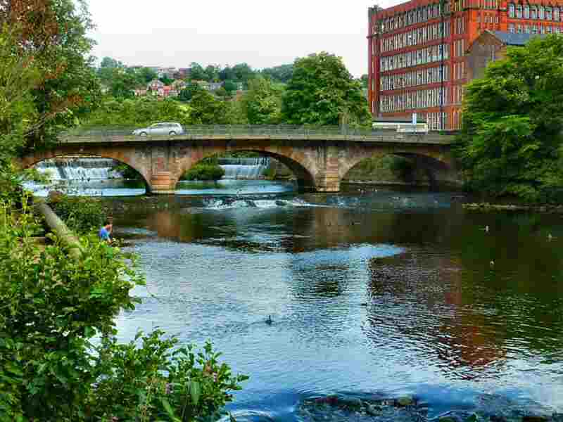
For those who have taken the time to explore, a completely different picture emerges of a small town so rich in industrial heritage that it is not only of national importance but occupies a pre-eminent position on the world stage. Belper is indeed an essential part of the Derwent Valley, universally recognised as the Cradle of the Industrial Revolution, and now holds World Heritage Status. In 2014, Belper won the hugely prestigious ‘The Great British High Street’ award. The judges said it was an example of how town centres can be transformed.
BELPER – RIVER GARDENS
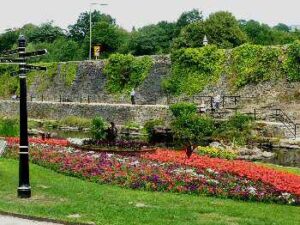
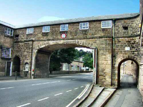
It is now possible to walk from Strutt’s North Mill Museum, past the semi-circular weir, into the River Gardens with its flowerbeds, arboretum, bandstand, water gardens, children’s playground and boating facilities. Road users on the A6 often never realise the gardens exist because of the high retaining wall. East Mill, a seven-storey red brick building from 1912, where the bricks were surprisingly laid from the inside, formerly occupied by the English Sewing Company but now put to other uses, overlooks the gardens.
BELPER – ST JOHN’S CHAPEL
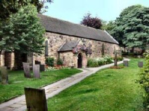
In the mid-1200s, William de Ferrers built a small stone church in a clearing, so that the foresters and their families would have somewhere to worship close to home. Today, it has changed very little in appearance but is now used for the joint purpose of the Town Council Chambers and Heritage Centre. Near the chapel is an area known as The Butts, where archery practice once took place and horse fairs were held twice a year.
BELPER – JEDEDIAH STRUTT
Rarely can one man and his family have created such a lasting impact on the economy of a small town as the Strutts did on Belper. Jedediah Strutt was born on a small farm at Blackwell near Alfreton. From a young age, he had an obsessive interest in machinery. But when his uncle died and left him a small holding, he took it over and married Elizabeth Woollatt, whom he had met during his apprenticeship as a wheelwright at Findern. His brother-in-law, who worked for a hosiery firm in Derby, knowing of Jedediah’s interest in machinery, informed him of the problems they were experiencing in trying to adapt their machines to produce ribbed-patterned stockings.
Jedediah spent many hours in his attic experimenting. At last, he succeeded, and the closer-fitting stockings that resulted were a great success. He went into partnership with his brother-in-law, opening a stocking factory in Derby, and patented his ‘Derby Rib Machine.’ Wishing to expand his business further, he entered a partnership with Samuel Need, and they later invited Richard Arkwright to join them. Together, they built mills at Belper, Cromford, and Milford. On the amicable dissolution of the partnership, Jedediah retained the mills at Belper and Milford. The first North Mill at Belper was destroyed by fire in 1803.
BELPER – NAILERS
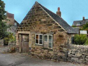
The first primary industry in Belper was nail-making. Hunting was a regular pastime in the area, and huntsmen would bring their horses to Belper to be shod. The horsenails made in Belper were considered the best in the country and attracted hunting men from miles around. The earliest written record of nailmaking in Belper dates to 1260. However, it may have begun shortly after the Norman Conquest. Initially, the nailer worked for himself with the help of his family. The children would carry the coal, his wife would work the bellows, and he would fashion the nails. It was a hard life, the work hot and exhausting.
The nailers had a reputation as hard drinkers, often got into fights, and many went to prison for drunkenness and disorderly behaviour. They did not work on Mondays, which they reserved as a day for celebration or recovery. In the 1800s, the trend shifted, and larger businesses emerged, but wages were low, and strikes were not uncommon. Gradually, competition from machinery led to the decline of the industry. From a high of 1,400 men and women, the number of workers dropped to 38 by 1901. Today, nail making is no more in Belper, but ‘The Nailers’ is the nickname of the local football team.
BERESFORD DALE (1.5 miles south of Hartington, off the A5012, in the Dove Valley)
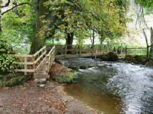
The dale enclosed by trees is one of the prettiest in the Peak District. Alongside the first of two footbridges over the River Dove, when approached from Hartington, is the Pike Pool. This name can be confusing, as it is not derived from a large fish, but rather from the jagged limestone spike that rises above the river. When you cross the first bridge, you leave Derbyshire and enter Staffordshire, returning to the former county a little later when crossing the second bridge – the River Dove marking the boundary between the two counties. Charles Cotton, who lived at Beresford Hall, now demolished, along with his great friend Izaak Walton, wrote a remarkable book about 17th-century rural England called The Compleat Angler. Charles shared his time between an extravagant lifestyle in London society and the quieter pleasures of the Peak District. That is when his creditors were not chasing him, then it is said he hid in a cave in Beresford Dale. The fishing lodge he built remains on private land in the dale, but can be viewed from a distance when approaching the dale.
BIGGIN (2 miles southeast of Hartington, off the A515 Ashbourne to Buxton Road – SK155594)
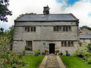
Biggin is a small, relatively isolated farming village two miles southeast of Hartington, just off the busy A515 between Ashbourne and Buxton. It is a popular spot for walkers who come to walk beside the River Dove through Beresford Dale and Wolfscote Dale. The Tissington Trail offers one of many options, particularly when planning a circular walk from the village. The route that leads down to Wolfscote Dale and the River Dove is appropriately named Biggin Dale. Most of the time, it is a pleasant limestone dale. But, during periods of heavy rain, underground waterways emerge from springs, producing a swift-running stream.
The Old Hall is almost certainly the oldest house in the village. Built in the 17th Century, it is a good example of small-scale farm architecture of that period. A Grade II* listed building, it is currently used as a restaurant and for holiday accommodation and is very popular with walkers. It is adjacent to the equally popular Waterloo Inn.
