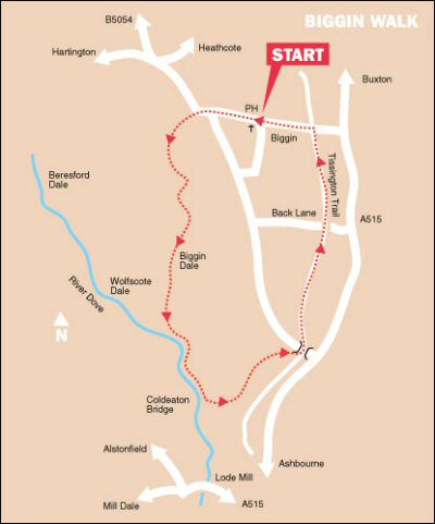
BIGGIN DALE WALK

River Dove - Biggin Dale Walk

THE WALK

Biggin Dale Walk is a superb walk taking in a wide variety of scenery, best walked in the spring or summer, when the wild flowers are in bloom. The walk includes a nature reserve and two dry dales, each of a completely different character to the River Dove that separates them. Tissington Trail, popular with walkers and cyclists, provides an interesting contrast for the final section of the walk.

A large part of Biggin Dale is designated as a National Nature Reserve. It contains many limestone-loving plants, including purple orchids, harebells, and purple-flowered meadow cranesbill. At first, the sides of the valley alongside the River Dove are bare and rock-fringed, but this soon changes, with the slopes on the right becoming thickly wooded. The dale, rich in wildlife, is wilder than Dovedale and more unspoiled.

After leaving the Dove near Coldeaton Bridge, you enter the second dry dale and the route soon becomes hemmed in by its steep rocky sides. On emerging from the dale, the Tissington Trail, a former railway track, is soon joined, with good open views to enjoy.

LOOK OUT FOR

Route Point 1 – Biggin Dale is named after the village of Biggin. It is designated a National Nature Reserve and contains a fine range of flowers in spring. Many limestone-loving plants, including purple orchids, harebells and purple-flowered meadow cranesbill, are to be found in the reserve. It is usually a pleasant limestone dale, but underground waterways emerge from springs during periods of heavy rain, producing a swift-running stream.

Point 3 – The River Dove rises on high ground at Axe Edge, near Buxton. Its clear waters meander southwards for 45 miles to eventually join the River Trent. For much of its course, the river runs through stunningly attractive countryside, with one bank in Derbyshire and the other in Staffordshire. It is a walker’s paradise, providing both easy walks for the casual walker as well as more strenuous hikes for the more experienced practitioner.

Biggin Dale
Biggin Dale
River Dove
River Dove

Point 4 – Cold Eaton Bridge is a wooden footbridge upon steel girders that crosses the River Dove. There was probably an earlier bridge on the site, of which the stone abutments survive. The bridge has been shown on maps of the area since 1837.

Point 6 – The Tissington Trail runs along a 13-mile route from Ashbourne to Parsley Hay. At this point, it joins up with the High Peak Trail, which runs from High Peak Junction by the Cromford Canal to Dowlow near Buxton. Surrounded by beautiful countryside, the traffic-free trail is ideal for horse riders, cyclists, naturalists, and walkers.

Coldeaton Bridge
Coldeaton Bridge
Tissington Trail
Tissington Trail

WALK DETAILS

Length:    6.5 miles.

Start:    Main Street, Biggin – roadside car parking near the church.

Location:    On the southern side of the A515 Ashbourne to Buxton Road.

Terrain:    The descent from Biggin to the River Dove is long, but not particularly steep. The lower section of Biggin Dale is strewn with scree boulders and carries surface water in the wet season, when this walk is best avoided. After leaving the River Dove, the climb up from the valley to join the Tissington Trail is not particularly strenuous. Good, expansive views are in evidence during the trail section of the walk.

Refreshments:    The Waterloo Inn is a popular village pub with a tiled floor and a real fire in winter. There is a 20-pitch site for caravans and camping at the rear of the pub. – Biggin Hall and Restaurant provides traditional meals in a pleasant setting and accommodation.

THE ROUTE

Biggin Dale
Biggin Dale

1. Walk down Main Street past the Waterloo Inn along the road towards Hartington. On reaching the end of the street, turn right but only for a few yards, before turning left at a sign for Biggin Dale.
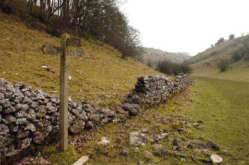
2. Continue down the dale, eventually crossing a stile as the valley curves to the left, a waymarker and a sign for ‘Bridleway to Biggin Dale’ guide you on your way.
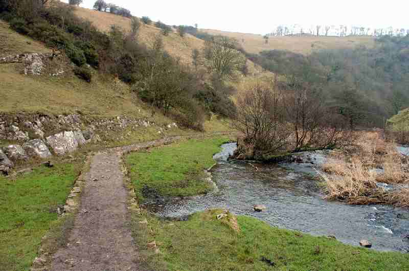
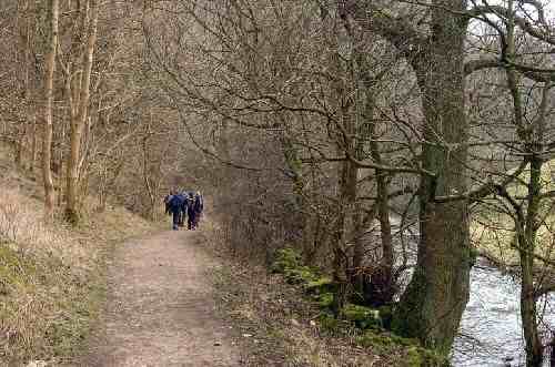
3. At the dale junction, the path bends further to the left to a stile, with a dew pond on your right. Once through the gate stile, turn sharp right and continue down the dale, with the wall on your right. Maintain the same direction along the valley floor, sections of which carry surface water in the wet season. On reaching the foot of Biggin Dale, turn left and walk alongside the River Dove.
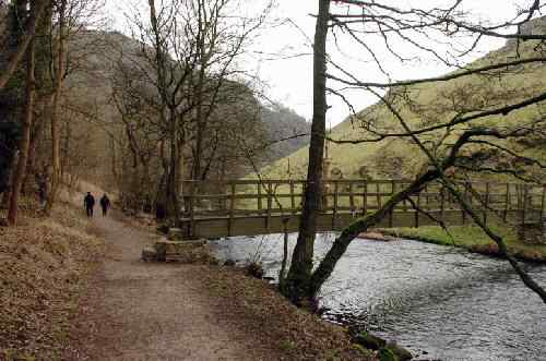
4. Forty yards past Coldeaton Bridge, turn left immediately after crossing a stile into a narrow side valley. Walk up the valley, eventually leaving what is National Trust land at a stile. Maintain the same direction, keeping the wall close on your left as you gently climb up the hillside.
5. The ground gradually flattens out a little, and you soon see some farm buildings, a little way ahead of you on the left. In the final field before the road, cross a stile by a gate a few yards in from the left-hand corner.
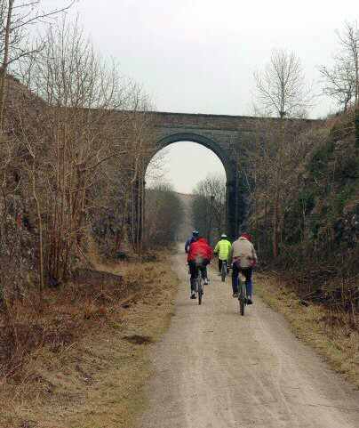
6. Go to the right up a minor road heading towards the bridge you can see in front of you. Do not go under the bridge, but turn right by an Information Board and then left to walk over the bridge and along the Tissington Trail.
7. Continue along the trail in a northerly direction, passing through Coldeaton Cutting and then open countryside, remaining on the trail as you cross Back Lane and an embankment.
8. After passing through a short cutting and reaching another embankment, you leave the trail at Biggin Road Bridge. Walk a few yards over the bridge before doubling back along the path to the road.
9. Turn right, and walk under the bridge you just crossed down the road to Biggin and the starting point of the walk.

BIGGIN

Biggin Dale Walk
Biggin Dale Walk
Biggin Dale Walk Map
Cyclists on Tissington Trail