BOYLESTONE TO BREASTON
A TO Z – DERBYSHIRE AND THE PEAK DISTRICT – CHAPTER 7
BOYLESTONE (off the A515 Ashbourne to Sudbury Road – SK183358)
The lovely, old village is famous for the ‘Bloodless Battle of
Boylestone.’ One evening in August 1644, Royalist troops en route to Wingfield Manor took refuge in St John the Baptist’s Church. During the night, Cromwell’s men surrounded the church. When the Royalists woke the next day, they were forced to file out of the door and surrender their weapons before marching off to captivity at Derby.
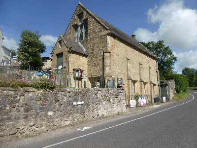
Boylestone was the site of the first Primitive Methodist Sunday School in the world. It commenced on 27 February 1814, and the chapel still exists and remains in use.
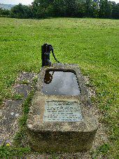
BRACKENFIELD (approximately 5 miles east of Matlock and 4.5 miles northwest of Alfreton – SK367589)
Brackenfield is a small village, surrounded by beautiful countryside close to Ogston Reservoir, a haven for birdwatchers, with a bird hide available. Severn Trent Water owns the reservoir, which is a Site of Special Scientific Interest. A large village green serves as the focal point, with several fine 17th-century houses nearby.
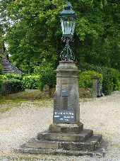
BRADBOURNE (5 miles north of Ashbourne, off the Fenny Bentley to Grangemill road – SK208526)
Bradbourne is a small, pretty village with limestone cottages clustered around the hall and church. All Saints’ Church has remnants of an 8th-century Saxon Cross in the churchyard. Bradbourne is one of the 31 Thankful Villages in England, having lost no servicemen in the First World War, and even more impressively, one of the 15 Doubly Thankful Villages that did not lose any in the Second World War either.
BRADFIELD (at the far northeastern edge of the Peak District, near Sheffield – SK267925 and SK264020)
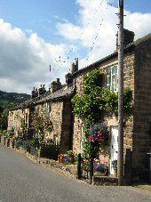
There are two parts of Bradfield conveniently named ‘High’ and ‘Low,’ which accurately define the two small settlements. Set amid glorious wild moorland scenery and deep green valleys, a steep drop of half a mile separates the two. Bradfield is just a short distance from Sheffield, the only city in Europe to have parts of a National Park within its boundaries.
Despite its proximity to a major city, the Loxley Valley has a surprisingly rural feel. The upper part of the valley becomes Bradfield Dale, where a series of reservoirs sit snugly in the valley bottom. However, this was not always the case, as on the night of 11 March 1864, between 11:30 p.m. and midnight, the Dale Dyke Embankment burst, causing what is known as the Great Sheffield Flood. The torrent of water surged down the Loxley Valley through Sheffield and even towards Rotherham.
It was the worst disaster in England in the 19th Century. More than 240 people died, 15 bridges were swept away, and in only half an hour, 4,500 homes were flooded lower down the valley. The damage was estimated at half a million pounds, a colossal sum in those days. The Damflask Reservoir was built after the great flood and is the lowest in a cascade of reservoirs known as the Bradfield Scheme.
BRADLEY (3 miles east of Ashbourne, off the A517 to Belper – SK225457)
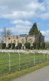
An attractive village found along winding lanes in the beautiful wooded countryside east of Ashbourne. It features an unusual squat church that lost its tower after being struck by lightning. It was subsequently demolished, and the wooden bell turret was removed, and the church bell was attached to the rear wall.
Bradley Hall stands opposite the church. Hugo Meynell demolished the Old Hall in the 18th Century, and the current hall was built as a stable block for a new hall that was never built. The stable block was then converted into the main residence, with later additions, and is now a Grade II listed building.
BRADLEY – MOOREND
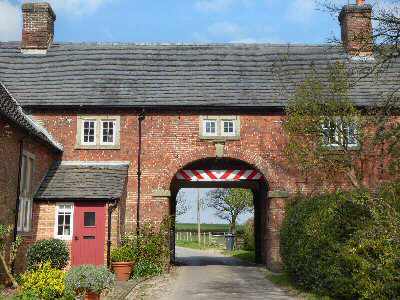
Another curiosity is the building known as ‘The Hole in the Wall’ at Moorend, where an archway spans the road between two cottages and may have been a toll house.
BRADWELL (On B6049 between the A6187 and the A623 Baslow – SK)
Hidden from the main road, the centre of the village clings to the steep hillside. Tiny individually shaped cottages set at odd angles, among a profusion of narrow winding streets and alleyways, give the appearance of a picturesque Cornish fishing village, with just the sea and several thousand gallons of whitewash missing.
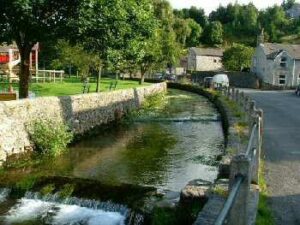
In its heyday, lead mining was the main occupation of the majority of the population, the village being one of the most important lead mining settlements in Derbyshire. The miners wore ‘Bradder Beavers’, a hat styled in the fashion of a military helmet, said to be the prototype of the ‘tin hat’. On top of the hat, a candle was placed to light the way down the mine. The hats became very popular and were used throughout Derbyshire. Although initially designed for lead miners, they were soon put to other uses, and their popularity spread well beyond the county boundaries.
The demise of lead mining did not result in the collapse of the local economy, as silk weaving, cotton spinning, and clog making continued. More unusually, Bradwell became the local centre of the optical industry, producing telescopes, opera glasses, and spectacles.
Some of the women worked in the cotton mill at Bamford, where they had a twelve-hour day starting at 6 a.m. They had to undertake the long journey twice a day, whatever the weather. To ensure they did not oversleep, a ‘knocker-up’ was employed to go round the houses in the morning. He carried a long pole, knocked on the windows, and called out the women’s names.
BRADWELL – SAMUEL FOX
Samuel Fox, the son of a shuttle maker, was born in Bradwell in 1815; he had an inventive mind and a capacity for hard work. He not only founded the massive steelworks at Stocksbridge, near Sheffield, but also gained worldwide recognition by designing the folding-frame umbrella. A benevolent man, he never forgot his home village, providing money to build a church, a site for the vicarage and setting up a trust fund for annual distribution to the poor and needy.
BRAILSFORD (midway between Derby and Ashbourne on A52 – SK255415)
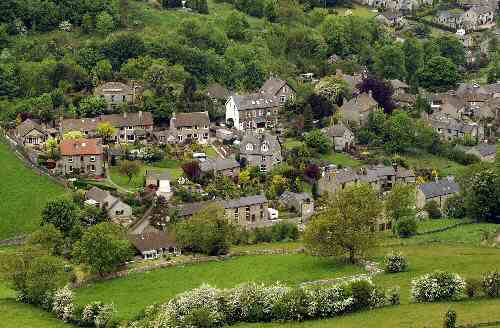
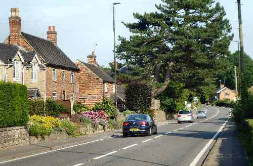
A relatively small redbrick village with mainly older houses built on either side of the main road, with some more recent development to the rear of the road on the northern and western sides. The village predates the Domesday Book and shares a church with the neighbouring village of Ednaston. At the time the church was built, both villages wanted to keep costs down, and as a result, agreed on a site in the fields between the two. It was recorded in the Domesday Book as ‘half a church.’
BRASSINGTON (off the B5035 between Kniveton and Carsington – SK232544)
An attractive limestone village set on a hillside with winding little streets in a remote corner of Derbyshire, about six miles to the northwest of Wirksworth. A surprising number of the houses are over 300 years old, with the entire village seemingly dominated by its Norman Church. A carved figure on a stone inside the clock chamber suggests that worship may have been conducted here in Saxon times, or possibly earlier. There are some interesting gravestones in the churchyard, one of which bears the inscription:
‘Remember this as you pass by
As you are now so once was I.
As I am now, so you will be,
Therefore prepare to follow me.’
Brassington prospered when lead mining was at its height; the rough ground to the east, west, and north of the village was marked by the hillocks and hollows of hundreds of abandoned mines. It stood on the main London to Manchester road, and there were 14 public houses in the village at the time, serving both travellers and thirsty lead miners. In 1738, the route was turnpiked as far as Brassington; the remainder of the road, northwards over the well-drained limestone uplands, was deemed sufficient for wheeled traffic. Unfortunately, Brassington’s days as a major staging post came to an end as new, less arduous routes north became available. Lead mining also gradually declined, although barytes and caulk were still mined in the 20th Century. The Golconda was the last mine to close in 1953.
BREASTON (on the A6005 between Derby and Nottingham – SK461335)
Breaston is a large, well-maintained village that was originally home to an agricultural community. Framework knitting was established in the 1800s. It is now primarily residential, with one of the largest village greens in the country, providing space and enjoyment for the local people. According to recent excavations, habitation in the area dates back over 2,000 years.
