CALDWELL TO CASTLE GRESLEY
A TO Z – DERBYSHIRE AND THE PEAK DISTRICT – CHAPTER 9
CALDWELL (4 miles south of Burton, 1 mile east of Rosliston – SK255173)
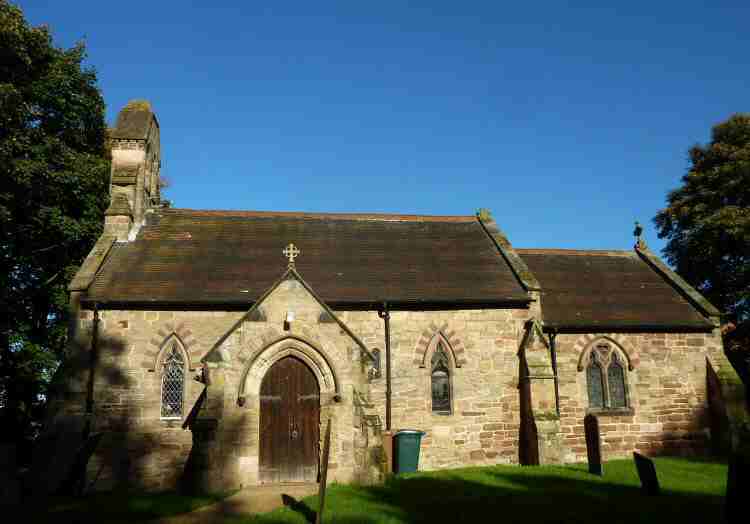
Caldwell is a small rural village situated in attractive countryside in the heart of the National Forest. The Manor and Manor Farm are the most imposing buildings amongst a collection of old and new. St. Giles Church probably dates to the 8th Century, although it has undergone extensive restoration. The three Saxon windows and the exterior masonry provide evidence of the original building’s age.
The Manor at Caldwell was given to the Abbey of Burton by William the Conqueror in 1068. The Abbey held it until the Dissolution of the Monasteries. The house then passed through various hands and, at one time, was even used as a nightclub before being converted into a school in 1972. Now education and care are provided for children and young people between the ages of eight and nineteen years, who have Autism, challenging behaviour and complex communication and learning difficulties.
CALKE (cul-de-sac road at Calke Park exit, south of Staunton Harold Reservoir – SK374221)
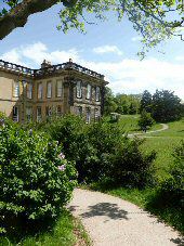
Situated in South Derbyshire, Calke is a tiny hamlet where a few houses line the road overlooking Staunton Harold Reservoir on the eastern side of Calke Park. The park, with its 600 acres of ancient parkland, is home to Calke Abbey, the second-largest country house in Derbyshire after Chatsworth. The house was built for Sir John Harpur, the 4th Baronet, between 1701 and 1704, on the site of a 12th-century Augustinian Priory. It was renamed Calke Abbey in 1808, despite never having been an Abbey.
Private vehicles now enter Calke Park from Ticknall. Before Sir Vauncey Harpur Crewe, the last Baronet of Calke, died in 1924, guests arriving in motorised vehicles were transferred to horse-drawn carriages at the entrance so as not to disturb the wildlife. Following the sudden death of Sir Charles Harpur-Crewe in March 1981, while out setting mole-traps, the estate was crippled by death duties and the Abbey was handed over to the National Trust in 1985.
The Harpur-Crewes were a reclusive family, and although Calke had been in their ownership since 1622, it remained a little-known and little-visited house. When the National Trust took it over, they found a fantastic collection of old papers, natural history items, stuffed birds and animals, paintings and other objects left where they had been placed, half a century or more ago. In the stable yard was a remarkable collection of carriages.
CALKE PARK (vehicular entrance at Ticknall, off the A5144 Swarkestone to Swadlincote road – SK356240)
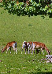
In 1922, the park was designated a Site of Special Scientific Interest, and in 2004, it was designated a National Nature Reserve. Many of the trees at Calke are more than 400 years old, with some reaching at least 700 years old. Two of the oaks are thought to be over 1,000 years old. A wide range of birds can be seen in the park, encouraged by the many holes in the old trees that provide ideal nesting places. The park is also important for its fungi and as a habitat for rare species of bats. It is a great place to go for a walk. The National Trust’s restoration of the old Ticknall Tramway, which has been converted into a circular trail, has led to an increase in the number of walkers and cyclists in the park.
CALTON (off the A523 Ashbourne to Leek Road, east of Waterhouses -SK103502)
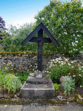
Calton is a tiny village in an attractive rural setting which has been part of Waterhouses Parish since 1934. The Grade I listed parish church contains fabric dating back to the 12th Century. In the churchyard are three Anglo-Saxon crosses, known as The Three Bishops. A short distance to the north stands the ruins of Throwley Old Hall – Staffordshire’s only surviving large medieval manor house. The estate is now privately owned.
CALVER (1 mile northwest of Baslow, off the A623– SK746240)
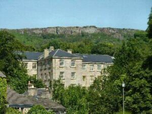
The most attractive part of the little river valley village of Calver hides behind the main A623 road. Here, charming stone cottages and smart modern houses coexist in comparative harmony near the ancient village cross. It was only after the building of the first bridge across the Derwent and lead mining became popular, that the village began to take shape from an isolated community of scattered dwellings. In 1778, a small mill built near the new bridge was soon followed by the construction of a much larger water-powered cotton mill. The second building was destroyed by fire and replaced by the impressive seven-storey granite building that remains today. No longer used for industrial purposes, it is now home to luxury apartments.
Shortly after the Second World War, the Mill achieved national recognition as ‘Colditz,’ the notorious German POW camp, in a popular television series. During the series, the swastika flew high above the Mill, but it fooled no one. It was not the case during the war itself, when lights were lit on the moors nearby, fooling the German bomber pilots into thinking that Sheffield lay below and releasing their loads harmlessly onto the moors.
CARSINGTON (off the B5035 between Ashbourne and Wirksworth – SK254533)
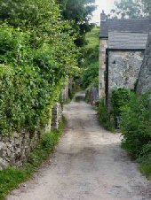
The picture-postcard village of Carsington, with Carsington Pasture rising steeply to 1,000 feet behind a row of attractive little cottages, is a quiet place. A considerable change to the landscape took place late last Century with the construction of Carsington Water. The reservoir, built for £107 million, increased Severn Trent’s raw water capacity by 10% to meet the growing demand for water in Derbyshire, Nottinghamshire, and Leicestershire.
Conservationists fought a long, hard battle against the site chosen for the reservoir. Now, a bypass takes much of the traffic away from the narrow, winding village road. Carsington Water has exceeded all expectations as a tourist centre. Thankfully, all this has been achieved without life in Carsington and the neighbouring village of Hopton seeming to have changed very much. Apart from the fact that more walkers now pass through the village on their way around the reservoir, which helps keep the village pub busy.
The village was once an important lead mining centre, and Carsington Pasture remains littered with disused lead mines. Mining was still in existence in the 20th Century with barytes extracted at the Golconda Mine until 1953.
CARSINGTON WATER (off the B5035 between Ashbourne and Wirksworth – SK241516)
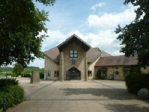
Officially opened by HM the Queen in 1992, Carsington Water instantly became one of Derbyshire’s most important tourist attractions. The original estimate of 300,000 visitors per year was soon revised to over 1 million. Further evidence of the reservoir’s popularity came when the East Midlands Tourist Board awarded it the ‘Visitor’s Attraction of the Year’ in 1993. Only a short, easy walk from the visitor centre car park is a wildlife centre where you can watch Carsington’s birdlife in warmth and comfort. Posters on the wall help identify the birds for those who are not experts. The weight of the turf-covered roof holds the building together without the need for screws or nails. Along the bankside towards Carsington Village are further bird hides, where a fascinating hour or more can be spent spotting as many different species of birds as possible.
Severn Trent has planted half a million trees and shrubs in woodlands, copses and hedgerows; the result has been not only to enhance a beautiful landscape but also to create many new habitats for wildlife. It was recognised in 1995 by the receipt of the Forestry Centre of Excellence award for using ‘The Highest Standards of Woodland Management’ at Carsington.
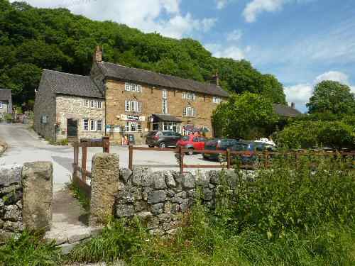
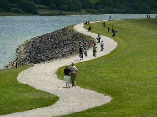
CASTLE GRESLEY (approximately 1.5 miles southwest of the centre of Swadlincote – SK279179)
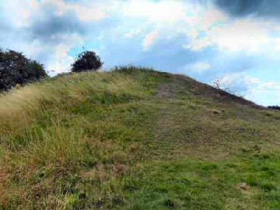
Little remains of a motte and bailey castle known locally as Castle Knob. What still survives behind a row of houses is a large grass mound. When the castle was constructed, it would have commanded expansive views over the countryside between the River Trent to the north and the River Mease to the south.
CASTLETON (on the A6187 Hope Valley Road – SK151829)
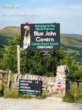
Castleton is a delightful village that invites exploration with its cluster of old stone cottages and hilltop castle. The sparkling little stream leading from Peak Cavern takes you through the oldest part of Castleton. Along the main street are a large variety of gift shops, cafés, pubs, and restaurants to suit all tastes.
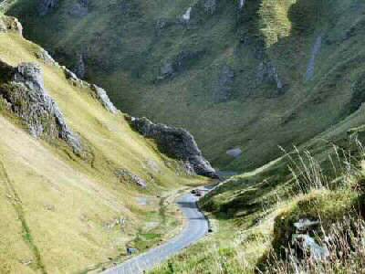
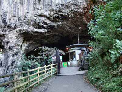
Frequently referred to as the gem of the Peak, Castleton is one of Britain’s most charming villages, situated in a magnificent location with stunning views in all directions. Approaching from the southwest, you descend into Castleton through the spectacular Winnats Pass with its forbidding appearance. The village is most famous for its caverns, of which only Peak Cavern is an actual cave. It has a dramatic entrance that is said to be the largest cave entrance in Britain. For hundreds of years, the entrance was used for rope making, and some of the equipment remains. Blue John Cavern is famous for its semi-precious stone, Speedwell for its half-mile subterranean boat trip and Treak Cliff Cavern for its stalactites. Mining of Blue John stone is unique to the village.
CASTLETON – PEVERIL CASTLE
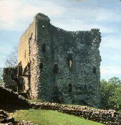
William Peverel originally built Peveril Castle (note the spelling variations). He was a favourite knight of William the Conqueror, who made him bailiff of the royal manors in northwestern Derbyshire. At that time, the Peak Forest was rich in game and minerals, and the castle was ideal for protecting both. King Henry II built the stone keep almost 100 years later in 1176. It still stands today and is in the care of English Heritage. It can be viewed up close by those prepared to climb the steep, zigzag path leading up to the castle, made famous by Sir Walter Scott in his novel ‘Peveril of the Peak’. Breathtaking views over the surrounding countryside will reward the climb up to the castle. To the rear of the castle is Cave Dale, the starting point of many walks in the area.
