Carsington and Brassington Walk offers breathtaking views of the ancient villages of Carsington and Brassington, once the homes of very active lead mining communities.
LOOK OUT FOR
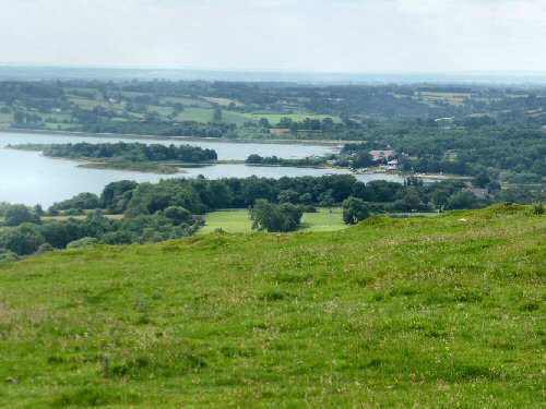
Route Point 4 – This point has good views over Carsington Water. The project to build the reservoir started in 1980, but four years later, with the work at an advanced stage, the dam collapsed. Following a lengthy consultation period, a new dam was constructed containing more than twice the old dam’s material and double the width at the base. The first water entered the reservoir on 16 October 1991.
Point 6 – On the moorland route between the two villages, there is plenty of evidence of the efforts of miners to extract lead from underneath the earth. At Nickalum Mine, in particular, spoil heaps that have been grassed over for a long time are to be seen in plentiful supply. The 20th century saw lead mining sites extensively reworked for minerals discarded initially by the lead miners, including fluorspar, barytes, and calcite.
Carsington Water View
Nickalum Mine
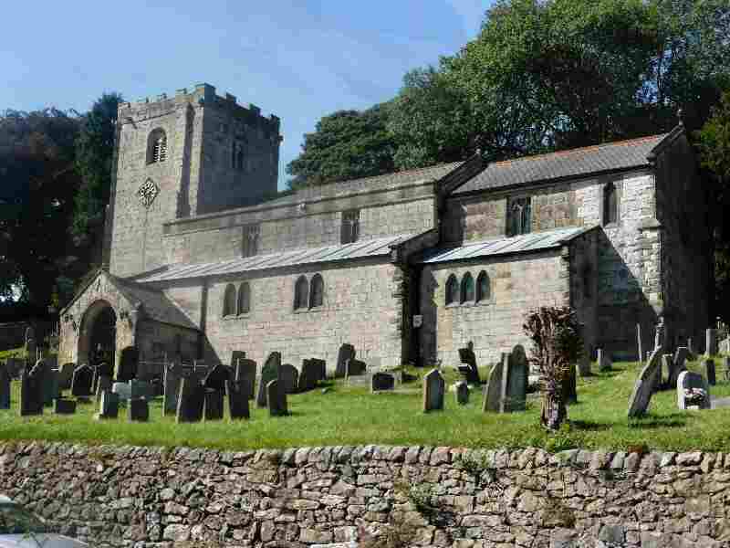
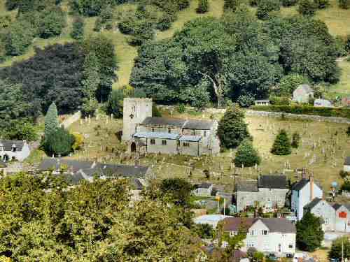
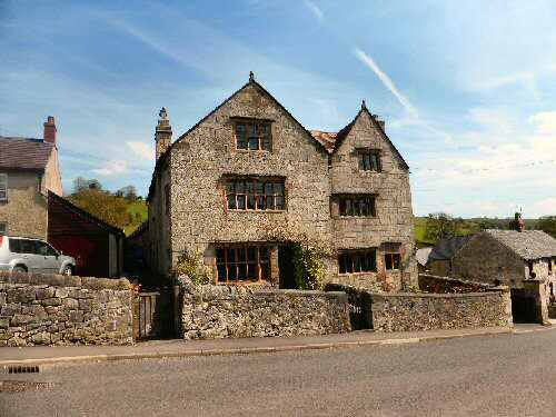
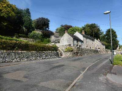
Point 8 – Brassington is an attractive limestone village set on a hillside with narrow winding streets in a remote corner of Derbyshire. The rough ground to the village’s east, west and north has the hillocks and hollows of hundreds of abandoned mines. A surprising number of the houses are over 300 years old. Several new homes have recently been built on the village’s southern edge. St James Church, which dates back to the Normans, dominates the village, standing on the hillside, seemingly guarding the route to the former lead mining area to the north.
Point 9 – The Tudor House, built in 1615, is probably Brassington’s oldest house. The initials shown at the front are those of Thomas Westerne and his wife, who had the house built. From 1820 to 1848, the building housed paupers for the Ashbourne Poor Law Union. The men worked in the quarry at the rear of the house, breaking stone into specific sizes. It only became known as the Tudor House in about 1900 and is now in private ownership.
View over Brassington
Tudor House
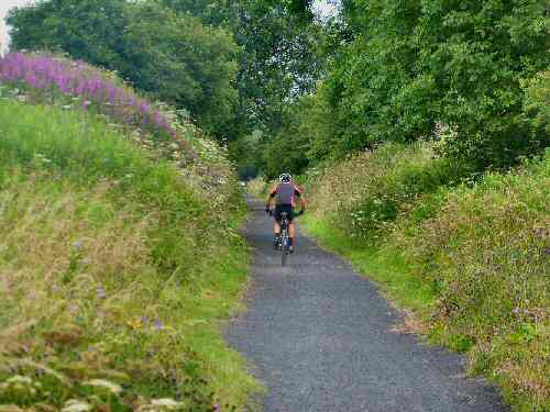
Point 10 – The High Peak Trail is a converted railway line. The Cromford and High Peak Railway linked Cromford Wharf, 277 feet above sea level, with Whaley Bridge, 517 feet above sea level. In the middle, it rose to 1266 feet at Ladmanlow. Following the line’s closure, it was purchased jointly by Derbyshire County Council and the Peak Park Planning Board and, in partnership with the Countryside Commission, converted into the High Peak Trail.
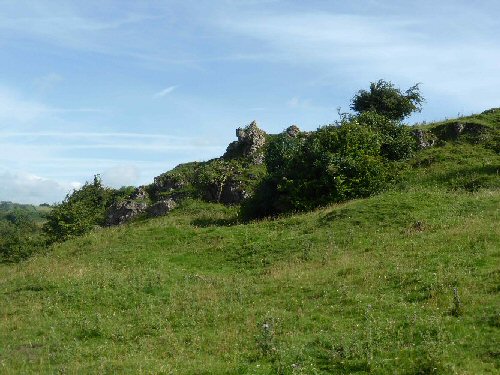
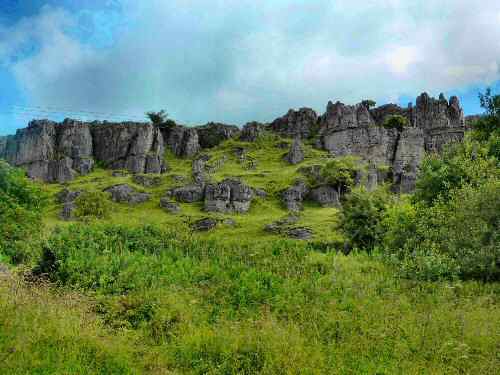
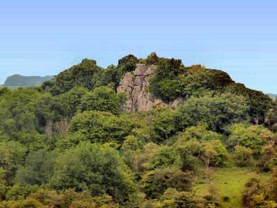
Point 11 – People lived in the area in prehistoric times. Remains of Bronze—and Iron Age men have been found at Harborough Rocks near the High Peak Trail. Minning Low is only a short distance away, where Neolithic chambered barrows were found on the summit. There are also many strange rock formations near Rainster Rocks and Hipley Hill.
High Peak Trail
Harborough Rocks
WALK DETAILS
Length: 5 miles.
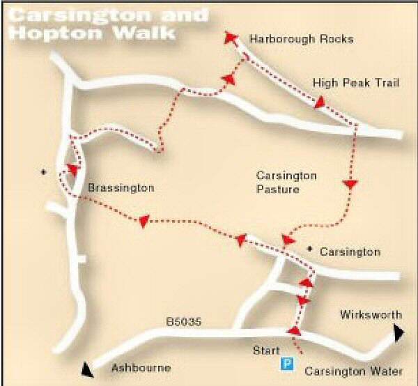
Start: Carsington and Brassington Walk starts off the B5035 Wirksworth to Ashbourne Road. When travelling east to west on the Carsington by-pass, watch out for a left turn into Sheepwash car park at Carsington Water. (SK250528)
Terrain: The Carsington and Brassington Walk has some steady ascents and one particularly steep descent, which can be extremely slippery. To avoid possible accidents, please keep to the path that passes through an area where lead mining was once predominant. The pretty villages of Carsington and Brassington provide interesting diversions.
Refreshments: The Miners Arms at Carsington is popular with walkers, and the Gate at Brassington is a much-visited historic public house.
THE ROUTE
1. Leave the Sheepwash car park at Carsington Water at the top right-hand edge and walk along the path towards the bird hide. Ignore the next sign for the bird hide and carry straight on to reach the B5035. 2. Cross the road and walk up the track in front of you, keeping straight on at an intersection before descending and bearing to the left by the school. 3. Walk up the lane past the village green to the road through the village. Continue straight ahead, and where the road swings to the left, go up the lane marked ‘No through road.’ Where the lane ends, go over a stile by a metal gate. 4. Continue along a track that soon curves to the right before straightening out. Go over a stile by a gate and angle to the right uphill at a marker post. It takes you along a path through a narrow V-shaped limestone cutting to the top of that section of the hill. 5. Maintain the same direction, aiming to the right of the two stone pillars at the top of the hill. As you progress, you realise the stone pillars once formed part of a redundant stile. With a group of trees on your left, go through a gap and descend across two stiled fields, aiming about 40 yards to the left of a stone barn. 6. Go over a rough track and follow the winding path up the hill towards the remains of Nickalum Mine before taking the waymarked sign to the left around the old workings, and then bear right through a cutting. 7. An obvious path now descends steadily, between two bushes, to a stile near a thorn tree. In the next field, follow the wall on your left until another stile is reached.
8. Go over the stile and straight down the field (alternatively and better in muddy conditions – turn right halfway down the field and follow an obvious path that brings you out into Brassington, where you turn left down the road and right up Miner’s Hill). If you do not take the diversion, aim for the farm yard path to the main road into Brassington. 9. Turn right, and within a few yards, cross the road by Tudor House and walk up Miner’s Hill, which is directly in front of you. The road leads you to the site of the Miner’s Arms, where you turn right and walk along Maddock Lake. At the end of the street, at a ‘T’ junction, turn left along the road leading to Longcliffe. On reaching the edge of the village, take the ‘No through road’ sign on the right along Wirksworth Dale. 10. When the road ends, go left through a stile by a gate. Follow the path uphill with care, past some old lead mine workings. Keep close to the wall/fence on the right, go to Manystones Lane, and turn right. About 150 yards after passing a factory entrance, take the footpath on the left along a track that soon reaches the High Peak Trail. 11. Detour to visit Harborough Rocks, which are directly in front of you, before retracing your steps and continuing along the trail in an easterly direction. 12. Just before reaching a gate across the track, cross a stile on the right near a factory. Go across the top corner of a field and over another stile to reach the road. Cross the stile on the other side of the road onto Carsington Pasture (signed Carsington one mile). 13. Follow the path alongside the wall to the top of Carsington Pasture. Then, leave the wall and descend very steeply to the right to a small waymarked gate into a back garden. 14. Go down a flight of steps and a lane the miners once used to get to and from work. Turn left at the bottom of the lane and retrace your steps back to the start of the walk.