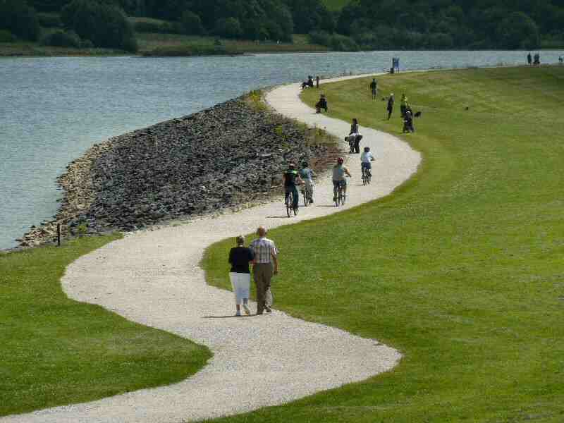
Carsington Water Walk includes visits to the pretty villages of Hopton and Carsington. It has been one of Derbyshire’s most important tourist attractions since it opened in 1992 and is an excellent place for a walk. A visit is a speciality for wildlife lovers and leisure enthusiasts. There is a Wildlife Centre, and bird hides along the reservoir’s banks, and bikes and waterborne craft are available for hire.
A highlight of the walk is the visits to the attractive conservation villages of Carsington and Hopton. They are inseparably linked and lie in a wooded valley with Carsington Pasture rising steeply to one thousand feet to the west, behind a row of attractive little cottages that line the roadside. Both villages share the same church and school. The houses in each village almost overlap on the shared narrow road, and they are both in the same parish.
LOOK OUT FOR
Route Point 2 – The project to build Carsington Water started in 1980, but four years later, with the work at an advanced stage, the dam collapsed. Following a lengthy period of consultation, rebuilding commenced. The new dam contained more than twice the material of the old dam and doubled the width at the base. It was completed in the autumn of 1991, and the first water entered the reservoir on 16 October. The Control Tower operates the pumping system from the River Derwent at Ambergate.
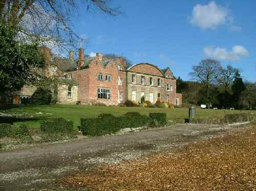
Point 7 – Hopton Hall was the home of the Gell family for nearly 500 years before it changed hands in 1989. The Hall hides behind a red brick crinkle-crankle wall, which traps the sun’s rays to assist fruit growing. The Gells built the school and had a considerable influence on the development of the church. Sir Philip Gell organised the building of the Almshouses in Hopton, above which a stone tablet declares that the buildings were for ‘2 poor men and 2 poor women of Hopton and Carson’, the latter being the old name for Carsington.
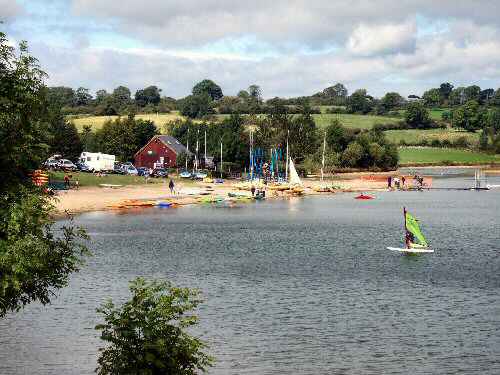
Carsington Water Sports
Hopton Hall
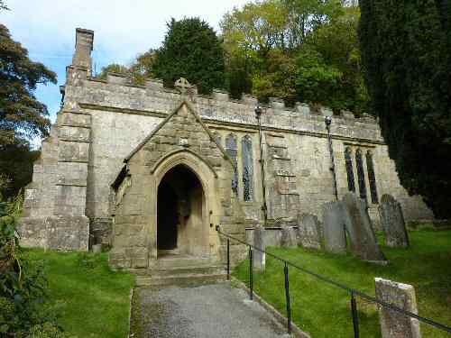
Point 9 – St Margaret’s Church fits the scene perfectly – pretty but not dominating. Evidence shows that a church existed as far back as the 12th century. Interestingly, in 1971, a gravedigger dug up the skeletons of a man, woman, and child, probably of Anglo-Saxon origin, giving rise to further speculation about the date of the first church. An unusual item in the church register records the life of Sarah Tissington, who was born in the village in 1664 without arms but, despite this severe handicap, learned to knit with her feet.
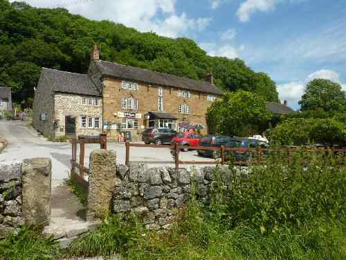
Point 10—The Miners Arms was once a popular pub for lead miners, and Carsington Pasture is still the home to many disused lead mines. Mining existed well into the 20th century, with barytes extracted at the Golconda Mine until 1953. On the village’s western side, Miners’ Lane was the miners’ route to and from work.
St. Margaret's Church, Carsington
Miners Arms, Carsington
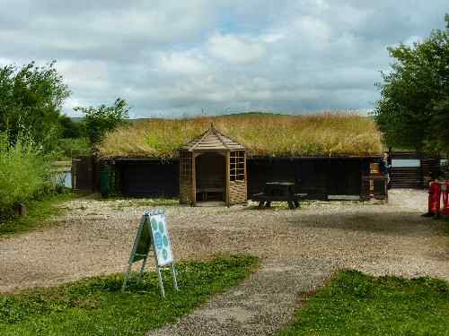
Point 11 – Carsington Wildlife Centre is a short walk from the Visitor Centre Car Park. Here, you can watch Carsington’s birdlife in warmth and comfort, with helpful posters on the wall to assist you in identification. The weight of the turf-covered roof holds the building together without need of screws or nails.
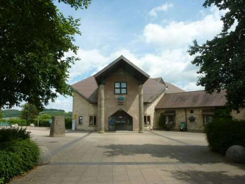
Point 12 – The recently refurbished Carsington Water Visitor Centre and its surroundings are great for a family day out. There is a sports and leisure centre, a sailing club, and a trout fishery for those looking for an activity to get involved in. Dogs and barbeques are welcome in the Country Park. Boat hire is also available, or you can hire a bike.
Carsington Water Wildlife Centre
Visitor Centre
WALK DETAILS
Length: 8 miles.
Start/Finish: Visitor Centre at Carsington Water.
Location: From the south, follow the signs from the A517 Ashbourne to Belper Road, and from the north, follow the B5035 Ashbourne to Wirksworth Road.
Terrain: Easy, relatively level walking on good paths through fields and woodland alongside the reservoir. There is no pavement on the section from Carsington to Hopton.
Refreshments: The Carsington Water Visitor Centre offers seating inside or out. The Miners Arms at Carsington is a popular food venue.
THE ROUTE
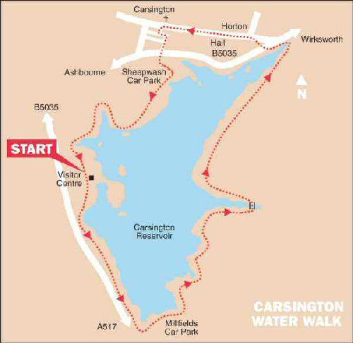
Carsington Water Walk
1. From the Visitor Centre, walk southwards and follow the path past the sailing club to pick up footpath signs for Millfields. 2. Continue along the dam wall, at the far end of which you follow the main path to Millfields. Cross the car park in front of the refreshment kiosk, which is open seasonally. 3. Follow the path close to the edge of the reservoir, and after crossing a long footbridge, take the footpath on the left with the yellow sign indicator (when there is an option – follow the yellow signs). 4. On reaching a narrow tarmac lane by Upperfields Farm, turn left for a few yards and right at a gate to follow a path signed for Hopton. 5. The path winds up and down through pasture and woodland before reaching a gate leading onto the B5035. At this point, turn left, with the wall on your right. After 35 yards, turn right and cross the road. 6. Follow the path opposite, which leads you up to the road through the village of Hopton. 7. Turn left and follow the road through Hopton to the adjoining village of Carsington, past Hopton Hall. Take care – there is no pavement on this section of the walk. 9. St Margaret’s Church is opposite the short road, where you turn left to access School Lane. 10. When you reach School Lane, turn left to walk past the Miners Arms Public House. Before you reach the school, turn right up a lane and continue straight on when it forks. 11. The Lane ends at the B5035, which you cross and follow the path straight ahead for a short distance before bending to the left and right. Walk across Sheepwash Car Park to the main path by the reservoir and eventually pass Carsington Wildlife Centre. 12. After only a few yards after passing the Wildlife Centre, you arrive at the main car park for Carsington Water Visitor Centre and the starting point of the walk.