CHAPEL-EN-LE-FRITH TO CHINLEY
A TO Z – DERBYSHIRE AND THE PEAK DISTRICT – CHAPTER 10
CHAPEL-EN-LE-FRITH (off the A6 between Buxton and New Mills – SK061809)
The small town of Chapel-en-le-Frith is situated on a high ridge surrounded by hills, six miles to the north of Buxton, close to the border with Cheshire. It did not enjoy the best of reputations with those drivers from the industrial towns of the northwest who, when visiting the Peak District for the day, stopped in the town – not to look around or take refreshment, but because they became stationary in a traffic jam. Fortunately, in 1987, a bypass was opened that took much of the traffic away from the centre of the town.
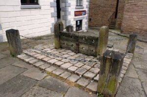
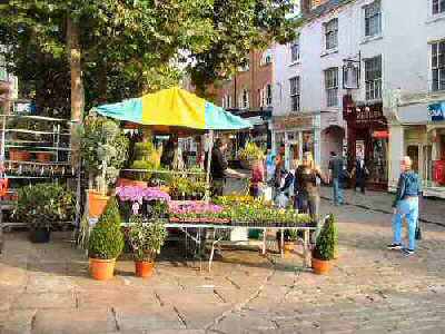
For those who turn off by the King’s Arms at the top of the town, a pleasant surprise awaits. The eye-catching cobbled marketplace rises from the main street, with a market cross, stocks, and several colourful old inns setting the scene.
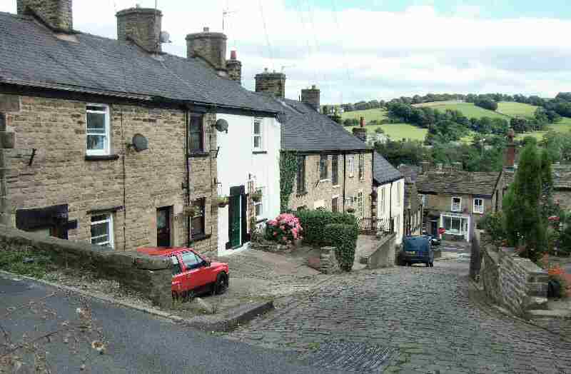
CHAPEL-EN-LE- FRITH – CHURCH BROW
Church Brow, a steep, cobbled street, leads off Market Street, lined with attractive little cottages that no architect ever planned, but that fit together in picture-postcard fashion. It has been likened to Gold Hill, in Shaftesbury, the small hilltop town in Dorset on which Hovis based a successful advertising campaign. Vehicles descending to High Street risk running out of control – unless they have good brakes – something for which the town is justifiably famous.
Local man Herbert Frood first developed a brake block for horse-drawn carts, before over a Century ago turning his attention to mechanical vehicles. He invented a brake lining for buses, and with the steady increase in the number of vehicles on the roads. He also provided brakes for vehicles, and his business rapidly prospered. As a result, a massive brake factory grew up in the town.
CHATSWORTH HOUSE (off the B6012 between Rowsley (A6) and Baslow (A619) – SK258701)
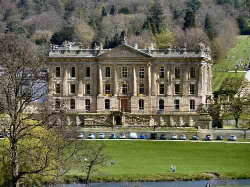
Often referred to as ‘The Palace of the Peak’, Chatsworth House is one of England’s ‘treasure houses’, boasting fine furniture, sculpture, tapestries, paintings, and other works of art. Set in beautiful surroundings, in the heart of the Peak District National Park, a short distance from Bakewell, it attracts admiring visitors from all over the world.
Bess of Hardwick, together with her husband, built the first house at Chatsworth. Building began in 1552, but Sir William died before completion. Since then, many interesting touches have been added. It is the home of the Duke and Duchess of Devonshire and has passed through 16 generations of the Cavendish family.
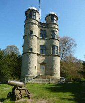
CHATSWORTH – HUNTING TOWER
The Hunting Tower is Elizabethan in construction and stands on the escarpment 400 feet above Chatsworth House, on the edge of Stand Wood. It boasts terrific views over Chatsworth Estate and was once used by the ladies of the house to watch the hunt when it took place in the park below. The cannon at the base of the house came from a ship that fought at the Battle of Trafalgar. The small stone building at the foot of the tower is let to large groups for accommodation.
CHATSWORTH PARK
Capability Brown laid out the 1,000-acre park in the 1760s. It is mainly open to the public free of charge throughout the year. Sheep and cattle graze the grass, and a large herd of deer can usually be seen as you walk through the park. The road that winds its way through the parkland provides a magnificent view of Chatsworth House. You look across the River Derwent to the west and south front, with its neat lawns sloping up the bank to the woods that provide a superb backcloth.
The gardens at Chatsworth have evolved over more than 450 years and have been described as among the ‘best and most vibrant in Britain.’ They extend to 105 acres, featuring five miles of footpaths, and can be visited separately from the house. Apart from rare trees, shrubs, formal hedges, temples, sculptures, streams and ponds, it is probably the famous waterworks that most catch the eye when fully operational.
For many years, visitors have gazed in awe at the Emperor Fountain, built in 1844 to impress Czar Nicholas of Russia. Unfortunately, the Czar was detained elsewhere and failed to visit Chatsworth. The fountain’s single-gravity fed high spout rises to 290 feet and is the tallest in Britain.
CHELMORTON (off the A5270 which links A515 Buxton/Ashbourne and Buxton/Bakewell – SK113701)
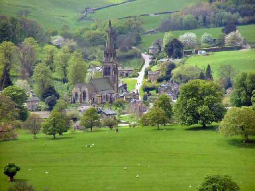
Chelmorton is an ancient village, the highest above sea level in Derbyshire, and at one time it was claimed to be the second-highest in the country, after Flash in Staffordshire. It is also nationally famous for its medieval strip field system, which remains with stone walls enclosing the narrow fields that run parallel to each other and at right angles to the main village street, behind the one-time crofters’ cottages. Even the village telephone box is stone-built and must be unique.
The Parish Church of St John the Baptist is at the highest point in the village, built of gritstone, which contrasts noticeably with most of the other buildings in Chelmorton, which are mainly of white limestone with gritstone features. The church, restored in 1574, dates to the 13th Century. In the porch are several early coffin lids, some belonging to the 12th Century. Outside in the churchyard is the base of a broken Saxon Cross. Facing the church stands the aptly named Church Inn, originally known as the Blacksmith’s Arms, reflecting the dual profession of a previous landlord who was also reputedly its best customer!
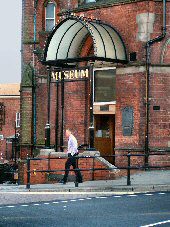
CHESTERFIELD (on the A61 Sheffield to Alfreton road – SK380710)
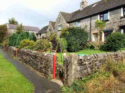
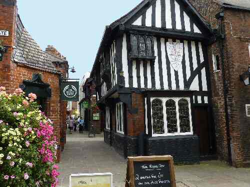
A busy redbrick town, Chesterfield, with more than 150 stalls doing a lively trade on market days, a delightful cricket ground at Queens Park and an unusual church spire is a splendid place to visit. Second, only to Derby in population in the county, it is quite different in style and character to any of its neighbours in the Peak District.
The town’s early prosperity stemmed from its role as a market town serving the entire North East Derbyshire region. As the area around Chesterfield was rich in minerals, the extraction of coal, ironstone and lead increased the town’s importance as a regional centre. With its mineral resources, the town was well-positioned to capitalise on its geographical location. Chesterfield Canal and later the railway opened up markets much further afield than North East Derbyshire.
In 1901, as a result of much-needed boundary changes, Chesterfield was no longer restricted to a small central area, which had previously been a significant factor limiting its growth. Houses had been crowded together in alleyways and yards, poorly constructed and lacking adequate sanitation. The lifting of the restrictions allowed the town to expand, and demolition of substandard housing began. This development continued well into the 20th Century, and it is only in recent years that conservation area status has been granted to the marketplace and its environs.
CHESTERFIELD – MARKETPLACE
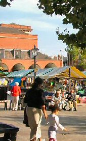
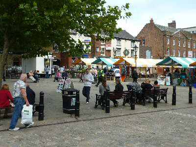
Initially, the marketplace extended further to the east, where the Shambles is today; however, it gradually gave way to permanent buildings as temporary stalls were replaced. The marketplace catches the eye, so much so that, following its redevelopment, it received a prestigious European award in recognition of its design and exemplary quality. The brightly covered market stalls, laden with goods, are busy with shoppers on Mondays, Fridays, and Saturdays. On Thursdays, ‘Flea Markets’ are held and Artisan markets on the last Sunday of every month. Other specialised markets also take place, with the lead-up to Christmas being a special time.
A notable feature in the marketplace is the pump, erected in 1826. It served as a meeting point, where, in the past, passionate speeches were made and even riots broke out. Behind it, the Market Hall, built in 1857, did not initially fare very well and came in for a lot of criticism. However, over the years, views have shifted, and it is now widely accepted as a vital part of the market scene.
CHESTERFIELD – ST MARY AND ALL SAINTS’ CHURCH
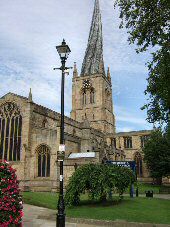
Many fanciful reasons have been advanced for the spire of St Mary and All Saints’ Church leaning. It started straight and local legend is that the Devil, having accidentally had a nail driven into his foot by a Bolsover blacksmith, flew over the church, and in lashing out in pain, struck the spire. Another story is that it was caused by bell ringing, which, considering the spire weighs 32 tons, must have required some deafening bells and immensely strong ringers! The experts say that the spire is crooked because the lead and timber used are incompatible. It caused the wood to warp because of the heat of the sun on the lead casing.
The spire was built in 1349, at the time of the Black Death. And a theory was proposed that the original craftsmen may have died. As a result, less experienced men completed the job, and they made the mistake of using green timber. Whatever happened, it has proved to be a masterstroke in increasing Chesterfield’s name awareness and marketing potential in the tourism trade.
CHINLEY (2 miles northwest of Chapel-en-le-Frith, on the B6062 off the A624 Hayfield Road – SK043825)
Chinley was little more than a few scattered farms until the railway arrived in 1866. It soon became an important junction on the London to Manchester line and as part of a branch line through the Hope Valley to Sheffield. Lots of new houses were built as a consequence. Although the old railway line closed some years ago, the magnificent curving viaducts remain. The village is surrounded by beautiful countryside and sits at the foot of one of Derbyshire’s most prominent hills, Chinley Churn. It has resulted in the village developing as a centre for visitors who come to explore the North Derbyshire hills. The Hope Valley line still runs through Chinley and provides a good stopping point for travellers.
