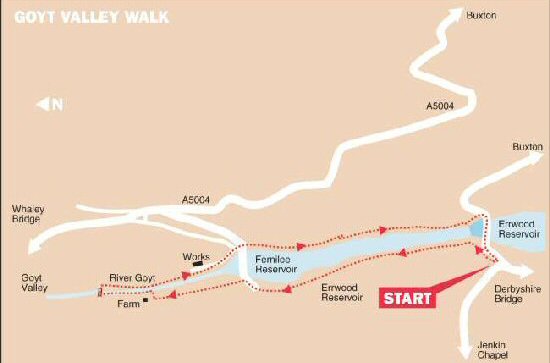
GOYT VALLEY - FERNILEE RESERVOIR WALK

Fernilee Reservoir View

THE WALK

The Goyt Valley – Fernilee Reservoir Walk explores the slopes of Goyt Valley, which contains a variety of forest and woodland, plus an abundance of wildlife. The return journey takes you along the former track of the Cromford and High Peak Railway, a nationally famous line.

The valley was acquired by Stockport Corporation in the early 20th century, for the building of two reservoirs, to meet the increasing demand for water in the Stockport and Manchester areas. Fernilee was the first reservoir constructed in 1938; Errwood Reservoir followed 29 years later.

The valley comes within the South West Peak Environmentally Sensitive Area. This initiative encourages the conservation of the landscape and wildlife habitats.

LOOK OUT FOR

Route Point 1 – Fernilee Reservoir is very close to the boundary between Derbyshire and Cheshire. Fed by the River Goyt, it supplies drinking water to the Stockport area and was the first and lowest of the two reservoirs constructed in the valley. Inaugurated in 1932, it was completed in 1938 and cost £480.000. Local farming families had to abandon their homes when construction started. A ‘Tin Town’ of corrugated iron was erected near Fernilee to accommodate the workforce engaged in building the reservoir.

Point 2 – Follow the shoreline path as it slopes up from the waters, climbing a series of gently rising steps, and providing glimpses of the reservoir before eventually joining the ‘Woodland Walk’. Depending on recent rainfall and the time of year, the reservoir water level can vary considerably. The combination of water and woodland (particularly on the western shore) makes this a popular spot for a walk at weekends and during the summer.

Fernilee Reservoir
Fernilee Reservoir
Fernilee Reservoir Walk

Point 7 – The tiny hamlet of Fernilee, from which the reservoir gets its name, sits perched by the roadside, on the main road leading from Whaley Bridge to Buxton. It is less than two miles south of Whaley Bridge and approximately four miles northwest of Buxton. To the southwest is Fernilee Reservoir. It consists only of a pub, a few farms and houses. From here, there is easy access for walkers to the Fernilee Reservoir and the Goyt Valley.

Point 8 – The latter part of the walk is along the former Cromford and High Peak Railway line. The construction of the railway, considered to be an engineering masterpiece, attracts railway enthusiasts, not only from this country but all over the world. It linked High Peak Junction, at two hundred and seventy-seven feet above sea level, with Whaley Bridge at five hundred and seventeen feet. In the middle, it rose to over a thousand feet at Ladmanlow. Stretching for thirty-three miles in length. In 1831, when the line fully opened, it transported minerals, corn, coal and other commodities from one canal to the other.

Fernilee Railway Trail
Former Cromford and High Peak Railway Line

WALK DETAILS

Length:    4.50 miles or, for the shorter option, 3 miles.
.
Start:    The Street Car Park on the northwest side of Errwood Reservoir.

Location:    Off A5004 Buxton to Whaley Bridge Road.

Terrain:    An easy walk, with only a slight ascent and descent, along woodland tracks, field paths and a former railway line.

Refreshments:    An ideal place to take a picnic and sit and enjoy the magnificent scenery. The Shady Oak at the tiny village of Fernilee and both Buxton and Whaley Bridge offer plenty of food venues to suit all tastes.

THE ROUTE

Woodland Walk
Woodland Walk

1. From the Street Car Park on the southern side of the reservoir, follow a Fernilee Reservoir sign and walk diagonally to the left, down a field to a stile. Angle down a rough field, in the direction of the reservoir, to go through a stile in the bottom corner.
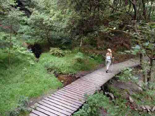
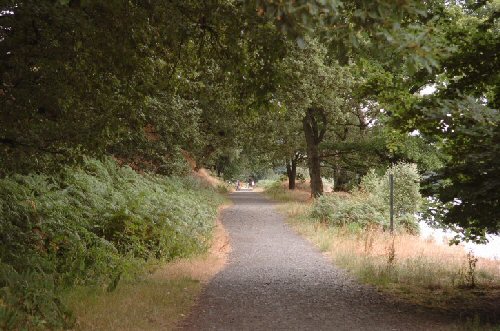
2. Continue to the left along a clear forest path, with the reservoir shoreline on your right. When you arrive at a finger post sign, take the ‘Fernilee via Waterside Walk’ and follow the path close to the reservoir.
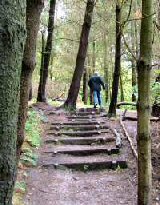
3. At one point, the walk takes you to the left up a flight of steps and around a ravine, before bending to the right along a wide forest path.
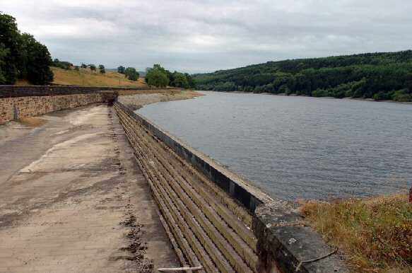
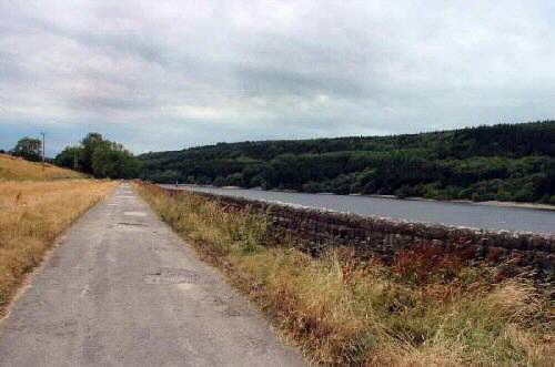
4. On reaching the far end of the wood, go through a stile and turn right along a lane that leads to the northern end of the dam wall. Do not cross the dam unless you want to shorten the walk, in which case, turn right after crossing the dam wall and go to point 8.
5. Turn left by the dam to join a narrow farm track that takes you through several gateways. With the farm in view, leave the track by a stile on your right and follow the footpath to the left down the field for a short distance to a stile gate in the bottom corner.
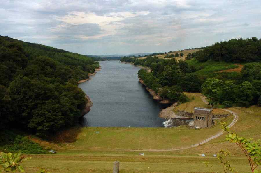
6. Follow a sunken track to the right for a short distance before it bends to the left and leads you to the bottom of the valley and into another field. A few yards further on, cross a concrete footbridge over the River Goyt and turn right along a clear path on the opposite side of the river.
7. Continue along the former railway track by the river with Fernilee a short distance away to the left. Walk through the reservoir works buildings and leave by the access road on the left, which winds up the bank to the dam wall. Walkers using the shorter version of the walk rejoin the main walk here.
8. Maintain the same direction along the route of the former Cromford and High Peak Railway Line. On reaching the dam wall at the far end of the reservoir, turn right along the road above the dam back to the starting point of the walk.

GOYT VALLEY

Fernilee Reservoir Dam Wall
Goyt Valley - Fernilee Reservoir Walk