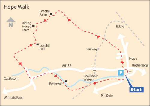
WALK DETAILS
Length: 6 miles.
Start: Hope Car Park on the left, just after the village centre, on the A6187 road to Castleton.
Location: On the A6187 between Castleton and Hathersage.
Terrain: A long, steady climb up to Losehill Farm, but mainly flat, easy walking after that. It may be muddy in places.
Refreshments: There are several places in Hope where you can obtain refreshments, including the Cheshire Cheese Inn along Edale Road. There is a good selection of cafés, pubs, and restaurants in Castleton.
THE ROUTE
1. Turn right out of the car park and immediately after passing a row of cottages on the opposite side of the road, go to the left through a narrow opening and in 25 yards ascend a short flight of steps by a footpath sign ‘Lose Hill – Mam Tor’.
2. Cross a short field through two kissing gates and continue straight on up an estate road, crossing the road at a ‘T’ junction to a stile on the opposite side. Continue straight ahead along the right edge of the field, before walking on the opposite side of the field boundary for a short distance, but without changing direction.
3. The route is easy to follow and leads to a bridge over a railway line. On the other side, the path goes over a short field to cross a stile and continue to the right of a house up a driveway by outbuildings and over another stile.
4. You now walk along a fenced path, before crossing a cart track and continuing with the hedge close on your left. Keep climbing gently without deviating in direction, heading towards Losehill Farm, crossing an open field, passing close to a barn on the right, over a stile and up another field to join a wall on the left.
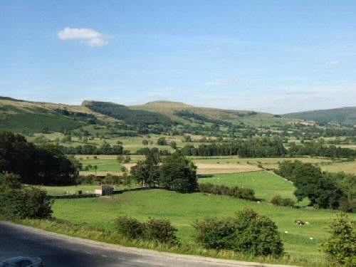
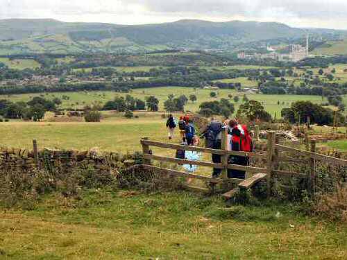
5. On reaching the farm, take the ‘Castleton’ sign to the left and then, in a few yards, go left again, where the path guides you onto the house driveway. By the drive gateway, take the stile on the right and walk straight across two fields to join a cart track. There are good views over towards Pindale and the Cement Works in the distance. Where the track turns to the left, carry straight on and walk along the top side of a field to a stile in the corner.
6. Turn left and just before reaching Riding House Farm, turn left again and head to the bottom right corner of the field. Go down a flight of steps and over a stream and up the other side into another field. Immediately turn left and walk down a clear path to reach the road at the rear of Losehill Hall.
7. Go right and, where the road bends to the left, walk straight on across a field going over a stream in the corner, before angling slightly to the left across the next field to reach a farm access road. Go through the gates at the end of the drive, passing Hollowford Outdoor Centre.
8. Soon, the road swings to the left. Continue ahead along Hollowford Road, the name of the road changing to Millbridge Road as you approach the outskirts of Castleton. At the end of the road, turn left to follow the main walk along the A6187. If you want to take a diversion to visit Castleton, follow the instructions below, otherwise go to route point 10.
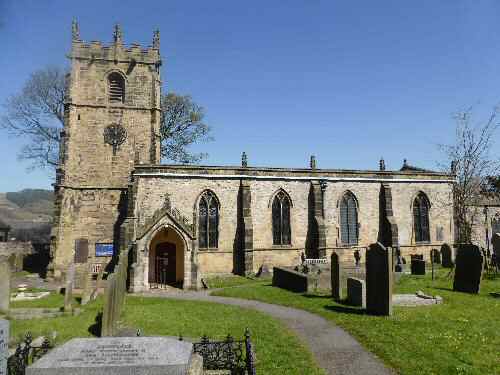
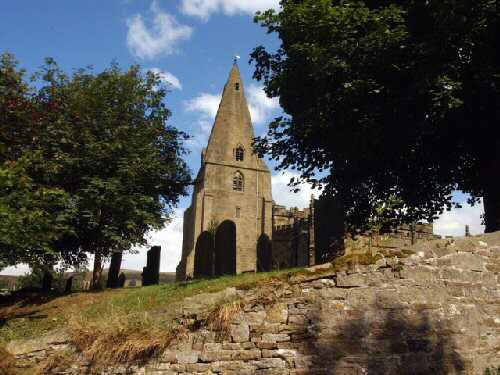
9. To take the diversion, continue straight ahead along the A6187, turning right into Cross Stret. Take the first left up Castle Street, past St Edmund’s Church, at the top of the street, with Peveril Castle in view. Go to the left into the Market Place and then left again into Back Street to return to the A6187, where you turn right to rejoin the walk.
10. From Castleton, follow the A6187 to the outskirts of the village. After passing a small field, turn right at the footpath sign for ‘Hope’ and walk up a walled lane that leads to a rough track.
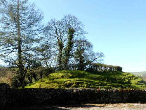
11. On leaving the track, a fence is followed first on the left and then on the right, before crossing several fields along a distinct path. Soon, you cross a railway line that serves the Cement Works, and after that, you go left and follow the gravelled path to Pindale Road. Turn left down the road, past a well-preserved Pinfold and the former site of Hope Castle.
12. On reaching the A6187, with St Peter’s Church on your right, turn left and walk along the main road back to the car park and the start of the walk.
HOPE