PLAN YOUR DAY OUT
Location: Ladybower is off the A57 Glossop to Sheffield Road (SK174894).
Visit: Call at the Upper Derwent Valley Visitor Centre and purchase one of the self-guided walks for a short stroll around the area, or get details of longer moorland walks. Better still, use the walk on this website. – Visit Tipp’s memorial, which has been erected at the western end of Derwent Dam, in memory of the sheepdog.
Refreshments: There are picnic tables at Fairholmes Visitor Centre and a refreshment kiosk open at the same time as the Visitor Centre. Yorkshire Bridge Inn, located close to the Ladybower Dam, is a popular inn offering both good food and accommodation. Ladybower Inn is situated on the A57 overlooking the reservoir. The inn was re-sited more than 100 years ago, having originally been located further up Ladybower Brook.
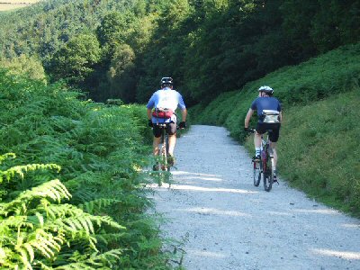
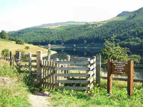
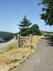
Walk: Ladybower Walk is outstandingly beautiful and must be one of the most enjoyable walks in the Peak District, suitable for anyone with a moderate fitness level. The reservoir is situated in the Upper Derwent Valley at the heart of the Peak National Park, in an area often referred to as the ‘Lake District of the Peak’. There are three reservoirs, Ladybower, Derwent, and Howden, surrounded by forest, farmland, and glorious moorland scenery. So, pick a clear day for this walk and get there early before the crowds.
Special Places of Interest in the Locality: Castleton’s spectacular collection of caverns and the castle. – Edale, where the Nag’s Head Inn is the traditional starting point of the 270-mile Pennine Way Trail, as it winds its way north to the Scottish border at Kirk Yetholm. – Hathersage and the impressive St. Michael’s Church with its fine collection of 15th-century brasses of the Eyre family, and Little John’s grave, and you can also call at the David Mellor Cutlery Factory, designated a masterpiece of modern architecture. The shop beside the factory sells a wide range of cutlery.
INTRODUCTION
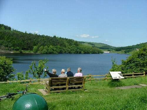
Ladybower Reservoir is situated in the Upper Derwent Valley at the heart of the Peak National Park, in an area often referred to as the “Lake District of the Peak.” It is surrounded by magnificent countryside where water and woodland, topped by high moors, predominate. Forestry has become an important factor in recent years, and the sides of the valley have been covered in conifers. Not surprisingly, the area has become so popular that over two million people visit each year.
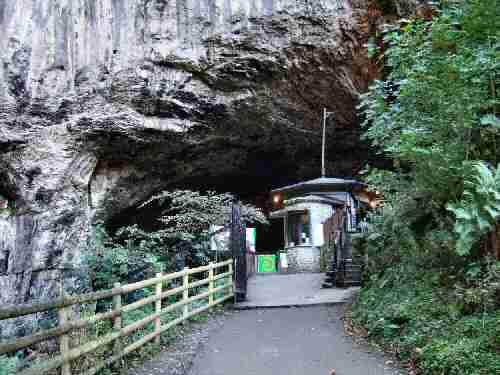
The area’s outstanding beauty is a magnet for walkers, cyclists, fell-runners and those who just come to relax and enjoy the countryside. At certain times, the road beyond Fairholmes is closed to help protect the environment, and a minibus service is operated. Disabled Badge holders are exempt. The Upper Derwent Information Centre is based at Fairholmes, where bikes can be hired, and information about the area can be obtained. If you arrive early, there are also large car parks, toilets and plenty of room for picnics.
WATER STORAGE
The valley was a very attractive location for water storage, with its long, deep valley and narrow points for dam building. This, combined with a high average rainfall, low population level and heavy demand for water from the industrial towns surrounding the Peak District, made the case for reservoir construction. The Derwent Valley Water Board was set up in 1899 to supply water to Derby, Nottingham, Sheffield and Leicester and the Howden and Derwent Reservoirs were constructed shortly afterwards.
At that time, the water demand was satisfied, and although plans existed for additional reservoirs, no further action was taken. However, demand continued to grow, and the decision was taken to build a large reservoir called Ladybower. This, though, entailed flooding the villages of Ashopton and Derwent and caused considerable unrest. However, the project went ahead, and the villagers were moved to houses built specially for them at Yorkshire Bridge.
DEMOLITION
The packhorse bridge that stood near the gates of Derwent Hall, which had a Preservation Order on it, was moved stone by stone and rebuilt at Slippery Stones at the head of the Howden Reservoir. All the graves in the churchyard were excavated, and the bodies reburied in nearby Bamford churchyard. Several properties built on slightly higher land, including the Shooting Lodge and former Roman Catholic School, survived. But the majority were demolished and flooded, leaving the church spire eerily poking out above the waters. The flooding was completed in 1945, and the opening ceremony was carried out on Tuesday, 25 September 1945, by King George VI. Two years later, the church spire was blown up.
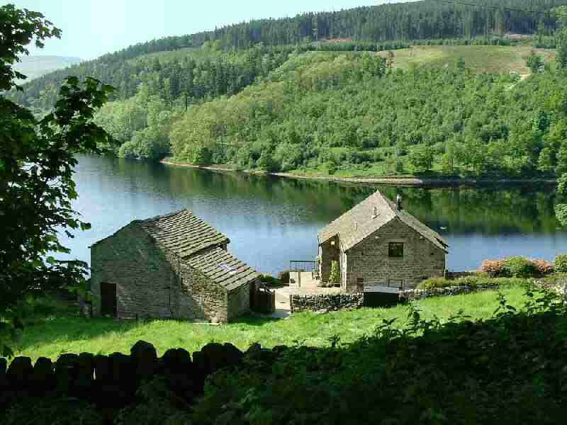
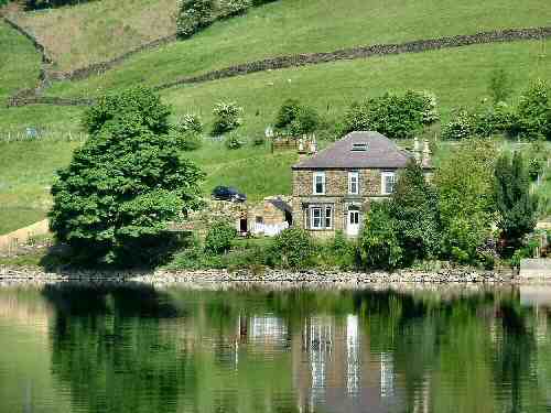
The tiny village of Yorkshire Bridge, which lies in the shadow of the dam wall of the Ladybower Reservoir, with its neat, regimented rows of houses, was used to house those rendered homeless by the valley’s flooding. One person refused to move: Miss A Cotterill of Gwinnett House. She remained there until she died in 1990, at the age of 99, the reservoir waters lapping at the front garden steps.
BRAVE SHEEPDOG
Perhaps Yorkshire Bridge’s best-known resident was a sheepdog named Tip. Her master, Tagg, was a well-known local sheep farmer who helped found Hope Valley Sheepdog Trials and lived there during his later years.
On 12 December 1953, Tagg, aged 85, went out for the last time with his faithful border collie, Tip, and vanished completely. Despite an exhaustive search, neither he nor his dog could be found. It was not until 15 weeks later that Tagg’s remains were discovered by chance, with the faithful Tip now completely exhausted, lying about five yards away. Somehow, Tip survived heavy snow, biting winds and freezing temperatures on one of the country’s most hostile stretches of moorland.
Tip was carried back to the rescuer’s lorry and later transferred to a caring home, where she was carefully nursed back to health. Once the story became known, Tip became famous in this country and abroad. A year later, in May 1955, she died. However, the hearts of those who had heard the story were so greatly touched that a memorial was erected at the western end of Derwent Dam in memory of Tip.
BOUNCING BOMBS
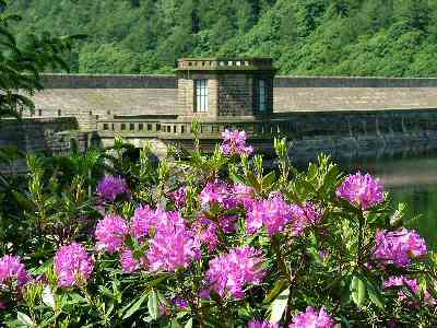
The Derwent Dams were used during the Second World War to perfect the ‘bouncing bombs’ technique, which in 1943 breached the Ruhr Valley Dams in the heartland of industrial Germany. A plaque and memorial museum in the west tower of Derwent Dam retells the story of the Dambusters.
TEN FASCINATING FACTS ABOUT LADYBOWER
1. The River Derwent is Derbyshire’s and the Peak District’s principal river. It flows first through Howden, Derwent and Ladybower Reservoirs before continuing south. Between them, the reservoirs provide most of Derbyshire’s water and a large part of South Yorkshire.
2. Ladybower Wood is a Derbyshire Wildlife Trust Nature Reserve noted for its ancient woodland. Leaving the woods, you can enjoy superb views over the reservoir and the surrounding countryside.
3. The Yorkshire Bridge Inn dates back to at least 1826 and takes its name from an old Packhorse bridge, the last crossing point on the River Derwent before the Yorkshire border.
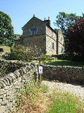
4. Today, Yorkshire Bridge is a tiny hamlet within the parish of Bamford, consisting of three rows of attractive gritstone cottages built on the sloping east bank of the Derwent.
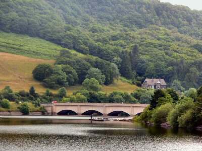
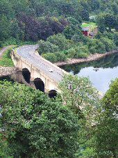
5. Ashopton Viaduct was constructed to carry the Snake Road to Glossop, and the Ladybower Viaduct to carry the road from Yorkshire Bridge to the A57.
6. The steep wooded valleys of the Upper Derwent offer excellent opportunities to spot various birds and other wildlife.
7. Ladybower Reservoir offers trout and fly fishing. Fishing boats with well-serviced engines can be hired and booked by calling Ladybower Fisheries at 01433 659712.
8. Ladybower Inn is on the A57, overlooking the reservoir. It was re-sited more than 100 years ago from a site further up Ladybower Brook.
9. At the western end of the dam at Ladybower is a small sculpture that forms part of the Bamford Touchstones Sculpture Trail, established by the residents of Bamford to mark the millennium. The Touchstones illustrate air, water, earth, and fire, and they are on a five-mile walk around the village’s edges.
10. Several hill farms are scattered about the area, most involved in sheep farming. The hardy white-faced woodland sheep are often seen in this part of the Peak National Park.
Ladybower Walk