PEAK FOREST TO PIKEHALL
A TO Z – DERBYSHIRE AND THE PEAK DISTRICT – CHAPTER 37
PEAK FOREST (5 miles northeast of Buxton, on the A623 between Sparrowpit and Wardlow Mires – SK115793)
Peak Forest takes its name from the Royal Forest of the Peak, which once covered an area of 180 square miles. Parts of the forest were gradually cleared as the demand for timber and brushwood increased. A ranger built a house in a clearing, which eventually led to the construction of more homes. The settlement takes its name from the forest. A church was built, and from 1665 the minister had the power to grant marriage licences and prove wills. It resulted in the church becoming the equivalent of Gretna Green in Derbyshire. Where young couples could get married without needing to have their banns read, and this arrangement proved very popular until further legislation put an end to it.
PEAK RAIL (runs from Matlock to Rowsley South Station)
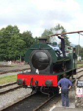
In 1849, the railway arrived at Matlock and eventually extended to Buxton. At its height, it was part of the Midland Railway’s line between Manchester Central and London St Pancras. Rowsley Station was very popular with tourists and welcomed hundreds of visitors en route to Chatsworth. They usually completed their journey by horse-drawn carriage. The line only survived until 1968, when Dr Beeching closed the section from Matlock to Buxton. Thanks to a band of determined enthusiasts, a section of the line has been brought back to life. Trains recommenced running from Matlock to Darley Dale Station in 1991, and six years later to Rowsley South Station. It is now a popular leisure attraction for visitors to Derbyshire and railway enthusiasts. Several special events are held every year.
PEAK VILLAGE SHOPPING CENTRE (on the Rowsley to Chatsworth Road, off the A6 – SK257662)
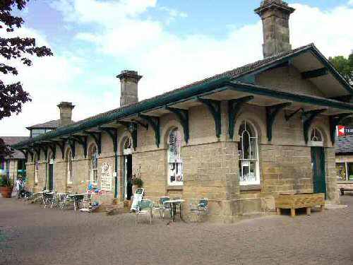
Paxton built an impressive Italianate Railway Station at Rowsley, along with four stone cottages to house railway workers. The Station Hotel, now renamed the Grouse and Claret, was also built nearby, and everything was ready to extend the line through the valley. Unfortunately, there was a problem. The Duke of Devonshire was adamant that he would not allow the line across Chatsworth Park. If that was not bad enough, the Duke of Rutland also refused an alternative plan for the railway to run across his estate at Haddon. At the time, the railway company could only run trains between Rowsley and Ambergate. The problem was solved when the Duke of Rutland agreed to the Midland Railway’s plans to build a track out of sight, in a cutting behind Haddon Hall. A new station was built a quarter of a mile to the south, and instead of the line running up the Derwent Valley, it ran along the Wye Valley. Paxton’s splendid station was left isolated in the wrong valley. It was not until 1867 that the line finally reached Manchester. In 1967, when Dr Beeching closed the line, the extensive marshalling yard and locomotive shed were no longer required, and Rowsley lost a major employer. For a few years, the yard was used by an engineering business. The transformation then took place into the Peak District’s first and only Factory Outlet Shopping Centre, with Paxton’s Station the centrepiece.
PENTRICH (on the B6016, off Ambergate to Ripley Road – SK390525)
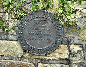
Pentrich is a small village, but it played a significant part in British History. When a group of Derbyshire weavers and miners resorted to rebellion, they made a futile attempt to overthrow the government by force. The uprising lasted only one night and ended in public executions and beheadings. About 300 unemployed labourers from local villages joined a march to Nottingham, under the leadership of Jeremiah Brandreth, on the night of 9 June 1817. They expected at least 70,000 from the North of England to join them, but none did, and many of the marchers departed under the cover of darkness. Those who remained were tried for high treason; four were sentenced to death, and several others were transported to Australia. Today, the Pentrich Revolution Trail is marked by a series of plaques located around the village.
PIKEHALL (on the A5012, between Cromford and Newhaven – SK192591)
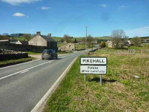
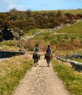
Pikehall is a small village situated on the A5012, between Cromford and Newhaven, and is often overlooked by road users as they pass through. It consists of a few dozen households and a handful of farms divided in half by the road. At one time, the main road through the village was the Nottingham to Newhaven turnpike road, created in 1759, when a tollgate was located at Pikehall. There is also an old milestone a short distance up the road towards Newhaven, which reads ‘London 157 miles and Nottingham 33 miles.’
The village was formerly an important junction of tracks and pathways, and the medieval track from Biggin was used for transporting salt from Cheshire. However, it was the arrival of steam trains that transformed this remote area. The railway track has now been converted into the High Peak Trail, with a designated car park a short distance to the south of the village. The popular Y-Not Festival is held annually at Pikehall.
