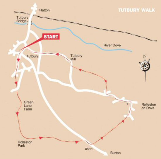
WALK DETAILS
Length: 6.5 miles.
Start: There is a car park at the top of Monk Street, near Tutbury Castle (SK212288). The railway station is on the Hatton side of the River Dove off the A511.
Location: North-west of Burton, on the A511 road to Foston, which links with the old Derby to Uttoxeter road.
Terrain: Easy, level walking with good open views. It can be wet in places and a bit overgrown in summer.
Refreshments: The Dog and Partridge, situated in the heart of Tutbury, a splendid 15th-century, former coaching inn, full of character with oak beams and an open log fire in winter; Tutbury Tea Room in High Street is a popular choice. Several other pubs, tea shops and restaurants in the village serve food and refreshments.
THE ROUTE
1. Turn left out of the car park and walk past Tutbury Museum. On reaching a mini-roundabout at the top of the main street, turn right up Ludgate Street. After reaching Portway Drive on the left-hand side of the road, continue ahead up the public footpath. Care, do not continue to follow the road. The path leads you up to Green Lane.
2. Turn left down the lane and then right after 25 yards, to go through a metal gate. Keep to the right of the building and continue straight ahead down a field track. At the end of the track, go through a gate and angle to the right across a large field, heading towards a tall tree in the distance.
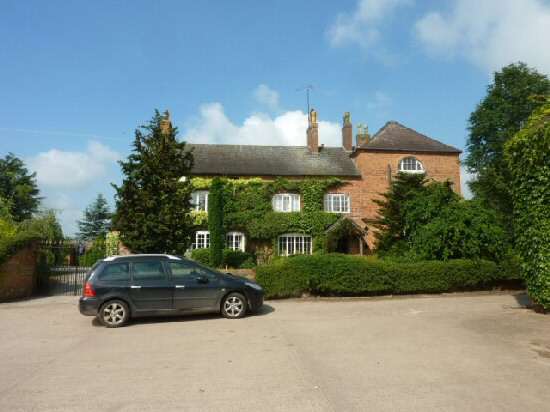
3. Walk through a gap into the top corner of the next field, and after a few yards, turn left and cross the field at an angle of about 45 degrees to a metal gate and a yellow walk indicator. Head for the gate into the farmyard at Rolleston Park, turn left in the yard and leave the farm by the drive, which you follow all the way to the main road.
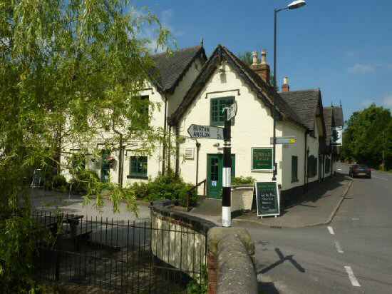
4. Turn right and walk along the pavement for about 200 yards to a stile on the left marked by a footpath sign for Rolleston. As indicated by the route markers, maintain the same direction over four smallish fields to reach Brook Hollows Spinney. Keep to the right through the Spinney, and then turn left down Burnside, as you head towards the centre of the village. Turn left again past the Spread-Eagle Hotel and continue your walk past the church.
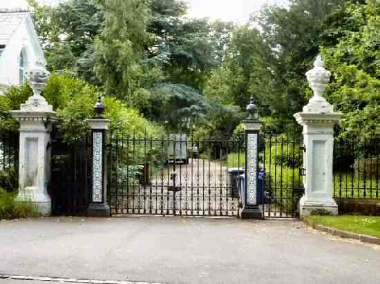
5. Just after passing the gateway to what was once Rolleston Hall, where Sir Oswald Mosley lived, turn right up Shotwood Close. Where the road bends to the right, continue straight on down a farm track, by a fingerpost signed for Marston Lane and Tutbury. Follow the track around when it curves to the left.
6. When the track ends, go over a stile and keep close to the hedge on your right. Walk up the field to another stile in the top corner. Cross the stile and continue straight on with the hedge now close on your left, to go over a stile in the corner.
7. Then angle to the right across the next field to a stile about 70 yards from the right-hand corner.
8. Cross the stile and turn right along Corn Mill Lane. Near the corner of the lane on your right is the site of the Old Corn Mill.
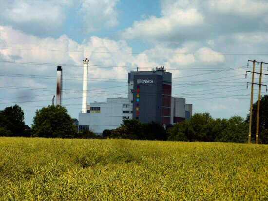
9. Continue to follow the lane with care as there is no pavement until you reach the outskirts of Tutbury. On your right, on the other side of the river, is The Nestlé Factory.
10. On reaching Tutbury High Street, turn left and walk to the top of the street, and go right at the mini-roundabout to return to the starting point of the walk.
TUTBURY