KIRK IRETON TO LATHKILL DALE
A TO Z – DERBYSHIRE AND THE PEAK DISTRICT – CHAPTER 23
KIRK IRETON (off the B5023 Duffield to Wirksworth road – SK269501)
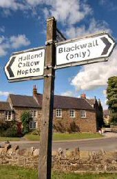
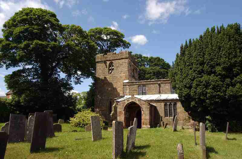
A charming old-world village which climbs steeply out of the Ecclesbourne Valley, rising to about 850 feet at the upper end, where there are excellent views over miles of lovely countryside. Large farmhouses once flanked the wide main street, but most of these have now been converted to residential use. At the lower end of the main street stands Holy Trinity Church, the oldest building in the village. It is entered through an interesting 18th-century pillared gateway believed to have come from the Old Manor House. The font came to a tragic end in the 1800s when, after being used as a water butt for a time, a plumber decided to melt some lead in it and lit a fire underneath, only to shatter it into many pieces.
Several interesting little roads lead off to the left as you climb the main street, with houses seemingly perched on every bit of level ground. The upper end of the village is often referred to as ‘The Windmill’ because of the former existence of a post mill, traces of which remain. It was the excellent water supply from the local springs that first attracted settlers to the area. Until 1905, villagers collected water from the two wells on Well Street. Then a pump was installed to pump the water that fed the wells up to a reservoir on Blackwall Lane, from where it was piped to people’s homes. The village was the first in the Ashbourne Rural District to have piped water.
KIRK IRETON – BARLEY MOW
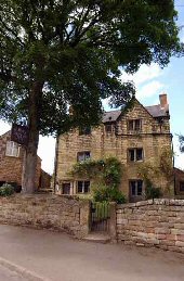
The Barley Mow, a handsome, Jacobean-style house dating back to 1683, is one of the very few remaining old English pubs to have retained the traditional image of what a public house used to look like in times past. The small main bar has a tiled floor, wooden settles, and a coal fire. There are two other furnished rooms, but no fruit machines or piped music to disturb the art of good conversation.
Tradition at the Barley Mow was so strong that on the introduction of decimal coinage in 1971, the owner, Mrs Ford, refused to accept the new currency. It caused regulars great amusement as they watched the faces of visitors when asked for ‘five shillings and eleven pence’. Customers had to pay in ‘old money’ up to the time of Mrs Ford’s death in 1977. The new owners celebrated their 40th anniversary of ownership in 2016. It is now a family-run pub, the only one left in the village following the closure of the Bull’s Head.
KNIVETON (3 miles northeast of Ashbourne on the B5035 –SK210503)
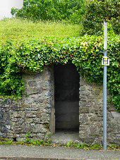
The village is sheltered in a deep hollow and hidden from view until the last minute for drivers travelling eastwards. It is a pretty, grey-stone-built village of considerable antiquity, mentioned in the Domesday Book. An ancient yew tree guards the doorway to St Michael and All Angels’ Church, where, on close inspection, grooves can still be seen to the side of the door, where the archers sharpened their arrows. A Bronze Age burial mound has been found nearby.
LADYBOWER RESERVOIR (off the A57 Glossop to Sheffield Road)
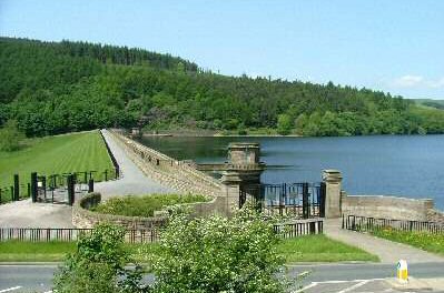
Ladybower Reservoir is situated in the Upper Derwent Valley, in an area often referred to as the ‘Lake District of the Peak.’ Surrounded by magnificent countryside where water and woodland, topped by high moors, predominate. Where, in recent years, forestry has become a significant factor, with the valley sides lined with conifers. Not surprisingly, the area has become so popular that over two million people visit each year. The outstanding beauty of the area acts as a magnet for walkers, cyclists, fell runners, and those who come to relax and enjoy the countryside.
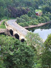
The valley was a desirable location for storing water, with its long, deep, and narrow points suitable for dam building. The average rainfall, low population density, and high demand for water from industrial towns all made a compelling case for reservoir construction. The Derwent Valley Water Board was set up in 1899 to supply water to Derby, Nottingham, Sheffield and Leicester and the Howden and Derwent Reservoirs were constructed shortly afterwards.
At that time, the water demand was satisfied, and although plans existed for additional reservoirs, no further action was required. However, demand continued to grow, and the decision was made to build one very large reservoir. It, however, entailed the flooding of the villages of Ashopton and Derwent, causing severe unrest. However, the project proceeded, and the Ladybower reservoir was constructed; the dispossessed villagers moved to houses built specially for them at Yorkshire Bridge.
LATHKILL DALE (from Ricklow Quarry, southeast of Monyash to Alport by Youlgreave)
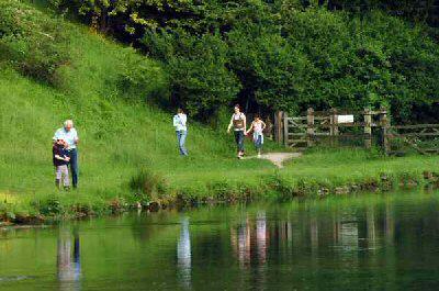
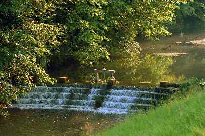
Lathkill Dale is one of the most beautiful dales in England, the first in Derbyshire to be designated a National Nature Reserve. The river, one of the purest in the country, rises in a cave near the top of the dale and sometimes disappears underground in its upper reaches before widening out below Over Haddon. It is for the sheer beauty of the scenery, the wonderful walks, and the natural beauty of its wildlife that visitors come to the area in droves at weekends and during the summer. A short distance down the river from Lathkill Lodge, there is a succession of eleven weirs, which create an incredible sight to look back on as you walk down the dale. Before Alport Bridge was built, where the Lathkill and Bradford join, the old Portway forded the river on its journey from Castle Ring to the Iron Age hill fort on Mam Tor near Castleton.
