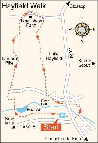
HAYFIELD AND LANTERN PIKE WALK

Birch Vale Reservoir from the Sett Valley Trail

THE WALK

Hayfield and Lantern Pike is an invigorating walk, which, after leaving the Sett Valley Trail, climbs steadily up to Lantern Pike for glorious views over Kinder Scout and Hayfield.

On the return journey, Little Hayfield soon comes into sight, and after passing Firbob Cottage, Clough Mill is seen close to the footpath. Opened as a cotton mill in 1830, it had to be protected by troops against attack from local spinners who felt the new technology threatened their livelihoods.

The final part of the walk takes you on a short riverside walk by the River Sett back into the centre of Hayfield.

LOOK OUT FOR

Route Point 1 – In 1868, the railway came to Hayfield and was soon busy with both passengers and goods, servicing all the mills in the valley. Passenger trains ran regularly to Manchester, and shortly after the First World War, it was quite common for 4,000 to 5,000 people to use the Sett Valley Line on a summer Sunday to visit the countryside. Business gradually diminished, and the line closed in 1970. Now it provides a recreational traffic-free route for walkers, cyclists, and horse riders. The trail runs from Hayfield to New Mills and forms part of the Pennine Bridleway National Trail between Hayfield and Birch Vale, and is of outstanding natural beauty. Derbyshire County Council has resurfaced it as part of a scheme designed to improve facilities for users and make the area more attractive to wildlife. Sections of woodland have been thinned along the side of the trail, and 1,600 trees planted, and new hedgerows established along the route.

Point 3 – Lantern Pike is a hill on land owned by the National Trust with the Pennine Bridleway running across its eastern flank. Its name likely came from the ancient custom of lighting beacons. On a clear day, with the aid of the viewfinder on the hill, you will be able to pinpoint well-known landmarks on Kinder Scout.

Sett Valley Trail
Sett Valley Trail
Lantern Pike Viewfinder

Point 4 – The right to roam the privately owned moor above Edale was severely restricted until the 1950s. Now that access to roam has been negotiated, subject to specific bylaws, the moors are very popular with walkers. However, Kinder Scout, a plateau that spans five square miles and reaches a maximum elevation of 2,088 feet, can be a very hazardous place. The weather can change quite suddenly from bright sunshine to thick mist, making it impossible to find your way without a compass.

Point 7 – Little Hayfield was a mill village from the 17th century onwards. Clough Mill, a former water-powered and later steam-powered textile mill, remains, converted to apartments in 1989. At the centre of the village is the Lantern Pike public house. It was here that Tony Warren wrote the first six episodes of Coronation Street in 1960. Pat Phoenix, who played Elsie Tanner and several other cast members, lived locally.

Kinder Scout
Kinder Scout
Lantern Pike public house, Little Hayfield

WALK DETAILS

Length:    4.5 miles.

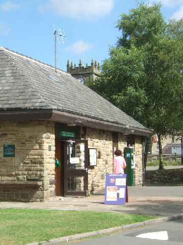
Start:    Sett Valley Trail Car Park is on the left at Hayfield, a few yards along the A6015, off the A624 Chapel-en-le-Frith to Glossop, where the Hayfield Countryside Centre is. Facilities include a picnic site, pay and display car park, and information centre, bus station and public toilets.

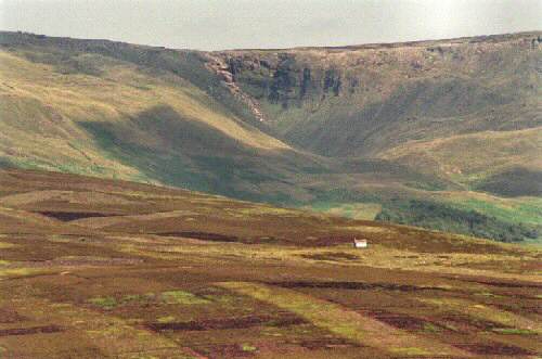
Terrain:    Long, steady climb up to Lantern Pike from the Sett Valley Trail. Rocky in places and can be muddy.

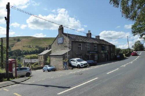
Refreshments:    There are several pubs and restaurants in and around Hayfield, including the Michelin-starred Pack Horse Inn. Marmalade Coffee Shop is on New Mills Road.

THE ROUTE

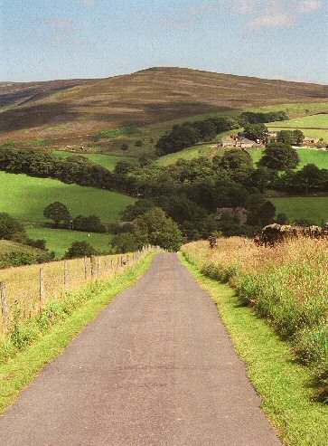
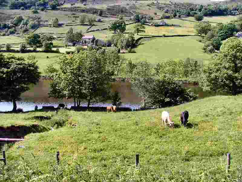
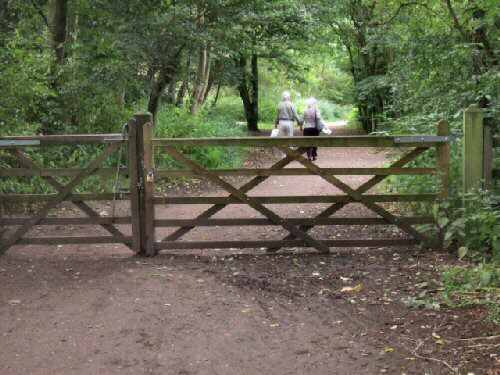
1. Leave the car park and walk along the Sett Valley Trail. After about one mile, turn right by a footpath sign immediately after passing Birch Vale Reservoir. Keeping the factory on the left and the reservoir on the right, go over a footbridge and through a stile, straight ahead up a field.

Lantern Pike Viewfinder

2. On reaching a track, turn left and follow it around a bend to join the Pennine Bridleway and climb up the hillside. Cross an intersection of tracks and continue ahead.
3. Follow the ‘Public Bridleway’ past Sunnyside as the surface starts to deteriorate into a rough track, at a gateway with a ‘National Trust Lantern Pike’ sign. You can either follow the bridleway (go to number 5) or, keeping close to the wall on your left, climb to the top of the hill.
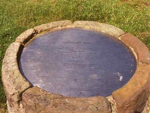
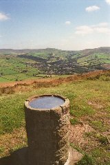
4. At a small wooden stake indicator, turn right and follow the ridge path, passing a stone pillar with a stainless-steel view pointer set in the top, where you will get excellent views across Kinder Scout.
5. The route soon descends back to the bridleway by another ‘National Trust Lantern Pike’ sign. Where you continue along the bridleway going to the left across a large field heading to the upper of two gates by a multiple signpost. Take the route to the right signed ‘Carr Meadow via Brookhouses,’ past Blackshaw Farm and down the farm access route.
6. After a short distance, turn to the right along a drive towards a cottage at a sign ‘By How Meadow to Little Hayfield’. Just before reaching the cottage, take a stile to the right and, keeping the fence on the right, continue up the field until the fence turns sharply uphill. At this point, go straight across the field, maintaining the same level to enter Hey Wood.
7. Go through the wood, keeping a broken stone wall on your left and across a short field before turning left down a stony track past Firbob Cottage. Follow the track alongside the hillside, with fine views of Little Hayfield coming into focus.
8. As the track bends, keep straight on along a path that goes above a steep, wooded slope until you reach a gate stile, where you fork left and continue descending into Bank Vale. Follow the tarmac lane and on reaching Swallow House Lane, turn left.
9. Just past Lea Road and before reaching the relief road bridge, go to the right and enter a small park. Follow the path alongside the river, walking underneath the village relief road into Market Street and turn right.
10. Fork to the right over the bridge and follow the road around between the former Bull’s Head and St. Matthew’s Church along a path which bends to the left to the subway under the A624 and back to the start of the walk.

HAYFIELD

Hayfield and Lantern Pike Walk
Hayfield and Lantern Pike Walk Map
Sett Valley Visitor Centre