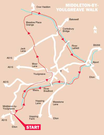
MIDDLETON-BY-YOULGREAVE WALK

Swimming Pool, Bradford Dale

THE WALK

This is a delightful walk for the most part along the banks of the Lathkill and Bradford, famous for the purity of their water.

After leaving Middleton and walking along Bradford Dale for a stretch, the walk soon takes you into the historic village of Youlgreave. Leaving the village behind, you quickly return to the open countryside before Lathkill Dale is reached. The Dale is well known for its aquatic life. Trout may be seen in the river, and the bank sides teem with wildlife.

The walk along Bradford Dale not only provides an opportunity to admire the scenery, but also to note the varying styles of bridges across the river and to gaze into the crystal-clear fish pools as you near Middleton.

LOOK OUT FOR

Route Point 1     The western end of Bradford Dale is quite different from the eastern end. Here, there is a succession of weirs and pools constructed to encourage trout to breed. Beds of watercress, reed, king cups, and rush encourage nesting birds. At the end of the dale are the remains of a disused pumping station, where a water turbine pumped water to the village before mains water arrived.

Point 4    The Old Hall and Old Hall Farmhouse at the rear have 17th-century origins. The former was probably built in the early part of the century, although the precise date is not known. Again, there is uncertainty as to whether it was the original manor house in the Village. It is a Grade II listed family house.

Bradford Dale (west end)
Old Hall, Youlgreave

Point 5    ‘The Fountain,’ which, since 1829, has supplied soft water to the villagers, initially at an annual charge of 6d. It was built following a campaign by the ‘Friendly Society of Women,’ who demanded a cleaner, healthier, and more efficient supply of water. It certainly was more efficient than carrying the water on the torturous journey up from Bradford Dale. The Village still has its own private water company, but prices have increased!

Point 9    Lathkill Dale is one of the most beautiful dales in England. The river, one of the purest in the country, rises in a cave near the top of the dale and sometimes disappears underground in its upper reaches before widening out below Over Haddon. A short distance down the river from Lathkill Lodge, a succession of eleven weirs creates a wonderful sight to look back on as you walk down the dale.

Lathkill Dale
Lathkill Dale
The Fountain, Youlgreave
Lathkill Dale
Lathkill Dale

Point 10    Alport stands on the route of the old Portway from Nottingham to Castleton at the confluence of the Rivers Lathkill and Bradford. It consists of an attractive group of cottages overlooking a handsome old bridge with a riverside corn mill completing the idyllic scene. An unusual sign on a building along the road to Youlgreave acts as a warning to vagrants. In 1824, the Vagrancy Act made it an offence to sleep on the street or to beg. The Act has been amended many times since then.

Point 11    As you walk up Bradford Dale, cliffs rise steeply on your left, and on the opposite side, cultivated meadows. After reaching a clapper bridge near Youlgreave, the dale opens out and runs through a lush meadow where cattle and sheep graze. Nearby, a concrete dam has been constructed to create a swimming pool where bathers can enjoy a splash and the rare experience of swimming in natural river water – when it is warm enough to do so.

Alport Vagrant Notice
Bradford Dale (east end)

WALK DETAILS

Length:    6 miles.

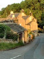
Start:    Roadside car parking in the centre of Middleton.

Location:    From the A6 Matlock to Buxton Road, take the B5056 to the village and then follow the signs for Middleton-by-Youlgreave.

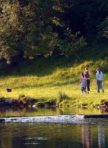
Terrain:    Mostly easy walking with only short climbs and descents. Much of the route follows the Lathkill and Bradford rivers. There are some muddy patches to watch out for in wet weather.

Refreshments:    There are three public houses in Youlgreave and a popular cafe at Monyash called The Old Smithy. It is a former Blacksmith’s shop converted into a cafe.

THE ROUTE

Bradford Dale
Bradford Dale

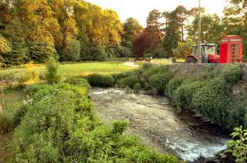
1. From the centre of the village, walk down the road opposite to the children’s play area and public toilet facilities. Continue as the road turns into a track, descending steadily with rock faces on either side to Bradford Dale.
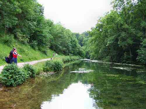
2. As the route levels out, the track bends to the left to run alongside the River Bradford. You follow the riverbank for a short distance until a bridge is reached, which you cross and follow the path on the opposite side of the river.
3. After a few yards, the route divides and you turn right to walk along a clear path through the trees, which soon brings you back close to the river, before climbing up to the road.
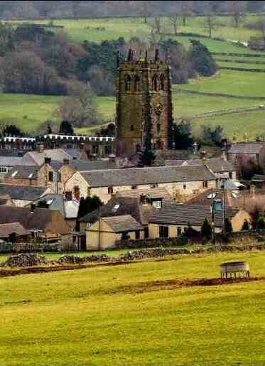
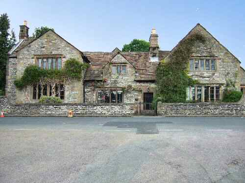
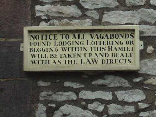
4. Turn right and head down the road towards the centre of Youlgreave, to reach the Old Hall, which faces Holywell Lane. Here you can take a short diversion and continue forward for a few yards into Youlgreave’s historic marketplace.
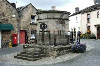
5. In the centre is a huge circular water tank or conduit head, known locally as ‘The Fountain.’ Keep to the left of the water tank and turn left at the top of the marketplace into Moor Lane, which you follow for a short distance before turning to the right along a rough, unsurfaced lane running between limestone walls.

Alport
Alport

6. At the end of the lane, go through a stile by a gate and keep close to the wall on the left, cross two fields to reach a tarmac road. Where you turn right and in 30 yards go over a stile on the opposite side of the road.
7. With the wall close on the right, cross another two fields, heading towards the entrance to Meadow Place Grange farmyard. Pass through the farmyard gateway and follow the signs across the yard between the buildings to leave by a gate into a field.
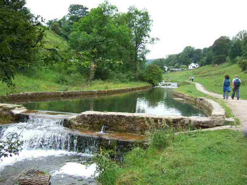
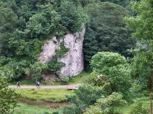
8. Bearing slightly to the right, cross the field to a gate to enter Lathkill Nature Reserve. Here, the path drops steadily through an area of mixed woodland and, after bending back on itself, reaches the riverbank.
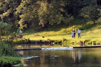
9. Cross the river by the footbridge beside a ford and turn right and walk down Lathkill Dale for two-thirds of a mile. On reaching a road, go to the right over Conksbury Bridge, and as the road starts to climb, go through a gap in the wall on the left.
10. Continue close to the river, for a mile, through several fields along a clear path to Alport. Cross the road and continue in the same direction, keeping close to the River Bradford.
11. At a road intersection by a clapper bridge, continue straight on by the side of the River Bradford. On reaching Holywell Lane, cross the bridge over the river and follow the path up the other side.
12. After a short walk, you will reach the bridge that you crossed earlier; this time, continue straight on. From this point, you will be easily able to retrace your steps back to the start of the walk.

MIDDLETON-BY-YOULGREAVE

Lathkill Dale
Lathkill Dale
Middleton-by-Youlgreave Walk Map
Youlgreave
Youlgreave