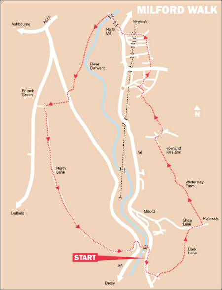
WALK DETAILS
Length: 6 miles.
Start: Makeney Road, a sharp turn right after crossing the bridge over the River Derwent, when travelling from Derby along the A6. There is usually some roadside parking along Makeney Road, a short distance from the bridge (SK352451).
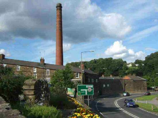
Location: Off the A6 Derby to Belper route, Makeney Road is on the eastern side of the River Derwent at Milford – a sharp right turn once across the bridge, for vehicles from the south.
Terrain: A relatively easy walk to follow along well-trodden paths and country tracks, with some pavement walking in Belper. There are a few ascents and descents, but nothing too strenuous, although the walk down Sunny Hill at Milford is quite steep.
Refreshments: The Old Mill House pub at Milford has been converted into a new ‘World Kitchen’ restaurant known as Soi on the Weir; Angelo’s, Italian Restaurant at the New Inn on Derby Road, Milford; Holly Bush Inn at Makeney is a 17th-century pub serving good food and real ale. Belper has several cafes, pubs and restaurants to meet all needs.
THE ROUTE
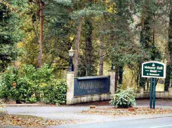
1. Walk along the pavement away from the A6, which soon bends to the left. On the right is the drive to Makeney Hall, a former residence of the Strutt family. Here you turn left up Holly Bush Lane and at the top of the lane, with the Holly Bush Inn a short distance away on your right, go left up Dark Lane.
2. At the end of a row of cottages, turn left at a fingerpost sign and walk up to the top of the field and go to the left, keeping close to the field boundary to cross a stile in the corner. Follow the hedge around to the right to another stile. Continue along the path and then cross a field angling about 45 degrees to the right.
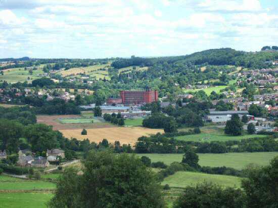
3. The route now follows an enclosed path through several fields to reach Shaw Lane. Go up the steps on the other side of the lane and follow an obvious path, with excellent views back over Milford and the Derwent Valley. Keep to the right of an area of woodland, at the end of which turn right towards Wildersley Hall Farm.
4. As you ascend the field, angle slightly to the left to reach Wildersley Lane. Turn left down the lane, and when you reach Holbrook Road, turn right and walk up the road. Where the road starts to bend to the right and changes its name to Bargate Road, turn sharp left. Follow a public footpath between a residents’ car park and garages and a row of bungalows on the other side of the path.
5. Where the row of bungalows ends, go to the right through a stile into parkland. Continue for a short distance before turning left to descend by some railings, passing a steeply sloping football pitch to reach an estate road by a stile gate. Here you turn right and then, within 25 yards, go left down Manor Road. Turn right by the first street light, along a winding path that leads between the houses to a street called Brookside.
6. Turn right and follow the street around as it bends to the left, up to the A609, where you turn right. But, only for about 25 yards, where you turn left through an archway into Belper War Memorial Park. Walk through the park to the far end, cross King Street and carry straight on along Green Lane. As Green Lane swings to the right into Mill Street, go down Long Row.
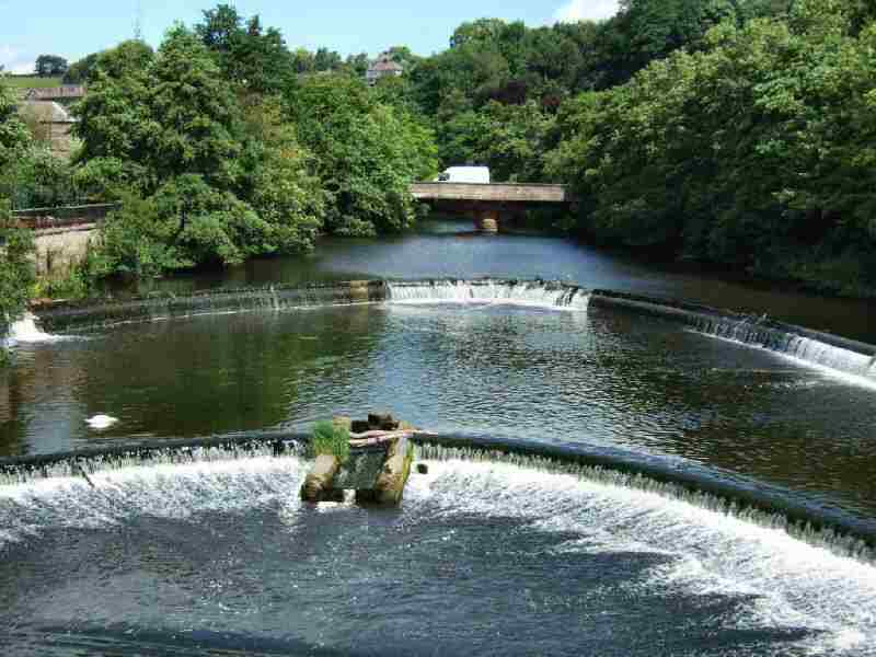
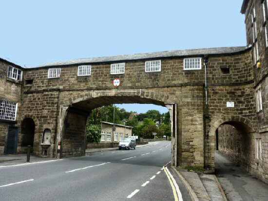
7. At the bottom of the street, turn right and then almost immediately left in front of East Mill and North Mill to cross the bridge over the River Derwent. Where the bridge ends, turn left down an access road. When the access road ends, go through a stile and continue over two fields with the boundary close on your left.
8. In the next field, keep close to the fence at first, before angling slightly towards the river. Follow the Derwent for about 200 yards. With the end of the field clearly in view, leave the riverbank and go to the right through a squeezer stile by a metal gate on the opposite side of the field.
9. Angle slightly uphill and to the left across two fields along a well-trodden path, before following a paved path up a gulley into another field. Aim towards a fence you can see at the top of the field, cross a stile and walk down to Chevin Road, where you turn left. After 200 yards, turn right at a fingerpost sign and ascend two steep fields, keeping close to the wall. At the top, turn left and walk along a wide track, North Lane, without deviating for approximately one mile.
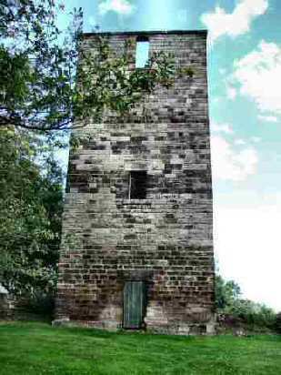
10. When the track starts to bend to the left, you pass a high Tower, before steeply descending Sunny Hill. On reaching the foot of the hill, where Milford County Junior and Mixed Infant School stands, turn right along Chevin Road.
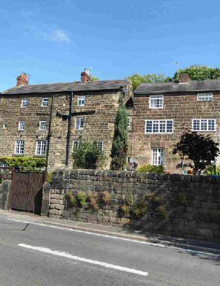
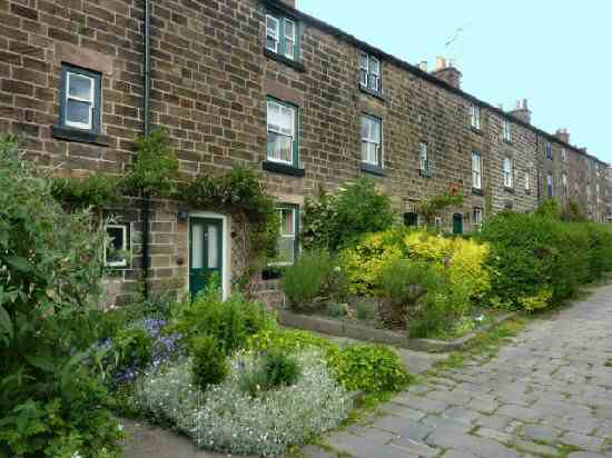
11. In only a few yards, go left down an access path in front of a row of cottages. Turn left along the footpath by the A6 and walk through the centre of Milford. After crossing the river bridge, turn sharp right up Makeney Road, where you started the walk.
MILFORD