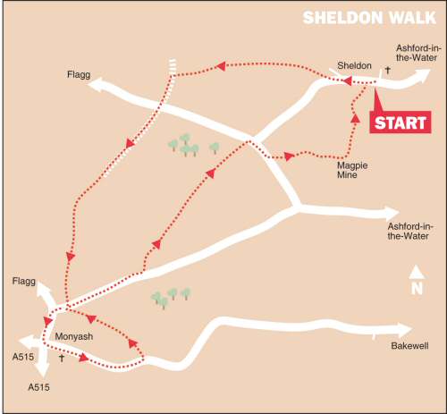
WALK DETAILS
Length: 6 miles.
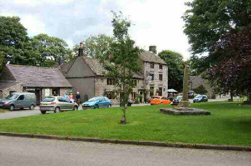
Start: Main Street, Sheldon.
Location: Off the B5055 Bakewell to Monyash Road.
Terrain: Relatively flat upland walking, through stone-wall country. Bagshaw Dale can be muddy.
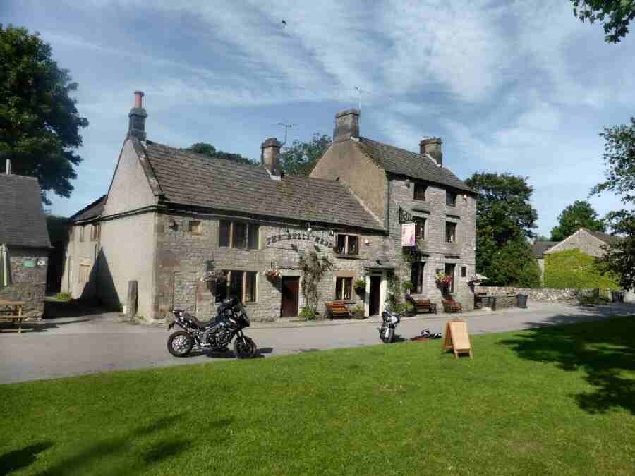
Refreshments: The Cock and Pullet Public House, at Sheldon, opened in 1995, and was once a farm building. The coal fire, beams and lovely antique furniture make this excellent little pub seem to be one of the oldest in The Peak National Park rather than one of the youngest. – The Old Smithy Café-Bar-Bistro, at Monyash, formerly a Blacksmith’s shop, now a visitor destination.
THE ROUTE
1. Walk up the street, past Top Farm and follow the road around to the left. About 75yards after leaving the last building behind, go over a stile on the right, by a fingerpost sign into a field. Aim towards the far-left-hand corner of the field to a squeezer stile, and then cross the corner of the next field.
2. Enter another field angling slightly to the left of a wall that juts out into the field, to reach a stile 20 yards from the right-hand corner of the field. Keep to the left where the path forks. Continue to maintain the same direction for the following four fields. Cut across the corner of the fifth field, and in the next field, head to a stile 35 yards from the left-hand corner.
3. In the next field, go over a stile to the right of an electricity pole and angle very slightly to the left down another field, to go over a stile at the bottom and then turn left down Wheal Lane. Cross a minor road and walk straight ahead down a walled path on the opposite side. Remain on this path until it ends, and you enter a field. Continue straight on, keeping to the right side of a series of fields.
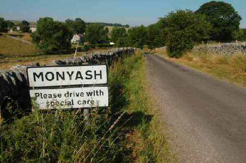
4. After passing a small wood on your right and going over a stile, turn left and cross the corner of a field to another stile. Once over the stile, keep close to the wall on your left all the way to the outskirts of Monyash to reach Horse Lane. Go to the right along the lane for a short distance before turning left at a road junction towards the centre of Monyash.
5. With the village green in front of you, turn left onto the B5055 for Bakewell. The Smithy Café and Bull’s Head are on your left if you require refreshment.
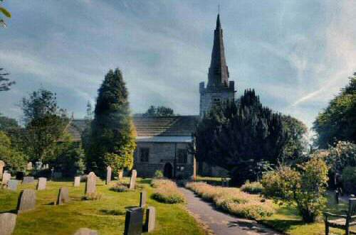
6. Continue along the main street with St Leonard’s Church on your right. After leaving the village behind, watch out for a path on your left, as the road starts to dip.
7. Walk up a clear path along the bottom of Bagshaw Dale, with the field boundaries close by on your left. It soon leads you back to Horse Lane, where you turn right towards Sheldon. About 100 yards after passing the drive to Nursery Fields Farm, go through a stile on the left into a field. Walk to the far-right-hand corner of the field and pass through a gateway.
8. Turn right by the field wall and cross a stile 15 yards from the right-hand corner of the field. Continue in the same direction across two narrow fields. Aim slightly to the left in the next field to the far corner. For the next two fields, follow the wall on your left. (Note: The stile dividing the fields takes you onto the opposite side of the wall, but within 10 yards, you go back through a stile, by a gate, to the side you want to be on.)
9. After entering another field, angle slightly away from the wall to a stile 40 yards from the corner of the field. Cross the corner of the next field to go through a narrow wood, and then walk straight ahead along the side of a boundary fence to a minor road.
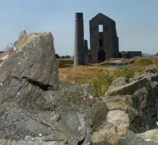
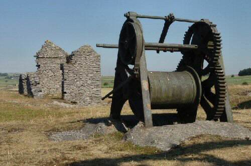
10. Turn right, ignore the road to Sheldon, and after a further 100 yards, at the bottom of a hollow, turn left at a stile beside a gate. Follow a rough path to the left of a dew pond to pass through a gap in the corner of the field. Go through another gap a few yards away, heading towards the mine buildings you can see in front of you.
11. At first, the path heads slightly to the left of the buildings, but it changes course a little as you get closer – most of the mine workings are on your left by the time you arrive. Pass through the buildings and turn left along the track in front of the mine, which you follow around to reach a wall, which you do not cross.
12. Turn right, keeping close to the wall on your left, and walk to a stile in the far corner of the field. Cross two fields along a clear path, heading towards some farm buildings you can see in the distance, and then turn right down a walled farm track.
13. Continue on the right when a small field is entered, to go through the gate at the rear of some farm buildings. Turn left and aim for a stile just behind the farm buildings.
14. Cross an enclosure to a stile by a yellow footpath marker, go over a stile along the bottom of a field and join a narrow path leading to Sheldon Village Street and the start of the walk.
SHELDON